Difference between revisions of "2009-05-14 67 20"
From Geohashing
imported>The ru (New page: {{meetup graticule | map=<map lat="67" lon="20" date="2009-05-14" /> | lat=67 | lon=20 | date=2009-05-14 }} The hashpoint was in the forest between Mertainen and Svappavaara, north of the ...) |
imported>FippeBot m (Location) |
||
| (2 intermediate revisions by one other user not shown) | |||
| Line 5: | Line 5: | ||
| date=2009-05-14 | | date=2009-05-14 | ||
}} | }} | ||
| − | The hashpoint was in the forest | + | The hashpoint was in the forest east of Mertainen (abandoned mine) and north of the Mertaseno reststop. |
[[User:the_ru|the ru]] was there. | [[User:the_ru|the ru]] was there. | ||
| + | |||
| + | |||
| + | <gallery perrow="4"> | ||
| + | Image:2009-05-14_67_20_1.jpg | | ||
| + | Image:2009-05-14_67_20_2.jpg | | ||
| + | Image:2009-05-14_67_20_3.jpg | | ||
| + | Image:2009-05-14_67_20_4.jpg | | ||
| + | Image:2009-05-14_67_20_5.jpg | | ||
| + | Image:2009-05-14_67_20_6.jpg | | ||
| + | Image:2009-05-14_67_20_7.jpg | | ||
| + | Image:2009-05-14_67_20_8.jpg | | ||
| + | </gallery> | ||
[[Category:Expeditions]] | [[Category:Expeditions]] | ||
| + | [[Category:Expeditions with photos]] | ||
[[Category:Coordinates reached]] | [[Category:Coordinates reached]] | ||
| + | {{location|SE|BD}} | ||
Latest revision as of 03:21, 8 August 2019
| Thu 14 May 2009 in 67,20: 67.7025246, 20.8509093 geohashing.info google osm bing/os kml crox |
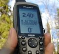
The hashpoint was in the forest east of Mertainen (abandoned mine) and north of the Mertaseno reststop.
the ru was there.


