Difference between revisions of "2009-05-24 40 -2"
From Geohashing
imported>Relet (+photos) |
imported>FippeBot m (Location) |
||
| (3 intermediate revisions by 3 users not shown) | |||
| Line 15: | Line 15: | ||
== Plans == | == Plans == | ||
| − | This time, the decision came easier.. today's hash point in [[40,-2]] would be right next to a Natural Reseve, the Tajo | + | This time, the decision came easier.. today's hash point in [[40,-2]] would be right next to a Natural Reseve, the Alto Tajo. I love Natural Reserves about as much as I love mountains. And Alto means high, so this is going to be a Natural Reserve on a Mountain. |
== Expedition == | == Expedition == | ||
| Line 33: | Line 33: | ||
*[http://relet.net/g2/d/15602-2/P1030902.JPG Same flower, but earlier] | *[http://relet.net/g2/d/15602-2/P1030902.JPG Same flower, but earlier] | ||
*[http://relet.net/g2/d/15607-2/P1030903.JPG Trumpets in blue] | *[http://relet.net/g2/d/15607-2/P1030903.JPG Trumpets in blue] | ||
| − | *[http://relet.net/g2/d/15612-2/P1030904.JPG | + | *[http://relet.net/g2/d/15612-2/P1030904.JPG Common Mullein, probably] |
*[http://relet.net/g2/d/15617-2/P1030907.JPG I identified this branching on my hand-drawn map] | *[http://relet.net/g2/d/15617-2/P1030907.JPG I identified this branching on my hand-drawn map] | ||
*[http://relet.net/g2/d/15622-2/P1030908.JPG A very small troll] - I later saw that the path I took was indicated on a hiking track map.. so it must be hikers who did this] | *[http://relet.net/g2/d/15622-2/P1030908.JPG A very small troll] - I later saw that the path I took was indicated on a hiking track map.. so it must be hikers who did this] | ||
| Line 71: | Line 71: | ||
[[Category:Expeditions with photos]] | [[Category:Expeditions with photos]] | ||
[[Category:Coordinates reached]] | [[Category:Coordinates reached]] | ||
| + | |||
| + | == Gallery == | ||
| + | <gallery widths="160px" align=center> | ||
| + | Image:2009052440-2P1030796.JPG|A library | ||
| + | Image:2009052440-2P1030892.JPG|A tower in a field | ||
| + | Image:2009052440-2P1030893.JPG|I was on the Don Quijote route | ||
| + | Image:2009052440-2P1030894.JPG|A milestone, or just a spur post? | ||
| + | Image:2009052440-2P1030895.JPG|It rained a bit | ||
| + | Image:2009052440-2P1030896.JPG|I walked from here on | ||
| + | Image:2009052440-2P1030897.JPG|A poppy | ||
| + | Image:2009052440-2P1030899.JPG|I'm going to need help with naming all the others | ||
| + | Image:2009052440-2P1030901.JPG|But they appealed to ḃoth my aesthetic and geometric senses | ||
| + | Image:2009052440-2P1030902.JPG|Same flower, but earlier | ||
| + | Image:2009052440-2P1030903.JPG|Trumpets in blue | ||
| + | Image:2009052440-2P1030904.JPG|Common Mullein, probably | ||
| + | Image:2009052440-2P1030907.JPG|I identified this branching on my hand-drawn map | ||
| + | Image:2009052440-2P1030908.JPG|A very small troll | ||
| + | Image:2009052440-2P1030910.JPG|Across the sea of rose | ||
| + | Image:2009052440-2field_fused.jpg|Suddenly, a field | ||
| + | Image:2009052440-2P1030918.JPG|I followed the tracks | ||
| + | Image:2009052440-2P1030919.JPG|Patches of haulms were everywhere among the fields | ||
| + | Image:2009052440-2P1030920.JPG|A dry thistle | ||
| + | Image:2009052440-2P1030922.JPG|Bear tracks? | ||
| + | Image:2009052440-2P1030924.JPG|Hash point reached! | ||
| + | Image:2009052440-2P1030926.JPG|A happy hasher | ||
| + | Image:2009052440-2P1030928.JPG|I marked the place with 'xkcd' for a change | ||
| + | Image:2009052440-2P1030929.JPG|More flowers on the way back | ||
| + | Image:2009052440-2P1030930.JPG|and in white | ||
| + | Image:2009052440-2P1030932.JPG|and in large | ||
| + | Image:2009052440-2P1030934.JPG|I spotted this little buddy drinking nectar | ||
| + | Image:2009052440-2P1030938.JPG|more white and yellow | ||
| + | Image:2009052440-2P1030939.JPG|A beeyard | ||
| + | Image:2009052440-2P1030940.JPG|violet! | ||
| + | Image:2009052440-2P1030941.JPG|blue! | ||
| + | Image:2009052440-2P1030943.JPG|violet again | ||
| + | Image:2009052440-2P1030944.JPG|and another poppy | ||
| + | Image:2009052440-2P1030945.JPG|and a live thistle | ||
| + | Image:2009052440-2P1030946.JPG|The Alto Tajo | ||
| + | Image:2009052440-2P1030950.JPG|Impressive rocks | ||
| + | Image:2009052440-2tajo_fused.jpg|down by the river | ||
| + | Image:2009052440-2P1030958.JPG|These buddies were huge | ||
| + | Image:2009052440-2P1030959.JPG|A solitary picnic site | ||
| + | Image:2009052440-2P1030960.JPG|and one for the next migration hash | ||
| + | Image:2009052440-2P1030961.JPG|more rocks | ||
| + | Image:2009052440-2P1030966.JPG|returning to Madrid on another road | ||
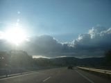
| + | Image:2009052440-2P1030974.JPG|Even highways can look good | ||
| + | </gallery> | ||
| + | {{location|ES|CM|GU}} | ||
Latest revision as of 00:02, 6 August 2019
| Sun 24 May 2009 in 40,-2: 40.7976355, -2.3838622 geohashing.info google osm bing/os kml crox |
Participants
Plans
This time, the decision came easier.. today's hash point in 40,-2 would be right next to a Natural Reseve, the Alto Tajo. I love Natural Reserves about as much as I love mountains. And Alto means high, so this is going to be a Natural Reserve on a Mountain.
Expedition
Pre-expedition:
- A library in the metro station. Only in Madrid!
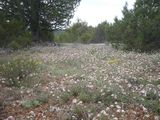
Again, I will still have to write this one up. But here are the pictures. I really enjoyed taking them - do have a look at all these flowers.
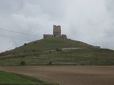
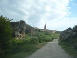
- A tower in a field - There was a town posted, called "Torremocha del Campo", meaning ugly tower of the field. I assumed that this had to be it, but I seem to have been wrong.
- I was on the Don Quijote route. No windmills here.
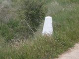
- A milestone, or just a spur post? - I started to take pictures roughly as soon as I left the highway.. there were still 30km to go on single lane, badly paved roads. It made me think these occasional stones might be milestones.
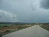
- It rained a bit
- I walked from here on - it's off the road to the north of the geohash, if you'd like to compare with the satellite pictures. Still a bit to go.
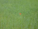
- A poppy
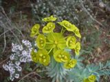
- I'm going to need help with naming all the others
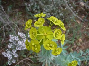
- But they appealed to ḃoth my aesthetic and geometric senses - It's a fractal!
- Same flower, but earlier
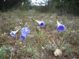
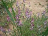
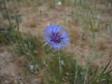
- Trumpets in blue
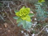
- Common Mullein, probably
- I identified this branching on my hand-drawn map
- A very small troll - I later saw that the path I took was indicated on a hiking track map.. so it must be hikers who did this]
- Across the sea of rose - I left the track when Tomtom said I had reached the correct latitude.
- Suddenly, a field.
- I followed the tracks of a machine - so as to not trample anything. However, the ground was really dry and the plants wide apart.
- Patches of haulms were everywhere among the fields where the machines couldn't cultivate them.
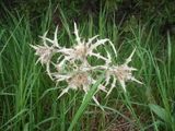
- A dry thistle - another fractal!
- Bear tracks? - in a sandbed at the bottom of the valley. Could have been a dog just as well.
- Hash point reached! - I won't complain about the batteries of Tomtom again. Once it is fully charged, it's great.
- A happy hasher
- I marked the place with 'xkcd' for a change
- More flowers on the way back
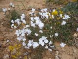
- and in white
- and in large
- I spotted this little buddy drinking nectar - are they supposed to do that?
- more white and yellow
- A beeyard
- violet!
- blue! - more fractals
- violet again
- and another poppy
- and a live thistle - I created some 3d fractals in Mathematica[tm] once upon a time, but nothing as elaborate as this.
Post-expedition expedition:
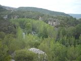
- The Alto Tajo greeted me like this. This is actually the river Tajo
- Impressive rocks - and I know there are more people here who can enjoy nice climbing spots
- down by the river - Unfortunately, I could not find the hiking path I was looking for in either direction.
- These buddies were huge compared to the ones we had on our garden pond
- A solitary picnic site
- and one for the next migration hash
- more rocks
- returning to Madrid on another road
- Even highways can look good provided the right weather. (I was actually trying to zoom in on the city in the background, but forgot to do exactly that)
