Difference between revisions of "2009-07-06 50 12"
imported>Reinhard (Not ready, yet. *yawn*) |
m (Location correction) |
||
| (4 intermediate revisions by 3 users not shown) | |||
| Line 5: | Line 5: | ||
| date=2009-07-06 | | date=2009-07-06 | ||
}} | }} | ||
| + | == Participants == | ||
| + | * [[User:Reinhard|Reinhard]] | ||
| − | + | == Expedition == | |
| − | + | The Monday 50 12 hashpoint was located near Gera in a forest. [[User:Reinhard|Reinhard]] also could have visited the 50 11 hashpoint near Kirchheim, south of Erfurt, which would be about the same distance from Jena, but he decided to take the Gera hashpoint, because he could produce new GPS bike tracks that way. That is also the reason he didn't take the shortest way there. | |
| + | |||
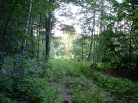
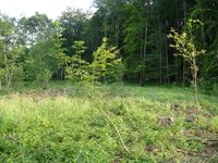
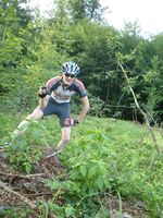
| + | He started with his bike from work around 17:50 and arrived in Ernsee, where he had to leave paved roads less than two hours later. When he was entering the forest, he first thought that it would be too dense to get to the exact spot, since it was more than 100 m away from the next forest path. But when he came to a clearing covered with a lot of prickly brushwood he thought there must be a way to carefully reach the spot walking. So he left his bike and went straight towards the hashpoint for about 100 m. He couldn't manage to get there without suffering several scratches at his lower legs, but was happy to get there at all. | ||
| + | |||
| + | After struggling back through the wood he continued his bike tour by visiting Gera and the castle "Schloss Osterstein" and took a detour via Münchenbernsdorf, finally ending up at work with 109 km cycled. There he got his backpack and rode home, getting in a bad thunderstorm, but happily reaching home at about 22:45. | ||
| Line 22: | Line 28: | ||
[[Category:Expeditions with photos]] | [[Category:Expeditions with photos]] | ||
[[Category:Coordinates reached]] | [[Category:Coordinates reached]] | ||
| + | {{location|DE|TH|G}} | ||
Latest revision as of 12:06, 25 October 2020
| Mon 6 Jul 2009 in 50,12: 50.0732875, 12.5899034 geohashing.info google osm bing/os kml crox |
Participants
Expedition
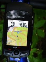
The Monday 50 12 hashpoint was located near Gera in a forest. Reinhard also could have visited the 50 11 hashpoint near Kirchheim, south of Erfurt, which would be about the same distance from Jena, but he decided to take the Gera hashpoint, because he could produce new GPS bike tracks that way. That is also the reason he didn't take the shortest way there.
He started with his bike from work around 17:50 and arrived in Ernsee, where he had to leave paved roads less than two hours later. When he was entering the forest, he first thought that it would be too dense to get to the exact spot, since it was more than 100 m away from the next forest path. But when he came to a clearing covered with a lot of prickly brushwood he thought there must be a way to carefully reach the spot walking. So he left his bike and went straight towards the hashpoint for about 100 m. He couldn't manage to get there without suffering several scratches at his lower legs, but was happy to get there at all.
After struggling back through the wood he continued his bike tour by visiting Gera and the castle "Schloss Osterstein" and took a detour via Münchenbernsdorf, finally ending up at work with 109 km cycled. There he got his backpack and rode home, getting in a bad thunderstorm, but happily reaching home at about 22:45.
- Photo Gallery
