Difference between revisions of "2009-11-04 34 -84"
(New page: {{meetup graticule | map=<map lat="34" lon="-84" date="2009-11-04" /> | lat=34 | lon=-84 | date=2009-11-04 | graticule_name=Roswell | graticule_link=Roswell, Georgia }} == Graticule == ...) |
m (Replacing http://wiki.xkcd.com/geohashing/Roswell%2C_Georgia with Roswell, Georgia) |
||
| (7 intermediate revisions by 3 users not shown) | |||
| Line 10: | Line 10: | ||
== Graticule == | == Graticule == | ||
| − | [ | + | [[Roswell, Georgia|Roswell]] |
== About == | == About == | ||
| Line 18: | Line 18: | ||
* [[User:NWoodruff|NWoodruff]] | * [[User:NWoodruff|NWoodruff]] | ||
| + | |||
| + | I really need to invest in a flash light if I am going to Geohash now after dark. I pulled into the parking lot and drove my truck so it pointed at the back of the building and put the high beams of the headlights on. | ||
| + | |||
| + | It was still a 300 feet walk to where the spot was and from 300 feet a way, my head lights on the truck were not doing all that much good. There is a patch of grass that extends about 50 feet from the building but geohash spot was probably more like 80 feet from the building. That meant a 30 foot walk into the trees. I couldn't see a thing as I was walking into the tall grass and trees. For some reason the mostly full moon was not up at this time providing light. | ||
| + | |||
| + | I inched my way into the tree line and kept an eye on my eTrex. After running face first into several small pine trees slightly taller than me, I found the hash spot with 1.25 feet to go. I took a few pictures and noticed how the flash of the camera lite the area up. I tried to take several pictures using the flash but almost none of them turned out. | ||
| + | |||
| + | I carefully stepped my way back out of the tree line to the mowed grass path behind the building. I then made my way back to my truck and drove home to Norcross. | ||
| + | |||
| + | 15 in a row. Here's hoping that I make it to at least 18. | ||
==Expeditions== | ==Expeditions== | ||
| Line 25: | Line 35: | ||
== Gallery == | == Gallery == | ||
<gallery caption="Photo Gallery" widths="200px" heights="200px" perrow="3"> | <gallery caption="Photo Gallery" widths="200px" heights="200px" perrow="3"> | ||
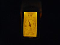
| − | Image:200921104_34_-84NW01.JPG| | + | Image:200921104_34_-84NW01.JPG| 1.25 feet to go. Close enough. |
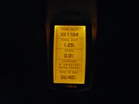
| + | Image:200921104_34_-84NW02.JPG| Time of the meetup. | ||
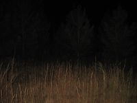
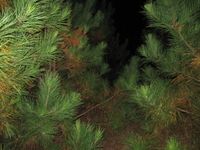
| + | Image:200921104_34_-84NW03.JPG| A picture of the area standing on the hash spot. | ||
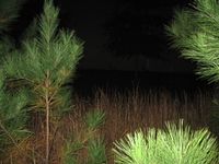
| + | Image:200921104_34_-84NW04.JPG| Another picture of the area using the flash of the camera. | ||
| + | Image:200921104_34_-84NW05.JPG| Looking towards the building standing on the hash spot. | ||
</gallery> | </gallery> | ||
| Line 31: | Line 45: | ||
{{Land geohash | latitude = 34 | longitude = -84| date = 2009-11-04| name = NWoodruff}} | {{Land geohash | latitude = 34 | longitude = -84| date = 2009-11-04| name = NWoodruff}} | ||
| + | {{consecutive geohash | count = 15 | latitude = 33 | longitude = -84 | date = 2009-10-21 | name = NWoodruff }} | ||
| + | |||
| Line 36: | Line 52: | ||
[[Category:Coordinates reached]] | [[Category:Coordinates reached]] | ||
[[Category:Expeditions with photos]] | [[Category:Expeditions with photos]] | ||
| + | {{location|US|GA|GW}} | ||
Latest revision as of 12:24, 19 February 2020
| Wed 4 Nov 2009 in Roswell: 34.0272437, -84.1049686 geohashing.info google osm bing/os kml crox |
Graticule
About
In the back lot of a business in Duluth Georgia.
People
I really need to invest in a flash light if I am going to Geohash now after dark. I pulled into the parking lot and drove my truck so it pointed at the back of the building and put the high beams of the headlights on.
It was still a 300 feet walk to where the spot was and from 300 feet a way, my head lights on the truck were not doing all that much good. There is a patch of grass that extends about 50 feet from the building but geohash spot was probably more like 80 feet from the building. That meant a 30 foot walk into the trees. I couldn't see a thing as I was walking into the tall grass and trees. For some reason the mostly full moon was not up at this time providing light.
I inched my way into the tree line and kept an eye on my eTrex. After running face first into several small pine trees slightly taller than me, I found the hash spot with 1.25 feet to go. I took a few pictures and noticed how the flash of the camera lite the area up. I tried to take several pictures using the flash but almost none of them turned out.
I carefully stepped my way back out of the tree line to the mowed grass path behind the building. I then made my way back to my truck and drove home to Norcross.
15 in a row. Here's hoping that I make it to at least 18.
Expeditions
Gallery
- Photo Gallery
Achievements
NWoodruff earned the Land geohash achievement
|
NWoodruff earned the Consecutive geohash achievement
|
