Difference between revisions of "2009-12-06 51 -1"
imported>Bluecont (New page: {{meetup graticule | lat=51 | lon=-1 | date=2009-12-06 }} == Location == Looks to be a fairly accessible (sort of) field near Wroughton - OS maps indicate there is a footpath less than 1...) |
imported>FippeBot m (Location) |
||
| (One intermediate revision by one other user not shown) | |||
| Line 7: | Line 7: | ||
== Location == | == Location == | ||
| − | + | An empty field not very far from Wroughton, near Swindon. | |
== Participants == | == Participants == | ||
| − | * [[User:Bluecont|Bluecont]] | + | * [[User:Bluecont|Bluecont]] |
| − | == | + | == Expedition == |
| − | + | The sun shone down upon Swindon today - which offered only further incentive to partake in a Sunday afternoon geohash. | |
| − | + | After gathering all the necessary equipment - no GPS systems aren't necessary equipment (otherwise I would clearly own one) whilst printed maps are necessary considering [[2009-01-01_51_-2#Photos|past successes]] with OS Maps - I made the truly challenging drive to Wroughton and found somewhere to park. After this great effort it was a true struggle to walk the 1 or 2km to the hash point - but I persevered. | |
| + | |||
| + | Previous rainfall had left the ground in a "squelchy" state which kept things interesting at least. On the way to the hash point I passed some cows who took an unusual interest in my activities - so I had a chance to practise some of my [[Cover_Stories|cover stories]] - however I didn't pass anyone else showing interest in my activities, human or otherwise. | ||
| + | |||
| + | Once I reached where I believed the hash point to be I used some basic navigation, and declared myself "Close Enough" and took the necessary photos of my presence. There are no photos of me attempting navigation because it's surprisingly hard to use a map, compass and camera all at the same time! | ||
| + | |||
| + | Deciding to make the most of the afternoon I walked the long way back to my car - a satisfying end to another successful geohash. | ||
| − | + | == Photographic Documentation == | |
| − | == | + | <gallery widths="190px" heights="152px" perrow="4"> |
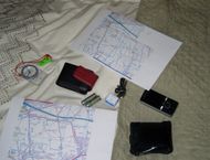
| + | Image:2009-12-06_IMG_0130.JPG|I was clearly prepared for anything. | ||
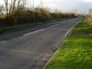
| + | Image:2009-12-06_IMG_0131.JPG|At this point the footpath simply disappeared | ||
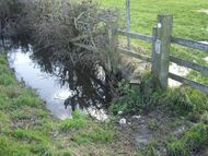
| + | Image:2009-12-06_IMG_0132.JPG|This small puddle was a sign of things to come... | ||
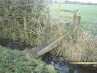
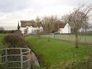
| + | Image:2009-12-06_IMG_0133.JPG|... including the requisite [[2009-01-01 51 -2|fast flowing rivers]]... | ||
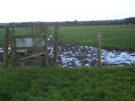
| + | Image:2009-12-06_IMG_0136.JPG|... and rather unhelpfully placed mud-baths. | ||
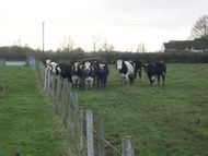
| + | Image:2009-12-06_IMG_0135.JPG|The locals were at first concerned at my sudden appearance... | ||
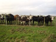
| + | Image:2009-12-06_IMG_0137.JPG|... some even took an interest in the geohashing concept... | ||
| + | Image:2009-12-06_IMG_0139.JPG|... but others... | ||
| + | Image:2009-12-06_IMG_0141.JPG|... took no interest in such endeavours. | ||
| + | Image:2009-12-06_IMG_0142.JPG|Once again a church was used to aid navigation. | ||
| + | Image:2009-12-06_IMG_0143.JPG|At last the hash point was sighted! | ||
| + | Image:2009-12-06_IMG_0146.JPG|[[user:Bluecont|Bluecont's]] declares himself "Close Enough"™ and takes a self portrait in celebration. | ||
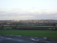
| + | Image:2009-12-06_IMG_0148.JPG|On the (rather circuitous) route back Swindon was sighted. | ||
| − | + | </gallery> | |
| − | [[Category:Expedition | + | [[Category:Expeditions]] |
| + | [[Category:Expeditions with photos]] | ||
| + | [[Category:Coordinates reached]] | ||
| + | [[Category:Expedition without GPS]] | ||
| + | {{location|GB|ENG|SWD}} | ||
Latest revision as of 02:56, 6 August 2019
| Sun 6 Dec 2009 in 51,-1: 51.5292116, -1.8216196 geohashing.info google osm bing/os kml crox |
Location
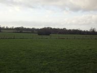
An empty field not very far from Wroughton, near Swindon.
Participants
Expedition
The sun shone down upon Swindon today - which offered only further incentive to partake in a Sunday afternoon geohash.
After gathering all the necessary equipment - no GPS systems aren't necessary equipment (otherwise I would clearly own one) whilst printed maps are necessary considering past successes with OS Maps - I made the truly challenging drive to Wroughton and found somewhere to park. After this great effort it was a true struggle to walk the 1 or 2km to the hash point - but I persevered.
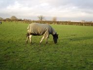
Previous rainfall had left the ground in a "squelchy" state which kept things interesting at least. On the way to the hash point I passed some cows who took an unusual interest in my activities - so I had a chance to practise some of my cover stories - however I didn't pass anyone else showing interest in my activities, human or otherwise.
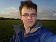
Once I reached where I believed the hash point to be I used some basic navigation, and declared myself "Close Enough" and took the necessary photos of my presence. There are no photos of me attempting navigation because it's surprisingly hard to use a map, compass and camera all at the same time!
Deciding to make the most of the afternoon I walked the long way back to my car - a satisfying end to another successful geohash.
Photographic Documentation
... including the requisite fast flowing rivers...
Bluecont's declares himself "Close Enough"™ and takes a self portrait in celebration.
