Difference between revisions of "2010-01-27 50 11"
imported>Reinhard (→Expedition: Manu and Reinhard) |
imported>FippeBot m (Location) |
||
| (9 intermediate revisions by 3 users not shown) | |||
| Line 5: | Line 5: | ||
| date=2010-01-27 | | date=2010-01-27 | ||
}} | }} | ||
| + | |||
| + | == Participants == | ||
| + | * [[User:Paintedhell|Juja]] | ||
| + | * [[User:Manu|Manu]] | ||
| + | * [[User:Reinhard|Reinhard]] | ||
===Location=== | ===Location=== | ||
| Line 22: | Line 27: | ||
---[[User:Paintedhell|Juja]] | ---[[User:Paintedhell|Juja]] | ||
| − | + | {{gallery|width=200|height=200|lines=2 | |
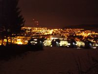
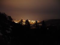
| − | Image:Geo_100127_50_11_1.jpg|Nightly view of Jena - beautiful and blurred. | + | |Image:Geo_100127_50_11_1.jpg|Nightly view of Jena - beautiful and blurred. |
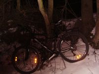
| − | Image:Geo_100127_50_11_5.jpg|Where my bike waited for me. | + | |Image:Geo_100127_50_11_5.jpg|Where my bike waited for me. |
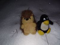
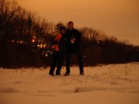
| − | Image:Geo_100127_50_11_3.jpg|Two little Geohashers in the snow. | + | |Image:Geo_100127_50_11_3.jpg|Two little Geohashers in the snow. |
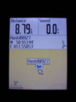
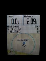
| − | + | |Image:Geo_100127_50_11_2.jpg|Proof of coordinates - blurred because of my cold camera. | |
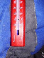
| − | Image:Geo_100127_50_11_2.jpg|Proof of coordinates - blurred because of my cold camera. | + | |Image:Geo_100127_50_11_6.jpg|Proof of temperature (-6°C). |
| − | Image:Geo_100127_50_11_6.jpg|Proof of temperature (-6°C). | + | }} |
| − | |||
| − | |||
===Expedition: [[User:Manu|Manu]] and [[User:Reinhard|Reinhard]]=== | ===Expedition: [[User:Manu|Manu]] and [[User:Reinhard|Reinhard]]=== | ||
| − | Not knowing that Juja intended to visit the geohash or that she already had, Manu and Reinhard planned to go there. Manu went to Jena anyway that day, so Reinhard waited for her in the evening. Coming from Cospeda by car, they got to the hashpoint from the opposite side (meaning from the West) than that which Juja came from. | + | Not knowing that Juja intended to visit the geohash or that she already had, Manu and Reinhard planned to go there. Manu went to Jena anyway that day, so Reinhard waited for her in the evening. Coming from Cospeda by car, they got to the hashpoint from the opposite side (meaning from the West) than that which Juja came from. Reinhard had already been to this area before and also Manu at least had been to the Haeckel stone (3rd picture). Nevertheless, both of them hadn't been visiting the former Soviet red army base, which was an appropriate place for parking the car. It felt a bit strange to pass the guard-house and the bar by car and at night. They couldn't drive much further than that, because a construction fence was blocking the way they wanted to go. It wouldn't have been good to drive further anyway, since the snow got deeper and Reinhard didn't feel like mounting the snow chains for the first time in such a cold night. On their way to the hashpoint, they didn't find the shortest one, so it was a good 2 km walk, on which they couldn't miss a visit of the nearby Haeckel stone and the great view from there. Reinhard's camera had serious power difficulties with both pairs of batteries, especially when loading the flash, thus only few pictures were taken. Actually, there were some foot prints leaving the path and going straight to the hash, but Reinhard thought they were too small and too dense for being effected by human geohashers. He probably should have looked more carefully, since Juja had obviously been there before 19:52! Taking a shortcut through the thicket, they managed to get back to the car after a total walking distance of 3.7 km. Nice evening walk and time to drive home! |
| − | to | ||
| − | |||
| − | + | {{gallery|width=200|height=200|lines=3 | |
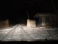
| − | Image:20100127-50N11E-01.jpg|Entering red army base. | + | |Image:20100127-50N11E-01.jpg|Entering red army base. |
| − | Image:20100127-50N11E-02.jpg|Training area: Jena forest. | + | |Image:20100127-50N11E-02.jpg|Training area: Jena forest. |
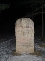
| − | Image:20100127-50N11E-03.jpg|[http://en.wikipedia.org/wiki/Ernst_Haeckel Ernst Haeckel]. | + | |Image:20100127-50N11E-03.jpg|[http://en.wikipedia.org/wiki/Ernst_Haeckel Ernst Haeckel]. |
| − | Image:20100127-50N11E-04.jpg|Coordinates reached! | + | |Image:20100127-50N11E-04.jpg|Coordinates reached! |
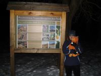
| − | Image:20100127-50N11E-05.jpg|Simon, Manu, Reinhard and Grünik at the hashpoint. City lights of Jena in the background. | + | |Image:20100127-50N11E-05.jpg|Simon, Manu, Reinhard and Grünik at the hashpoint. City lights of Jena in the background. |
| − | Image:20100127-50N11E-06.jpg|View from Haeckel memorial stone. | + | |Image:20100127-50N11E-06.jpg|View from Haeckel memorial stone. |
| − | + | }} | |
===Achievements=== | ===Achievements=== | ||
| Line 53: | Line 54: | ||
[[Category:Expeditions with photos]] | [[Category:Expeditions with photos]] | ||
[[Category:Coordinates reached]] | [[Category:Coordinates reached]] | ||
| + | {{location|DE|TH|J}} | ||
Latest revision as of 00:37, 9 August 2019
| Wed 27 Jan 2010 in 50,11: 50.9114415, 11.5505311 geohashing.info google osm bing/os kml crox |
Contents
Participants
Location
Today's geohash is somewhere that's green, between Jena Lichtenhain and Ammerbach. Too near to miss, isn't it?
Expedition: Juja
Like always, this trip was extremely well prepared. I looked up the point only in the morning, and after that there was a whole day's struggle with Uli and Jens whether it would be worth going or not, keeping in mind that the evening before we had about -15°C and I half froze to death going only 3 km by bike then.
In the evening, laziness seemed to triumph: after we asked half our colleagues if they maybe had any thermometers with them (what should we go for if not frozen geohash?) and nobody had one, we decided to just go home. Half an hour after that decision I really went home, but on the way I noticed that it didn't feel so damn cold at all, so I got me a thermometer and my camera at home and went off.
The way was terrible, I could ride my bike to the last bus stop before the point, but only on bigger streets, as all the rest was iced. After that bus stop I had to walk anyway, because the way was steep and iced, too. On top of the hill and at the last houses, I finally left my bike and walked the last km without it. Good decision, because the way went further up the hill and was all ice, but I had some of the most beautiful views of nightly Jena and I must admit I've never been in this part of the city before.
At the point, my camera started again to do the strange things it already did at my last hash and it seems to do everytime it's too cold. So some of the pictures are not too good, but there are no better ones... Additionally, my Edgie started to make noises because of low battery (extremely well prepared), so I just took everything I had and hurried home. Hooray!
---Juja
|
Expedition: Manu and Reinhard
Not knowing that Juja intended to visit the geohash or that she already had, Manu and Reinhard planned to go there. Manu went to Jena anyway that day, so Reinhard waited for her in the evening. Coming from Cospeda by car, they got to the hashpoint from the opposite side (meaning from the West) than that which Juja came from. Reinhard had already been to this area before and also Manu at least had been to the Haeckel stone (3rd picture). Nevertheless, both of them hadn't been visiting the former Soviet red army base, which was an appropriate place for parking the car. It felt a bit strange to pass the guard-house and the bar by car and at night. They couldn't drive much further than that, because a construction fence was blocking the way they wanted to go. It wouldn't have been good to drive further anyway, since the snow got deeper and Reinhard didn't feel like mounting the snow chains for the first time in such a cold night. On their way to the hashpoint, they didn't find the shortest one, so it was a good 2 km walk, on which they couldn't miss a visit of the nearby Haeckel stone and the great view from there. Reinhard's camera had serious power difficulties with both pairs of batteries, especially when loading the flash, thus only few pictures were taken. Actually, there were some foot prints leaving the path and going straight to the hash, but Reinhard thought they were too small and too dense for being effected by human geohashers. He probably should have looked more carefully, since Juja had obviously been there before 19:52! Taking a shortcut through the thicket, they managed to get back to the car after a total walking distance of 3.7 km. Nice evening walk and time to drive home!
|
Achievements
Juja earned the Frozen Geohash Achievement
|
