Difference between revisions of "2010-02-14 42 -88"
imported>Mrmoses (→Location) |
imported>FippeBot m (Location) |
||
| (8 intermediate revisions by 2 users not shown) | |||
| Line 1: | Line 1: | ||
| − | |||
<!-- If you did not specify these parameters in the template, please substitute appropriate things for IMAGE, LAT, LON, and DATE (YYYY-MM-DD format) | <!-- If you did not specify these parameters in the template, please substitute appropriate things for IMAGE, LAT, LON, and DATE (YYYY-MM-DD format) | ||
| Line 18: | Line 17: | ||
== Participants == | == Participants == | ||
| − | + | *[[User:mrmoses|MrMoses]] | |
| + | *[[User:dleininger|DLeininger]] | ||
| + | *and a friend | ||
== Plans == | == Plans == | ||
| − | + | Plan on going sometime in the early afternoon. There's a Sonic about 1 mile away, so we will probably grab a slushie to get the [[GeoSquishy|GeoSquishy]] award. | |
== Expedition == | == Expedition == | ||
| − | + | On Google maps satellite view it looked like there was a path we could take out into the field, but it was a lie. We couldn't find that path from the road, so we went into a nearby neighborhood and pulled into the driveway that was closest. | |
| + | |||
| + | We asked if we could park the car in the driveway while we adventured out into the field, and the man said it was no problem, but the guy who owns the field is pretty sensitive. So we drove to the house that we thought owned the field to ask for permission. | ||
| + | |||
| + | They were confused as to why there was a game that included their private property, and it took some time to explain that the destination is kind of randomly calculated. Eventually they gave us permission and we drove back into the neighborhood to park as close as we could. | ||
| − | == Tracklog == | + | We headed down a snowy hill, and eventually out into the field. The field had lots of ruts, so it seemed like every other step was deeper. Some spots had a layer of ice under the snow, but it was pretty thin and we kept breaking through going even deeper into the snow. |
| − | + | ||
| + | When we got to the hashpoint, we enjoyed our slushies for a bit and took some pictures. We drew a snowman in the snow, and I also dropped my camera into the snow. It got snow/water on the lens, so the rest of the pictures have some blurry spots. | ||
| + | |||
| + | == [http://maps.google.com/maps/ms?ie=UTF8&hl=en&msa=0&msid=109316342448012701002.00047ffd4c53dd43fb9ab&t=h&z=12 Tracklog]== | ||
| + | |||
| + | Here is a screenshot of the tracklog near the hashpoint. Click the image to view the full track log. | ||
| + | [[File:2010-02-14 42 -88 tracklog.png|left|650px|link=http://maps.google.com/maps/ms?ie=UTF8&hl=en&msa=0&msid=109316342448012701002.00047ffd4c53dd43fb9ab&t=h&z=12]] | ||
| + | <br style="clear: both;" /> | ||
== Photos == | == Photos == | ||
| − | |||
<gallery perrow="4"> | <gallery perrow="4"> | ||
| − | Image: | + | Image:2010-02-14 42 -88 sonic.JPG|stopped at Sonic to get some slushies |
| − | Image: | + | Image:2010-02-14 42 -88 gps sonic.JPG|GPS at Sonic |
| + | Image:2010-02-14 42 -88 hill.JPG|going down the hill | ||
| + | Image:2010-02-14 42 -88 path.JPG | path at the bottom of the hill | ||
| + | Image:2010-02-14 42 -88 path back.JPG|looking back down the path | ||
| + | Image:2010-02-14 42 -88 fence under snow.JPG|some metal under the snow | ||
| + | Image:2010-02-14 42 -88 fence snow 2.JPG|more metal under the snow | ||
| + | Image:2010-02-14 42 -88 thumbs up slushie.JPG | enjoying slushie | ||
| + | Image:2010-02-14 42 -88 into field.JPG|heading out into the field | ||
| + | Image:2010-02-14 42 -88 field.JPG | crossing the field | ||
| + | Image:2010-02-14 42 -88 walking in tracks.JPG | walking in tracks with bad snow shoes | ||
| + | Image:2010-02-14 42 -88 rolled pant leg.JPG | rolled pant leg | ||
| + | Image:2010-02-14 42 -88 road in field.JPG | wish we could taken this road | ||
| + | Image:2010-02-14 42 -88 slushie cheap gps.JPG | still got the slushie | ||
| + | Image:2010-02-14 42 -88 cheap gps.JPG | cheap gps says we made it | ||
| + | Image:2010-02-14 42 -88 camera snow reflection.JPG | i dropped my camera in the snow | ||
| + | Image:2010-02-14 42 -88 snowman.JPG | we made snowman art | ||
| + | Image:2010-02-14 42 -88 snowman hat.JPG | snowman with a hat! | ||
| + | Image:2010-02-14 42 -88 plane.JPG | plane flying overhead | ||
| + | Image:2010-02-14 42 -88 power lines.JPG | power lines | ||
| + | Image:2010-02-14 42 -88 powerlines 2.JPG | more power lines | ||
| + | Image:2010-02-14 42 -88 face.JPG | about to sneeze? | ||
| + | Image:2010-02-14 42 -88 tracks 1.JPG | snow on my camera lens | ||
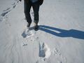
| + | Image:2010-02-14 42 -88 tracks 2.JPG | sometimes we broke through a layer of ice | ||
| + | Image:2010-02-14 42 -88 creek.JPG | theres a creek over there | ||
| + | Image:2010-02-14 42 -88 up hill.JPG | going back up the hill | ||
| + | Image:2010-02-14 42 -88 going up hill.JPG | still got snow on my lens | ||
| + | Image:2010-02-14 42 -88 birdhouse hill.JPG | still got one pant leg rolled | ||
</gallery> | </gallery> | ||
| − | |||
| − | |||
| − | |||
| − | |||
| − | + | [[Category:Expeditions]] | |
| − | |||
| − | [[Category: | ||
| − | |||
| − | |||
| − | |||
| − | |||
[[Category:Expeditions with photos]] | [[Category:Expeditions with photos]] | ||
[[Category:Expeditions with videos]] | [[Category:Expeditions with videos]] | ||
| − | + | ||
| − | |||
| − | |||
| − | |||
[[Category:Coordinates reached]] | [[Category:Coordinates reached]] | ||
| − | + | {{location|US|IL|BO}} | |
| − | |||
| − | |||
| − | |||
| − | |||
| − | |||
| − | |||
| − | |||
| − | |||
| − | |||
Latest revision as of 00:53, 9 August 2019
| Sun 14 Feb 2010 in 42,-88: 42.2715064, -88.8845079 geohashing.info google osm bing/os kml crox |
Location
corn field
Participants
- MrMoses
- DLeininger
- and a friend
Plans
Plan on going sometime in the early afternoon. There's a Sonic about 1 mile away, so we will probably grab a slushie to get the GeoSquishy award.
Expedition
On Google maps satellite view it looked like there was a path we could take out into the field, but it was a lie. We couldn't find that path from the road, so we went into a nearby neighborhood and pulled into the driveway that was closest.
We asked if we could park the car in the driveway while we adventured out into the field, and the man said it was no problem, but the guy who owns the field is pretty sensitive. So we drove to the house that we thought owned the field to ask for permission.
They were confused as to why there was a game that included their private property, and it took some time to explain that the destination is kind of randomly calculated. Eventually they gave us permission and we drove back into the neighborhood to park as close as we could.
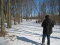
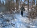
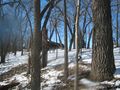
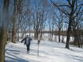
We headed down a snowy hill, and eventually out into the field. The field had lots of ruts, so it seemed like every other step was deeper. Some spots had a layer of ice under the snow, but it was pretty thin and we kept breaking through going even deeper into the snow.
When we got to the hashpoint, we enjoyed our slushies for a bit and took some pictures. We drew a snowman in the snow, and I also dropped my camera into the snow. It got snow/water on the lens, so the rest of the pictures have some blurry spots.
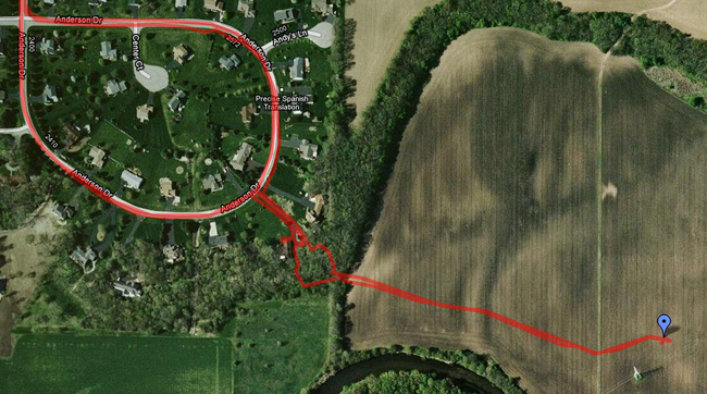
Tracklog
Here is a screenshot of the tracklog near the hashpoint. Click the image to view the full track log.
Photos
stopped at Sonic to get some slushies
GPS at Sonic
going down the hill
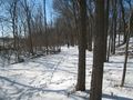
path at the bottom of the hill
looking back down the path
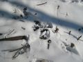
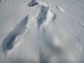
some metal under the snow
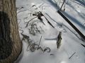
more metal under the snow

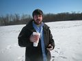
enjoying slushie
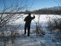
heading out into the field
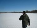
crossing the field
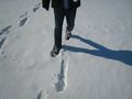
walking in tracks with bad snow shoes
rolled pant leg
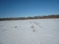
wish we could taken this road
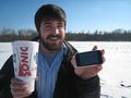
still got the slushie
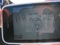
cheap gps says we made it
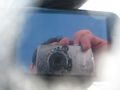
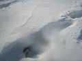
i dropped my camera in the snow
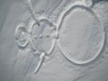
we made snowman art
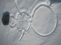
snowman with a hat!

plane flying overhead
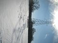
power lines
more power lines
about to sneeze?
snow on my camera lens
sometimes we broke through a layer of ice
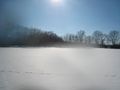
theres a creek over there
going back up the hill
still got snow on my lens
still got one pant leg rolled


