Difference between revisions of "2010-02-25 50 11"
imported>Reinhard (report) |
imported>FippeBot m (Location) |
||
| (2 intermediate revisions by one other user not shown) | |||
| Line 5: | Line 5: | ||
| date=2010-02-25 | | date=2010-02-25 | ||
}} | }} | ||
| + | == Participants == | ||
| + | * [[User:Reinhard|Reinhard]] | ||
| − | The hashpoint was pretty far from Jena, but since it was on or really close to a road, [[User:Reinhard|Reinhard]] decided to get there anyhow. After work he drove to A9 exit Schleiz and parked the car nearby. From there he started his little bike trip, that made him collect many new | + | == Expedition == |
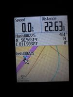
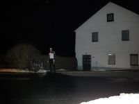
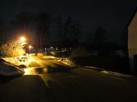
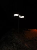
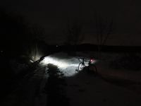
| + | The hashpoint was pretty far from Jena, but since it was on or really close to a road, [[User:Reinhard|Reinhard]] decided to get there anyhow. After work he drove to A9 exit Schleiz and parked the car nearby. From there he started his little bike trip, that made him collect many new kilometers with elevation profile for the [http://www.rennrad-tourenplaner.de/Tourenplaner/Tourenplaner quaeldich.de trip planner]. He easily arrived in Langenbuch, where he at first thought, the exact position might be in a residential house or at least in its garden, but when he got really close to the hedgerow, he could make his GPS device show 0 meters distance. Coordinates reached! Then he took some photos and wrote a SMS to Manu that he was successful and continued the bike trip. Reinhard thought, he already made it, but then he was taught that the winter wasn't over, yet, because he had to stumble through over .5 m high snowbanks for several hundred meters [[2010-02-04_51_11|once again]]. That happens, when you are not using public roads in winter. He got back to the car after 41.5 km cycling and was at home shortly after 10 pm. | ||
{{gallery|width=200|height=200|lines=3 | {{gallery|width=200|height=200|lines=3 | ||
| Line 22: | Line 25: | ||
[[Category:Expeditions with photos]] | [[Category:Expeditions with photos]] | ||
[[Category:Coordinates reached]] | [[Category:Coordinates reached]] | ||
| + | {{location|DE|TH|SOK}} | ||
Latest revision as of 00:59, 9 August 2019
| Thu 25 Feb 2010 in 50,11: 50.5651943, 11.9032348 geohashing.info google osm bing/os kml crox |
Participants
Expedition
The hashpoint was pretty far from Jena, but since it was on or really close to a road, Reinhard decided to get there anyhow. After work he drove to A9 exit Schleiz and parked the car nearby. From there he started his little bike trip, that made him collect many new kilometers with elevation profile for the quaeldich.de trip planner. He easily arrived in Langenbuch, where he at first thought, the exact position might be in a residential house or at least in its garden, but when he got really close to the hedgerow, he could make his GPS device show 0 meters distance. Coordinates reached! Then he took some photos and wrote a SMS to Manu that he was successful and continued the bike trip. Reinhard thought, he already made it, but then he was taught that the winter wasn't over, yet, because he had to stumble through over .5 m high snowbanks for several hundred meters once again. That happens, when you are not using public roads in winter. He got back to the car after 41.5 km cycling and was at home shortly after 10 pm.
|
