Difference between revisions of "2010-03-12 34 -84"
From Geohashing
imported>NWoodruff (Created page with '{{meetup graticule | map=<map lat="34" lon="-84" date="2010-03-12" /> | lat=34 | lon=-84 | date=2010-03-12 | graticule_name=Roswell | graticule_link=Roswell, Georgia }} == Grati…') |
m (Replacing http://wiki.xkcd.com/geohashing/Roswell%2C_Georgia with Roswell, Georgia) |
||
| (3 intermediate revisions by 2 users not shown) | |||
| Line 10: | Line 10: | ||
== Graticule == | == Graticule == | ||
| − | [ | + | [[Roswell, Georgia|Roswell]] |
== About == | == About == | ||
| Line 26: | Line 26: | ||
== Gallery == | == Gallery == | ||
<gallery caption="Photo Gallery" widths="200px" heights="200px" perrow="3"> | <gallery caption="Photo Gallery" widths="200px" heights="200px" perrow="3"> | ||
| − | Image:20100312_34_-84NW01.JPG| | + | Image:20100312_34_-84NW01.JPG | Traffic getting onto the interstate. |
| + | Image:20100312_34_-84NW02.JPG | Traffic once on the interstate. | ||
| + | Image:20100312_34_-84NW03.JPG | Traffic for as far as you could see. | ||
| + | Image:20100312_34_-84NW04.JPG | Ah... The reason.... | ||
| + | Image:20100312_34_-84NW05.JPG | Another river that I had to cross. The is the only way across. | ||
| + | Image:20100312_34_-84NW06.JPG | I made it across. Only another 300 feet or so to go. | ||
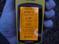
| + | Image:20100312_34_-84NW07.JPG | 2.49 feet to go. Close enough. | ||
| + | Image:20100312_34_-84NW08.JPG | Time of the meetup. | ||
| + | Image:20100312_34_-84NW09.JPG | Date of the meetup. | ||
| + | Image:20100312_34_-84NW10.JPG | 13 feet accuracy. | ||
| + | Image:20100312_34_-84NW11.JPG | Looking west towards the interstate. It was close enough that I could make out the bigger trucks going by. | ||
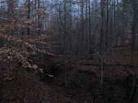
| + | Image:20100312_34_-84NW12.JPG | Me standing on the exact Geohash spot, getting rained on. | ||
| + | Image:20100312_34_-84NW13.JPG | The huge frog pond. There were so many frogs in this pond making so much noise that I could heard them from where I parked 1/2 mile away. | ||
</gallery> | </gallery> | ||
| Line 32: | Line 44: | ||
{{Land geohash | latitude = 34 | longitude = -84| date = 2010-03-12| name = NWoodruff}} | {{Land geohash | latitude = 34 | longitude = -84| date = 2010-03-12| name = NWoodruff}} | ||
| + | {{consecutive geohash | count = 4 | latitude = 33 | longitude = -84 | date = 2010-03-09 | name = NWoodruff }} | ||
| Line 37: | Line 50: | ||
[[Category:Coordinates reached]] | [[Category:Coordinates reached]] | ||
[[Category:Expeditions with photos]] | [[Category:Expeditions with photos]] | ||
| + | {{location|US|GA|GW}} | ||
Latest revision as of 12:27, 19 February 2020
| Fri 12 Mar 2010 in Roswell: 34.0449015, -84.0250764 geohashing.info google osm bing/os kml crox |
Graticule
About
200 yards into the woods near the split of I-85 and I-985 near Suwanee Georgia
People
Expeditions
Gallery
- Photo Gallery
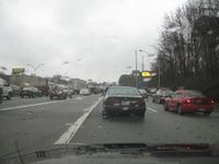
Traffic getting onto the interstate.
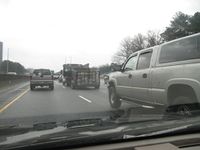
Traffic once on the interstate.
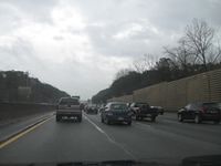
Traffic for as far as you could see.
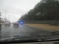
Ah... The reason....
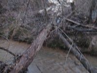
Another river that I had to cross. The is the only way across.
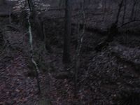
I made it across. Only another 300 feet or so to go.

2.49 feet to go. Close enough.
Time of the meetup.
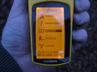
Date of the meetup.
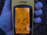
13 feet accuracy.
Looking west towards the interstate. It was close enough that I could make out the bigger trucks going by.
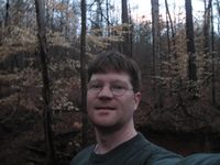
Me standing on the exact Geohash spot, getting rained on.
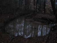
The huge frog pond. There were so many frogs in this pond making so much noise that I could heard them from where I parked 1/2 mile away.


Achievements
NWoodruff earned the Land geohash achievement
|
NWoodruff earned the Consecutive geohash achievement
|