Difference between revisions of "2010-05-22 49 8"
imported>Fivetonsofflax (Added plans) |
imported>FippeBot m (Location) |
||
| (3 intermediate revisions by 2 users not shown) | |||
| Line 2: | Line 2: | ||
| lat=49 | | lat=49 | ||
| lon=8 | | lon=8 | ||
| − | | date=2010- | + | | date=2010-05-22 |
}} | }} | ||
| Line 36: | Line 36: | ||
Image:2010-05-22 49 8 04.JPG | Image:2010-05-22 49 8 04.JPG | ||
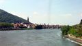
Image:2010-05-22 49 8 05.JPG|View back to Heidelberg | Image:2010-05-22 49 8 05.JPG|View back to Heidelberg | ||
| − | Image:2010-05-22 49 8 06.JPG|I decided to leave my bike | + | Image:2010-05-22 49 8 06.JPG|I decided to leave my bike here... |
Image:2010-05-22 49 8 07.JPG|A decision I didn't regret. | Image:2010-05-22 49 8 07.JPG|A decision I didn't regret. | ||
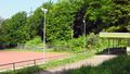
Image:2010-05-22 49 8 08.JPG|Sports ground in the middle of the woods | Image:2010-05-22 49 8 08.JPG|Sports ground in the middle of the woods | ||
| Line 48: | Line 48: | ||
Image:2010-05-22 49 8 16.JPG|Back in Heidelberg | Image:2010-05-22 49 8 16.JPG|Back in Heidelberg | ||
</Gallery> | </Gallery> | ||
| + | |||
| + | == Achievements == | ||
| + | {{Geohashing Day | ||
| + | | latitude = 49 | ||
| + | | longitude = 8 | ||
| + | | year = 2010 | ||
| + | | coorddate = 2010-05-22 | ||
| + | | name = fivetonsofflax | ||
| + | | mouseover = true | ||
| + | }} | ||
[[Category:Expeditions]] | [[Category:Expeditions]] | ||
[[Category:Coordinates reached]] | [[Category:Coordinates reached]] | ||
[[Category:Expeditions with photos]] | [[Category:Expeditions with photos]] | ||
| + | {{location|DE|BW|HD}} | ||
Latest revision as of 02:08, 9 August 2019
| Sat 22 May 2010 in 49,8: 49.4635260, 8.7646015 geohashing.info google osm bing/os kml crox |
Location
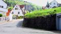
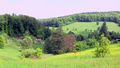
On a meadow in Wilhelmsfeld
Participants
Plans
In wilhelmsfeld. As I am in Heidelberg now, i am considering this for mouseover day. Other heidelberghAshers want to join me? Koepfel talk 19:03, 21 May 2010 (UTC)
- I guess I'll be there, but pretty early. Maybe around 11 am or so. Fivetonsofflax 22:27, 21 May 2010 (UTC)
Expedition
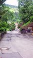
I started by bike from my place in Heidelberg-Kirchheim. The first part of the expedition to the center of Heidelberg was identical with my daily route to university. Not too exciting. I crossed the Neckar river and went on eastwards to Ziegelhausen. When I turned left, away from the river, and the route started to go uphill, I began to realize the I might have underestimated the Odenwald mountains. A few kilometers later, I had to admit to myself that neither my bike nor my body were fit for the steep climb, so I left my bike behind and continued on foot. I went through the woods for a while and soon reached Wilhelmsfeld. The hashpoint was easy to find and access, so I didn't stay there for a long time. I returned to Peterstal, where I had left my bike, and from there went back to Heidelberg.
Tracklog
http://www.everytrail.com/view_trip.php?trip_id=630044
Photos
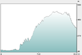
Height profile from OpenRouteService
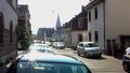
Starting in Heidelberg-Kirchheim
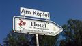
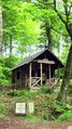
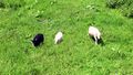
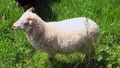
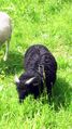
Koepfel's natural habitat
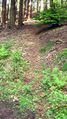
Beginning of the exhausting part
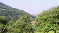
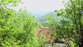
View back to Heidelberg
I decided to leave my bike here...
A decision I didn't regret.
Sports ground in the middle of the woods
OpenStreetMap coverage never ceases to amaze me.
View to Wilhelmsfeld, the hash village
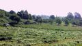
View from hashpoint
Back in Heidelberg


Achievements
fivetonsofflax earned the 2010 Mouse Over Day achievement
|