Difference between revisions of "2010-11-20 34 -83"
From Geohashing
imported>NWoodruff (Created page with '{{meetup graticule | map=<map lat="34" lon="-83" date="2010-11-20" /> | lat=34 | lon=-83 | date=2010-11-20 | graticule_name=Toccoa | graticule_link=Toccoa, Georgia }} == Graticu…') |
m (Replacing http://wiki.xkcd.com/geohashing/Toccoa%2C_Georgia with Toccoa, Georgia) |
||
| (7 intermediate revisions by 2 users not shown) | |||
| Line 10: | Line 10: | ||
== Graticule == | == Graticule == | ||
| − | [ | + | [[Toccoa, Georgia|Toccoa]] |
== About == | == About == | ||
| Line 20: | Line 20: | ||
=== [[User:NWoodruff|NWoodruff]] === | === [[User:NWoodruff|NWoodruff]] === | ||
| + | In a bizarre twist of fate, I agreed to go on a bicycle ride for today that passes 500 feet or so from this Geohash spot. I've been a big fan of [http://www.cyclenittygritty.org/ this bicycle club] and am going to ride this route [http://www.cyclenittygritty.org/maps/applevalley_loop.pdf Apple Valley Loop]. It will pass by the hash point so close as I will have to stop. | ||
| − | + | I am a fan of long distance riding as you can see [http://connect.garmin.com/activity/56226216 here.] I am looking forward to today's ride. | |
| + | |||
| + | I found the geohash spot with 1.25 feet to go. I took a few pictures and then continued on my way. | ||
| + | |||
| + | The ride can be found [http://connect.garmin.com/activity/57364138 here] | ||
| + | |||
| + | === Gallery === | ||
<gallery caption="Photo Gallery" widths="200px" heights="200px" perrow="3"> | <gallery caption="Photo Gallery" widths="200px" heights="200px" perrow="3"> | ||
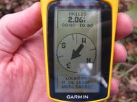
| − | Image:2010112034-83NW01.jpg | | + | Image:2010112034-83NW01.jpg | 2.06 feet to go. Close enough. |
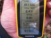
| + | Image:2010112034-83NW02.jpg | Time of the meetup. | ||
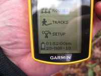
| + | Image:2010112034-83NW03.jpg | Date of the meetup. | ||
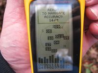
| + | Image:2010112034-83NW04.jpg | 14 feet accuracy. | ||
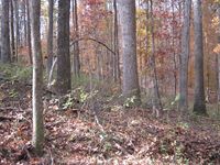
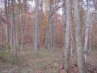
| + | Image:2010112034-83NW05.jpg | Looking North Standing on the Geohash spot. | ||
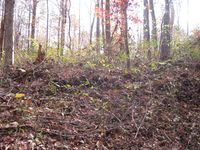
| + | Image:2010112034-83NW06.jpg | looking West up the hill towards the road. | ||
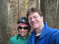
| + | Image:2010112034-83NW07.jpg | Me with my sister as a drag along. | ||
| + | Image:2010112034-83NW08.jpg | Looking East down the hill standing on the Geohash spot. | ||
</gallery> | </gallery> | ||
| Line 30: | Line 44: | ||
{{land geohash | latitude = 34 | longitude = -83| date = 2010-11-20| name = NWoodruff}} | {{land geohash | latitude = 34 | longitude = -83| date = 2010-11-20| name = NWoodruff}} | ||
| + | {{Bicycle geohash | ||
| + | |||
| + | | latitude = 34 | ||
| + | | longitude = -83 | ||
| + | | date = 2010-11-20 | ||
| + | | name = Nathan | ||
| + | | distance = 66.68km | ||
| + | |||
| + | }} | ||
| + | |||
[[Category:Expeditions]] | [[Category:Expeditions]] | ||
| Line 35: | Line 59: | ||
[[Category:Coordinates reached]] | [[Category:Coordinates reached]] | ||
[[Category:Addicted to geohashing|NWoodruff]] | [[Category:Addicted to geohashing|NWoodruff]] | ||
| + | {{location|US|GA|JC}} | ||
Latest revision as of 12:43, 19 February 2020
| Sat 20 Nov 2010 in Toccoa: 34.1520055, -83.5408657 geohashing.info google osm bing/os kml crox |
Graticule
About
Off of County Farm Road in Jefferson.
Expedition
NWoodruff
In a bizarre twist of fate, I agreed to go on a bicycle ride for today that passes 500 feet or so from this Geohash spot. I've been a big fan of this bicycle club and am going to ride this route Apple Valley Loop. It will pass by the hash point so close as I will have to stop.
I am a fan of long distance riding as you can see here. I am looking forward to today's ride.
I found the geohash spot with 1.25 feet to go. I took a few pictures and then continued on my way.
The ride can be found here
Gallery
- Photo Gallery
Achievements
NWoodruff earned the Land geohash achievement
|
Nathan earned the Bicycle geohash achievement
|
