Difference between revisions of "2010-11-25 60 10"
imported>Relet m (fix cats) |
m (2020-01-01 update) |
||
| (2 intermediate revisions by 2 users not shown) | |||
| Line 7: | Line 7: | ||
__NOTOC__ | __NOTOC__ | ||
== Location == | == Location == | ||
| + | It's in the woods between the road to Ask, the highway, and a railroad. | ||
({{PBGH_battleship|lat=60|lon=10|date=2010-11-25}} Just for the records. We already know there is only water there.) | ({{PBGH_battleship|lat=60|lon=10|date=2010-11-25}} Just for the records. We already know there is only water there.) | ||
| Line 54: | Line 55: | ||
[[Category:Expeditions with photos]] | [[Category:Expeditions with photos]] | ||
[[Category:Coordinates reached]] | [[Category:Coordinates reached]] | ||
| + | {{location|NO|30}} | ||
Latest revision as of 00:26, 16 February 2020
| Thu 25 Nov 2010 in 60,10: 60.1533829, 10.2176960 geohashing.info google osm bing/os kml crox |
Location
It's in the woods between the road to Ask, the highway, and a railroad.
(Today's battleship location is: C 2 Just for the records. We already know there is only water there.)
Participants
Plans
It's in the woods between the road to Ask, the highway, and a railroad. I'll get there somehow in the evening - ETA 1800. Should be dark and snowy.
Expedition
- Coordinates reached! -- relet @60,1534,10,2178 17:48, 25 November 2010 (MEZ)
Wow! That was intense!
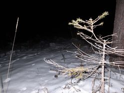
It was really just a quick 3km ride with my bike, and a few hundred meters through the forest. But part of what makes geohashing so amazing is that it all has to happen at the worst possible time at the wrong time of year. :D So, it was dark, freezing and snowy. And when I say dark, I mean that amazing moment when you pass the last streetlight out of town, and suddenly that huge black starry sky spans over your head and you just think: that's where you belong - somewhere right here.
I parked my bike right next to the highway crossing on the road side, and started wading through the (ground covering, but not yet very deep) snow. Following a forest track in darkness (it's never really dark when there is snow on the ground), I discovered a forest, and a ravine. And I could make out the railroad tracks in the distance. My map showed me that I would have to cross a small river, so I decided to go down the ravine and see where the river would pass.
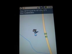
Turns out there was no river there, and the geohash would be a bit further. Scrambled up the side of the ravine, and back down on the other side of the hill. There should be something like a stream under my feet, but it was sufficiently frozen. Up another forested hillside, 40m to go. Down the left flank... 20... 16.. 16. I made quite a few circles in the snow without the coordinates changing significantly. Eventually, they were kind enough to fall below the 10m mark and I called it a coordinates reached. Anything within 8m had already been walked.
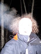
Cold weather and a flash make for nice pictures. Too bad it's Thanksgiving and not Halloween. :D
Surprisingly, my feet stayed dry all the time. Yay for waterproof shoes and dry, cold snow.
Tracklog
Photos
|


