Difference between revisions of "2011-02-18 45 -106"
imported>Tankgunk (Getting the page going...) |
m (per Renaming Proposal) |
||
| (9 intermediate revisions by 4 users not shown) | |||
| Line 1: | Line 1: | ||
| + | [[Image:{{{image|2011-02-18_45_-106_cattlegate.jpg}}}|thumb|left]] | ||
| − | |||
| − | |||
| − | |||
| − | |||
| − | |||
| − | |||
| − | |||
| − | |||
| − | |||
{{meetup graticule | {{meetup graticule | ||
| lat=45 | | lat=45 | ||
| Line 15: | Line 7: | ||
}} | }} | ||
| − | |||
__NOTOC__ | __NOTOC__ | ||
== Location == | == Location == | ||
| − | + | A dirt road near Decker Coal Mine in Montana. | |
== Participants == | == Participants == | ||
| − | + | [[User:Tankgunk|tankgunk]] and his sister. | |
== Plans == | == Plans == | ||
| − | + | The location is an hour away from tankgunk's house, and smack dab on a road, so tankgunk took his sister out for some driving hours on her permit. | |
== Expedition == | == Expedition == | ||
| − | + | Twas a blast, we took a dirt road up for fun, and took the real highway back home (it was getting late). Might have been more pretty hills and stuff to look at during the day, though. | |
| − | == | + | == Photos == |
| − | + | The quality of these photos is really really bad, a combination of late night geohashing and phone cameras. I promise, next time we'll go during the day with a real camera. Also, I didn't get any pictures of the actual ground at the location; all the dirt road looked the same as the first picture I took, so I didn't worry about it. | |
| + | |||
| + | My favorite is the serious business entrance to the coal mine. The fence around the entire mine, where they bother to have one, is barbed wire. And it's huge, it's almost-but-not-really like trying to secure the Mexico border. Anyway, they operate 24/7, someone was probably watching me from the security booth and wondering what I was up to... | ||
| − | |||
| − | |||
| − | |||
| − | |||
<gallery perrow="5"> | <gallery perrow="5"> | ||
| + | Image:2011-02-18_45_-106_road.jpg | The road we drove on to get to the hash location. | ||
| + | Image:2011-02-18_45_-106_railroadxing.jpg | One of a few railroad crossings encountered. | ||
| + | File:2011-02-18_45_-106_montanasign.jpg | The Wyoming/Montana border. | ||
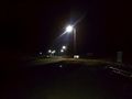
| + | File:2011-02-18_45_-106_cattlegate.jpg | Didn't see any cows, just this cattle gate and cattle x-ing sign. The lights in the distance are the Decker Coal Mine. | ||
| + | File:2011-02-18_45_-106_deckersign.jpg | The actual coal mine, I've been here before to watch a large explosion. Best high school field trip ever. | ||
| + | File:2011-02-18_45_-106_deckerroad.jpg | Ignore the barbed wire fence and check out the secure entrance :P | ||
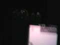
| + | File:2011-02-18_45_-106_coords.jpg | Poor quality proof. Sorry :( | ||
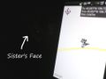
| + | File:2011-02-18_45_-106_stupidgrins.jpg | Unsuccessful attempt at proof, with slightly more visible face. | ||
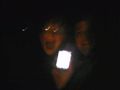
| + | File:2011-02-18 45 -106 speed.jpg | Bumpy road makes for really blurry pictures, but this is us driving over the location at the highest legal speed (45mph). | ||
</gallery> | </gallery> | ||
== Achievements == | == Achievements == | ||
{{#vardefine:ribbonwidth|800px}} | {{#vardefine:ribbonwidth|800px}} | ||
| − | + | {{land geohash | |
| + | | latitude = 45 | ||
| + | | longitude = -106 | ||
| + | | date = 2011-02-18 | ||
| + | | name = tankgunk | ||
| + | }} | ||
| + | {{Speed racer | ||
| + | | latitude = 45 | ||
| + | | longitude = -106 | ||
| + | | date = 2011-02-18 | ||
| + | | name = tankgunk | ||
| + | | speed = 45mph | ||
| + | }} | ||
| + | {{drag-along | ||
| + | | latitude = 45 | ||
| + | | longitude = -106 | ||
| + | | date = 2011-02-18 | ||
| + | | partner = his sister | ||
| + | | name = tankgunk | ||
| + | }} | ||
| + | {{Graticule unlocked | ||
| + | | latitude = 45 | ||
| + | | longitude = -106 | ||
| + | | date = 2011-02-18 | ||
| + | | name = tankgunk | ||
| + | }} | ||
| − | |||
| − | |||
| − | |||
| − | |||
| − | |||
| − | |||
| − | |||
| − | |||
| − | |||
| − | |||
| − | |||
[[Category:Expeditions]] | [[Category:Expeditions]] | ||
| − | |||
[[Category:Expeditions with photos]] | [[Category:Expeditions with photos]] | ||
| − | |||
| − | |||
| − | |||
| − | |||
| − | |||
[[Category:Coordinates reached]] | [[Category:Coordinates reached]] | ||
| − | + | {{location|US|MT|BI}} | |
| − | |||
| − | |||
| − | |||
| − | |||
| − | |||
| − | |||
| − | |||
| − | |||
| − | |||
Latest revision as of 05:57, 20 March 2024

| Fri 18 Feb 2011 in 45,-106: 45.0569460, -106.7266731 geohashing.info google osm bing/os kml crox |
Location
A dirt road near Decker Coal Mine in Montana.
Participants
tankgunk and his sister.
Plans
The location is an hour away from tankgunk's house, and smack dab on a road, so tankgunk took his sister out for some driving hours on her permit.
Expedition
Twas a blast, we took a dirt road up for fun, and took the real highway back home (it was getting late). Might have been more pretty hills and stuff to look at during the day, though.
Photos
The quality of these photos is really really bad, a combination of late night geohashing and phone cameras. I promise, next time we'll go during the day with a real camera. Also, I didn't get any pictures of the actual ground at the location; all the dirt road looked the same as the first picture I took, so I didn't worry about it.
My favorite is the serious business entrance to the coal mine. The fence around the entire mine, where they bother to have one, is barbed wire. And it's huge, it's almost-but-not-really like trying to secure the Mexico border. Anyway, they operate 24/7, someone was probably watching me from the security booth and wondering what I was up to...
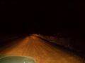
The road we drove on to get to the hash location.
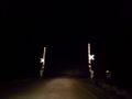
One of a few railroad crossings encountered.
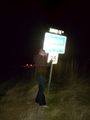
The Wyoming/Montana border.
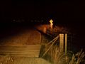
Didn't see any cows, just this cattle gate and cattle x-ing sign. The lights in the distance are the Decker Coal Mine.

The actual coal mine, I've been here before to watch a large explosion. Best high school field trip ever.
Ignore the barbed wire fence and check out the secure entrance :P
Poor quality proof. Sorry :(
Unsuccessful attempt at proof, with slightly more visible face.
Bumpy road makes for really blurry pictures, but this is us driving over the location at the highest legal speed (45mph).


Achievements
tankgunk earned the Land geohash achievement
|

tankgunk earned the Drag-along achievement
|
tankgunk earned the Graticule Unlocked Achievement
|