Difference between revisions of "2011-04-28 50 11"
imported>Reinhard (Reinhard's report) |
imported>FippeBot m (Location) |
||
| (2 intermediate revisions by one other user not shown) | |||
| Line 11: | Line 11: | ||
== Participants == | == Participants == | ||
* [[User:Paintedhell|Juja]] and Hans | * [[User:Paintedhell|Juja]] and Hans | ||
| + | * [[User:Reinhard|Reinhard]] | ||
== Expedition (Juja) == | == Expedition (Juja) == | ||
| Line 35: | Line 36: | ||
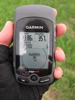
|Image:20110428-50N11E-01.jpg|Hashpoint reached! (Reinhard's proof) | |Image:20110428-50N11E-01.jpg|Hashpoint reached! (Reinhard's proof) | ||
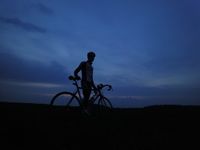
|Image:20110428-50N11E-02.jpg|Reinhard with bike in the dark. | |Image:20110428-50N11E-02.jpg|Reinhard with bike in the dark. | ||
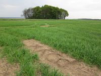
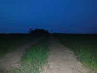
| − | |Image:20110428-50N11E-03.jpg|View towards | + | |Image:20110428-50N11E-03.jpg|View towards Karsdorfberg. |
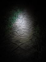
|Image:20110428-50N11E-04.jpg|Finally found Juja's mark. | |Image:20110428-50N11E-04.jpg|Finally found Juja's mark. | ||
}} | }} | ||
| Line 42: | Line 43: | ||
[[Category:Expeditions with photos]] | [[Category:Expeditions with photos]] | ||
[[Category:Coordinates reached]] | [[Category:Coordinates reached]] | ||
| + | {{location|DE|TH|SHK}} | ||
Latest revision as of 06:19, 9 August 2019
| Thu 28 Apr 2011 in 50,11: 50.9760390, 11.7793011 geohashing.info google osm bing/os kml crox |
Location
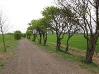
Near a fieldway in the middle of nothing (near the villages of Hohendorf, Schmörschwitz and Karsdorfberg, a small distance away from Bürgel).
Participants
Expedition (Juja)
The weather reports for today were not too good, so I waited all day and finally decided in the evening after work that I would try to reach the hash (since it was warm and even a bit sunny then). So I started about half past five, rode the nice bikeway to Bürgel (thanks to that bikeway I even avoided travelling through the middle of Bürgel this time), passed the Hash of March 21 by some hundred meters and went on to Hohendorf and Schmörschwitz, over those perfect cobbled streets that Uli is always raving about ;)
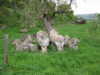
After I passed "Rittergut Karsdorfberg" I was finally on the direct way to today's geohash point, but I still had to pass three electric fences (fortunately it was possible to open and close it so I did not need to climb over it together with my bike) and some staring horses (I am a little afraid of those huge guys) before I could ride the last hundred meters in the fields. It's probably wheat that will grow there later this year, but the plants were still very small and since there were huge skidmarks in the field (one of which I also marked) it was no problem to get to the hash.
To get home I went on on that fieldway, and surprisingly it didn't just end (like Googlemaps and OSM said) but lead me on the way which led me home (passing Poxdorf, Graitschen and Golmsdorf). Since the weather was so exceedingly fine (which means it still didn't rain) I took a quick detour over the Jenzig (my backyard mountain) on the way home, biking the way up through Laasan and down the hill again, where I met the first smiling biker for this month. Whoever you are: thank you, you saved my day!
Expedition (Reinhard)
From one of hist last expeditions I learned that small pasta leftovers are not enough food for starting an average bike geohashing trip, so I also had several toasts with jam and finally started at 8 p.m., after despairingly waiting for rain (in case of rain I'd had had a good excuse to stay at home). Though also starting from Jena, I took a totally different route to the hash, passing through Dorndorf-Steudnitz and Rockau. There I discovered (with the preceding help of Google satellite view) a paved bike path which was getting me 1.4 km closer to the hashpoint. The last part consisted of 1 km gravel road and 1.2 km field path. I didn't see any hints of Juja, so just found the exact spot and started taking photos. I looked for XKCD marks, but didn't seem to be successful, thus I bagged my camera and let my bike headlight glance one last time over the hash area, when I suddenly recognized four letters in the dry ground of the field tractor lane next to the spot. I continued towards Karsdorfberg, where the nearest paved road leading home (again through Dorndorf-Steudnitz) was awaiting me.
Photos
|

