Difference between revisions of "2011-09-17 57 -2"
imported>Damianc (→Photographs) |
imported>Fippe (Location) |
||
| (7 intermediate revisions by one other user not shown) | |||
| Line 18: | Line 18: | ||
We'd always planned a water geohash but somehow never got around to it. So when today's location was straight out of our village harbour, not too far offshore, and the tide and weather were OK, we couldn't not go for it. | We'd always planned a water geohash but somehow never got around to it. So when today's location was straight out of our village harbour, not too far offshore, and the tide and weather were OK, we couldn't not go for it. | ||
| − | A point note: As far as we can tell, this is by far the furthest hash away from land to date, at approximately 6 km from Portknockie/Findochty. Surely this is a record which can be easily and dramatically beaten? | + | A point to note: As far as we can tell, this is by far the furthest successful hash away from land to date, at approximately 6 km from Portknockie/Findochty. Surely this is a record which can be easily and dramatically beaten? |
| − | [[User:smoulder|smoulder]] | + | [[User:smoulder|smoulder]] had not ventured this far on water before, so [[User:damianc|damianc]] decided that full pastafarian regalia might add a bit too much stress. |
| − | The sea was fairly lumpy all the way out, and [[User:smoulder|smoulder]] started to feel a bit green sitting in the cuddy doing the navigating. Technically this would | + | The sea was fairly lumpy all the way out, and [[User:smoulder|smoulder]] started to feel a bit green sitting in the cuddy doing the navigating. Technically this would have been a juggernaut geohash insofar as we went in a straight line with no obstacles to overcome. |
Actually trying to position a boat to the accuracy of a metre or so in the open sea with a strongish drift involves a fair bit of wobbly circling around. Similarly, trying to photograph the gps app proved tricky in the swell. But still, [[User:smoulder|smoulder]] bagged the picnic achievement by eating a juicy victoria plum. | Actually trying to position a boat to the accuracy of a metre or so in the open sea with a strongish drift involves a fair bit of wobbly circling around. Similarly, trying to photograph the gps app proved tricky in the swell. But still, [[User:smoulder|smoulder]] bagged the picnic achievement by eating a juicy victoria plum. | ||
| Line 36: | Line 36: | ||
| longitude = -2 | | longitude = -2 | ||
| date = 2011-09-17 | | date = 2011-09-17 | ||
| − | | name = | + | | name = smoulder and damianc |
| + | | vehicle = skylark | ||
}} | }} | ||
| Line 43: | Line 44: | ||
| longitude = -2 | | longitude = -2 | ||
| date = 2011-09-17 | | date = 2011-09-17 | ||
| − | | name = smoulder | + | | name = [[User:smoulder|smoulder]] |
| food = victoria plum (juicy) | | food = victoria plum (juicy) | ||
| Line 66: | Line 67: | ||
Image:2011-09-17_57_-2-harbour2.jpg|Pots in the harbour | Image:2011-09-17_57_-2-harbour2.jpg|Pots in the harbour | ||
</gallery> | </gallery> | ||
| + | {{location|GB|SCT}} | ||
Latest revision as of 17:51, 5 July 2019
| Sat 17 Sep 2011 in Aberdeen: 57.7586070, -2.8922134 geohashing.info google osm bing/os kml crox |
Contents
About
Smoulder and Damianc made this expedition aboard the Skylark.
Expedition
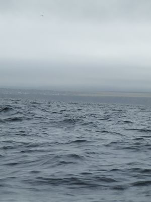
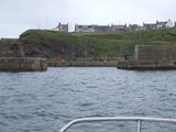
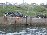
We'd always planned a water geohash but somehow never got around to it. So when today's location was straight out of our village harbour, not too far offshore, and the tide and weather were OK, we couldn't not go for it.
A point to note: As far as we can tell, this is by far the furthest successful hash away from land to date, at approximately 6 km from Portknockie/Findochty. Surely this is a record which can be easily and dramatically beaten?
smoulder had not ventured this far on water before, so damianc decided that full pastafarian regalia might add a bit too much stress.
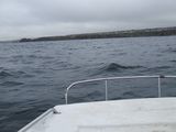
The sea was fairly lumpy all the way out, and smoulder started to feel a bit green sitting in the cuddy doing the navigating. Technically this would have been a juggernaut geohash insofar as we went in a straight line with no obstacles to overcome.
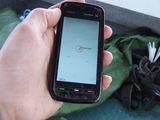
Actually trying to position a boat to the accuracy of a metre or so in the open sea with a strongish drift involves a fair bit of wobbly circling around. Similarly, trying to photograph the gps app proved tricky in the swell. But still, smoulder bagged the picnic achievement by eating a juicy victoria plum.
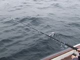
After a short fruitless bash at geocatching some fish for tea we has a pleasant trip back to harbour, followed by kittiwakes, herring gulls, and being circled by gannets, plus the occasional little auk passing by (No dolphins or FSM).
Achievements
smoulder and damianc earned the Water geohash achievement
|
smoulder earned the Picnic achievement
|
