Difference between revisions of "2011-09-18 43 -116"
From Geohashing
imported>Michael5000 m (→Photos) |
imported>FippeBot m (Location) |
||
| (3 intermediate revisions by one other user not shown) | |||
| Line 23: | Line 23: | ||
== Photos == | == Photos == | ||
| − | <--Yes, all of the photos have misleading file names. I was confused.--> | + | <!--Yes, all of the photos have misleading file names. I was confused.--> |
<gallery perrow="5"> | <gallery perrow="5"> | ||
| Line 35: | Line 35: | ||
== Achievements == | == Achievements == | ||
{{#vardefine:ribbonwidth|800px}} | {{#vardefine:ribbonwidth|800px}} | ||
| − | + | ||
| + | *Only the second ever Expedition to the Boise graticule! | ||
| + | *Sixth Expedition of the [[Endurance Geohashing]] series. | ||
| + | |||
[[Category:Expeditions]] | [[Category:Expeditions]] | ||
| Line 41: | Line 44: | ||
[[Category:Coordinates reached]] | [[Category:Coordinates reached]] | ||
| + | {{location|US|ID|OW}} | ||
Latest revision as of 00:53, 13 August 2019
| Sun 18 Sep 2011 in 43,-116: 43.1259597, -116.5505765 geohashing.info google osm bing/os kml crox |
Location
Two miles off of Highway 78 on the Silver City road.
Participants
Expedition
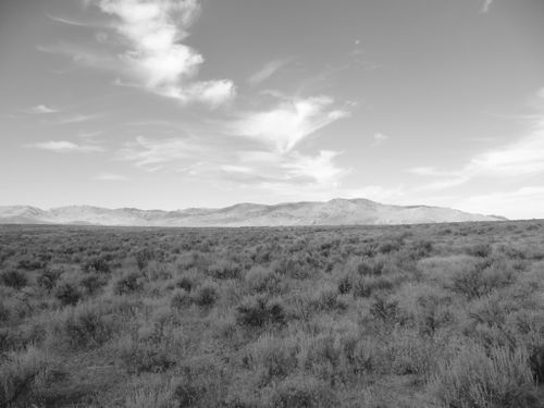
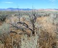
I rolled up to the hashpoint at 11:04 local time, but not surprisingly there were not throngs of local geohashers out to join me along the Owyhee Front. Traveling geohashes don't get much simpler: the Silver City Road, which apparently gets pretty rugged up in the hills but is perfectly well-behaved down in the desert flat, brought me to within a well-chucked stone's throw of the hashpoint. I wandered out into the sagebrush, enjoyed the views, communed with nature, took my photographs, etc., and then set course for further adventures!
Photos
Achievements
- Only the second ever Expedition to the Boise graticule!
- Sixth Expedition of the Endurance Geohashing series.


