Difference between revisions of "2011-12-30 53 10"
imported>Bierhefe (new page) |
imported>FippeBot m (Location) |
||
| (11 intermediate revisions by 2 users not shown) | |||
| Line 1: | Line 1: | ||
| − | |||
| − | |||
| − | |||
| − | |||
| − | |||
| − | |||
| − | |||
| − | |||
| − | |||
| − | |||
{{meetup graticule | {{meetup graticule | ||
| − | | lat= | + | | lat=53 |
| − | | lon= | + | | lon=10 |
| − | | date= | + | | date=2011-12-30 |
}} | }} | ||
| − | |||
__NOTOC__ | __NOTOC__ | ||
== Location == | == Location == | ||
| − | + | In a forest between Hamburg and Glinde. | |
== Participants == | == Participants == | ||
| − | + | [[User:Bierhefe|Bierhefe]] and wife. | |
== Plans == | == Plans == | ||
| − | + | This one is within walking distance from our home. Depending on when my wife can leave work tomorrow we will be there at around 6PM. If it's getting too late for her I will have to venture there alone. | |
| + | |||
| + | Depending on how dense the forest is (or if there are fences, etc.) the hash point might be inaccessible. Also this is a great opportunity to try and get the Tron Achievement. | ||
== Expedition == | == Expedition == | ||
| − | <!-- | + | My wife was tired when she got home, but after a lot of convincing she finally agreed to come with me. We set out at around 17:50 and walked to the hash point. Our efforts to fulfill the requirements for a Tron Achievement where rendered void however, since the paths that we saw on google maps didn't seem to exist, so we had to turn around and backtrack to a cross-way we passed a few minutes ago. |
| + | |||
| + | While we where looking for a way to enter the forest we found a riding trail, which was narrow and muddy, but still a lot better to walk on compared to fighting our way through (not so thick) bushes. | ||
| + | |||
| + | When we where really close to the hash point I kind of lost orientation for a while, reading the map on my GPS wrong, which resulted in a very short detour into the forest, when all we had to do was to jump over a small stream. Now we crossed the stream serveral times and I got a wet foot on my next to last jump! | ||
| + | |||
| + | But at least we made it to the hash point and returned home after that, again walking. So, while we didn't fulfill the requirements for a [[Tron achievement]], we still earned a ribbon for a [[Walk geohash]]. | ||
| + | |||
| + | Alas, we didn't take too much pictures as it was already dark outside. But the tracklog should be proof enough that we didn't take any other means of transportation. <!-- And if that isn't enough... well, you just have to believe me that we walked to the hash! :P --> | ||
== Tracklog == | == Tracklog == | ||
| − | + | Tracklog available on [http://de.everytrail.com/view_trip.php?trip_id=1402082 Everytrail]. Average speed of 3.7 kmh (2.3 mph) should be proof enough that we walked the whole way. If we could go that slow on a bicycle... well, that would be an achievement, right? :D | |
== Photos == | == Photos == | ||
| − | < | + | <gallery perrow="3"> |
| − | Image: | + | Image:2011-12-30 001.jpg | Coordinates where a bit jumpy |
| − | -- | + | Image:2011-12-30 002.jpg | A bit off, but it was in a dense forest... |
| − | + | Image:2011-12-30 003.jpg | Believe it or not, this is a picture of a stream! | |
| + | Image:2011-12-30 004.jpg.JPG | Our hashcots didn't dare to jump it... | ||
| + | Image:2011-12-30 005.jpg.JPG | The moon. | ||
</gallery> | </gallery> | ||
== Achievements == | == Achievements == | ||
{{#vardefine:ribbonwidth|800px}} | {{#vardefine:ribbonwidth|800px}} | ||
| − | + | {{Walk geohash | |
| + | | latitude = 53 | ||
| + | | longitude = 10 | ||
| + | | date = 2011-12-30 | ||
| + | | name = [[User:Bierhefe|Bierhefe]] and his wife | ||
| + | | distance = 4.98 km | ||
| + | }} | ||
| + | == Geohashing Expeditions and Plans on This Day == | ||
| − | + | {{expedition summaries|2011-12-30}} | |
| − | |||
| − | |||
| − | |||
| − | |||
| − | |||
| − | |||
| − | |||
| − | |||
[[Category:Expeditions]] | [[Category:Expeditions]] | ||
| − | + | [[Category:Coordinates reached]] | |
[[Category:Expeditions with photos]] | [[Category:Expeditions with photos]] | ||
| − | + | {{location|DE|SH|OD}} | |
| − | |||
| − | |||
| − | |||
| − | |||
| − | |||
| − | |||
| − | |||
| − | |||
| − | |||
| − | |||
| − | |||
| − | |||
| − | |||
| − | |||
| − | |||
Latest revision as of 01:55, 13 August 2019
| Fri 30 Dec 2011 in 53,10: 53.5241562, 10.2115693 geohashing.info google osm bing/os kml crox |
Location
In a forest between Hamburg and Glinde.
Participants
Bierhefe and wife.
Plans
This one is within walking distance from our home. Depending on when my wife can leave work tomorrow we will be there at around 6PM. If it's getting too late for her I will have to venture there alone.
Depending on how dense the forest is (or if there are fences, etc.) the hash point might be inaccessible. Also this is a great opportunity to try and get the Tron Achievement.
Expedition
My wife was tired when she got home, but after a lot of convincing she finally agreed to come with me. We set out at around 17:50 and walked to the hash point. Our efforts to fulfill the requirements for a Tron Achievement where rendered void however, since the paths that we saw on google maps didn't seem to exist, so we had to turn around and backtrack to a cross-way we passed a few minutes ago.
While we where looking for a way to enter the forest we found a riding trail, which was narrow and muddy, but still a lot better to walk on compared to fighting our way through (not so thick) bushes.
When we where really close to the hash point I kind of lost orientation for a while, reading the map on my GPS wrong, which resulted in a very short detour into the forest, when all we had to do was to jump over a small stream. Now we crossed the stream serveral times and I got a wet foot on my next to last jump!
But at least we made it to the hash point and returned home after that, again walking. So, while we didn't fulfill the requirements for a Tron achievement, we still earned a ribbon for a Walk geohash.
Alas, we didn't take too much pictures as it was already dark outside. But the tracklog should be proof enough that we didn't take any other means of transportation.
Tracklog
Tracklog available on Everytrail. Average speed of 3.7 kmh (2.3 mph) should be proof enough that we walked the whole way. If we could go that slow on a bicycle... well, that would be an achievement, right? :D
Photos
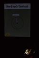
Coordinates where a bit jumpy
A bit off, but it was in a dense forest...
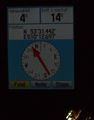
Believe it or not, this is a picture of a stream!

Our hashcots didn't dare to jump it...

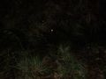
The moon.


Achievements
Bierhefe and his wife earned the Walk geohash Achievement
|
Geohashing Expeditions and Plans on This Day
Expeditions and Plans
| 2011-12-30 | ||
|---|---|---|
| Ballarat, Australia | Felix Dance | In a field of wheat near Beaufort. |
| Melbourne West, Australia | Felix Dance | In a cow field north of Ballan |
| Hamburg (East), Germany | Bierhefe | In a forest between Hamburg and Glinde. |