Difference between revisions of "2012-02-20 45 -122"
imported>Michael5000 m (→Expedition) |
imported>FippeBot m (Location) |
||
| (One intermediate revision by one other user not shown) | |||
| Line 53: | Line 53: | ||
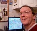
File:2012-02-20 45 -122 Michael5000.jpg | Feeling triumphant about my complete map. | File:2012-02-20 45 -122 Michael5000.jpg | Feeling triumphant about my complete map. | ||
File:2012-02-20 45 -122 Map.jpg | My complete map. Color coding is by season; purple was for the earliest runs, etc. | File:2012-02-20 45 -122 Map.jpg | My complete map. Color coding is by season; purple was for the earliest runs, etc. | ||
| + | file:2012-02-20 45 -122 view from lot.jpg | kydlt. I forgot to take the camera over to the spot with me, but it's right over there. | ||
</gallery> | </gallery> | ||
| Line 69: | Line 70: | ||
[[Category:Coordinates reached]] | [[Category:Coordinates reached]] | ||
| + | {{location|US|OR|MU}} | ||
Latest revision as of 02:26, 13 August 2019
| Mon 20 Feb 2012 in 45,-122: 45.4981044, -122.6267383 geohashing.info google osm bing/os kml crox |
Location
On the campus of the Parry Center for Children in Southeast Portland.
Participants
Expedition
This is not at all far from my home on the beautiful East Side, so a running expedition was clearly in order. Since I worried that a residential center for children with mental and behavioral health issues might not relish random visitors to their tucked-away campus, I thought I would strike at dawn. As it turned out, I was approaching the hashpoint through the parking lot just as some employees were showing up for a 7 a.m. shift, but the combination of the darkness and the confident-jogger-with-headphones (and/or spaced-out-jogger-with-headphones) persona seemed to work. The employees seemed to pause, but then think "eh, what the hell, he'll probably take a few laps on our running track and then leave. Maybe he does it every day." Or, maybe they are fine with visitors, and that's just what I imagined the employees were thinking.
Anyway, the hashpoint was just inside a small running track. It was too dark for pictures.
As part of the same run, I completed a project that I've been working on for the last year and a half: to run down every street in a "box" of Portland formed by the Willamette River, Interstates 84 and 205, and Holgate Street in the South. I had only a short stretch of 36th Avenue a half mile south of the hashpoint left to run, so I looped through it on the way to the hashpoint and took care of two arbitrary-travel adventures before breakfast! Total running mileage for the morning: 4.49 miles.
Expedition the Second
I was in town with the grandchildren and had to tun down to CityBikes for some used bike parts and took a short walk in the rain. I am posting challenged right now but will post a photo later. kydlt @ 16:30
Expedition the Third
Jim had a meeting in the evening in Portland, so he took a side jaunt on the way home and headed east on highway 26. He got to the Parry Center and pulled into the parking lot, but decided it was too late at night to be wandering around and they would probably not be happy, so he considered the 200 feet close enough and headed home.
Tracklog
Photos
Achievements
- Land Geohash
- Michael5000's 50th Successful Expedition in the Portland, Oregon graticule.


