Difference between revisions of "2012-05-08 29 -81"
imported>DrCanadianNinja (→Gallery) |
m (per Renaming Proposal) |
||
| (6 intermediate revisions by 3 users not shown) | |||
| Line 1: | Line 1: | ||
| + | {{Advert}} | ||
| + | |||
{{meetup graticule | {{meetup graticule | ||
| map=<map lat="29" lon="-81" date="2012-05-08" /> | | map=<map lat="29" lon="-81" date="2012-05-08" /> | ||
| Line 11: | Line 13: | ||
=== Geohashers === | === Geohashers === | ||
| − | * [[user: | + | * [[user:Geoffistopheles|Geoff]] |
* [[user:NinjaBait|Erica]] | * [[user:NinjaBait|Erica]] | ||
| Line 18: | Line 20: | ||
But now, on the celebratory day of 26 years of continued existence, would he luck out and find one he could easily reach? | But now, on the celebratory day of 26 years of continued existence, would he luck out and find one he could easily reach? | ||
| + | |||
| + | |||
| + | At first, I didn't think I could reach this one, but I kept looking at it and mulling it over. It was a quick drive, it wasn't fenced off, it's questionable private property... I called Erica to get her thoughts on the matter, and we agreed we could get to this one. The plan was to leave for the hash by 4:30, beat the rush hour traffic for I-295, and do a quick in and out of Green Cove Springs for a successful hash. | ||
=== The Adventure === | === The Adventure === | ||
| Line 40: | Line 45: | ||
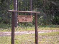
Image:2012-05-08_29_-81_Crosswinds.JPG|I like this sign and I don't know why. | Image:2012-05-08_29_-81_Crosswinds.JPG|I like this sign and I don't know why. | ||
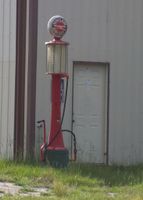
Image:2012-05-08_29_-81_Pump.JPG|Old fashioned! | Image:2012-05-08_29_-81_Pump.JPG|Old fashioned! | ||
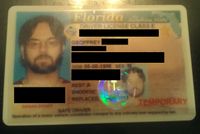
| − | Image:2012-05-08_29_-81_BirthdayProof. | + | Image:2012-05-08_29_-81_BirthdayProof.jpg|Now with censorship! |
</gallery> | </gallery> | ||
== Achieveables == | == Achieveables == | ||
| + | {{Graticule unlocked | ||
| + | | latitude = 29 | ||
| + | | longitude = -81 | ||
| + | | date = 2012-05-08 | ||
| + | | name = [[user:Geoffistopheles|Geoff]] | ||
| + | | image = 2012-05-08_29_-81_Haller.JPG | ||
| + | }} | ||
| + | {{Birthday geohash | ||
| + | | latitude = 29 | ||
| + | | longitude = -81 | ||
| + | | date = 2012-05-08 | ||
| + | | pronoun = his | ||
| + | | name = [[user:Geoffistopheles|Geoff]] | ||
| + | | number = 26th | ||
| + | | image = 2012-05-08_29_-81_StupidGrin.JPG | ||
| + | }} | ||
[[Category:Meetup on 2012-05-08]] | [[Category:Meetup on 2012-05-08]] | ||
[[Category:Meetup in 29 -81]] | [[Category:Meetup in 29 -81]] | ||
[[Category:Expeditions]] | [[Category:Expeditions]] | ||
| + | [[Category:Expeditions with photos]] | ||
[[Category:Coordinates reached]] | [[Category:Coordinates reached]] | ||
| + | {{location|US|FL|CY}} | ||
Latest revision as of 05:38, 20 March 2024
| Have you seen our geohashing marker? We'd love to hear from you! Click here to say "hi" and tell us what you've seen!
Curious about what geohashing is? Read more! |
| Tue 8 May 2012 in Green Cove Springs, Florida: 29.9087370, -81.6851337 geohashing.info google osm bing/os kml crox |
Expedition
Geohashers
The Plan
A spectacularly failed geohash resulted in less interest. A solid month of frustrated efforts. Hashes in the middle of nowhere, in the middle of nowhere in the Atlantic, or worse yet, in the middle of nowhere in Georgia. It was enough to make a man sick of the sport.
But now, on the celebratory day of 26 years of continued existence, would he luck out and find one he could easily reach?
At first, I didn't think I could reach this one, but I kept looking at it and mulling it over. It was a quick drive, it wasn't fenced off, it's questionable private property... I called Erica to get her thoughts on the matter, and we agreed we could get to this one. The plan was to leave for the hash by 4:30, beat the rush hour traffic for I-295, and do a quick in and out of Green Cove Springs for a successful hash.
The Adventure
I took off from work around quarter after 4 to pick up Erica. Given that it was a private airstrip with private residences, I called ahead to wonder if it'd be okay to take some pictures of the airstrip from the overruns. I got the okay, but also the warning that the overruns weren't owned by the same people. I didn't think it'd be a terrible problem, so we went on ahead nonetheless.
For leaving closer to quarter to 5, we ran into some pretty light traffic. I was expecting much worse. As we were joking around, however, we both saw something we had never seen before: Moosehaven, funded by the Loyal Order of Moose. And it wasn't just some college kid's random sign; this was a large gated community with a rather large main house. Despite the fact they've got lodges in all fifty states, or so Wiki tells me, this was the first time we had ever heard of the Loyal Order of Moose. It just seemed so random and nonsensical to stick out in memory. Alas, we were only able to get a few shots and most came out to blurry to post.
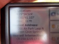
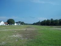
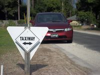
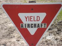
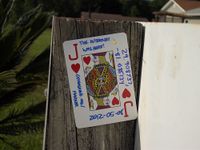
We reached Haller Airpark with little fanfare; it had threatened to rain while we left home and again when we got there, but it never amounted to more than a few drops. We parked just outside of the taxiway and walked out to the overrun. Surprisingly, no one came out to ask what we were doing on their property, which I have to admit I was completely expecting at that point. There was a sign saying to yield to aircraft, which both struck me as common sense and an excellent place to stick the Jack of Hearts.
We took a spin around the airpark, checking out the houses as some of them looked really nice, then headed back to Jacksonville for a birthday/celebratory dinner.
Gallery
- Photo Gallery
Achieveables
Geoff earned the Graticule Unlocked Achievement
|
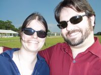
Geoff earned the Birthday Geohash Achievement
|
