Difference between revisions of "2012-06-09 52 4"
imported>Murfie (Created page with "{{meetup graticule | lat=52 | lon=4 | date=2012-06-09 | graticule_name=Amsterdam | graticule_link=Amsterdam, Netherlands}}") |
imported>FippeBot m (Location) |
||
| (15 intermediate revisions by 3 users not shown) | |||
| Line 1: | Line 1: | ||
{{meetup graticule | lat=52 | lon=4 | date=2012-06-09 | graticule_name=Amsterdam | graticule_link=Amsterdam, Netherlands}} | {{meetup graticule | lat=52 | lon=4 | date=2012-06-09 | graticule_name=Amsterdam | graticule_link=Amsterdam, Netherlands}} | ||
| + | |||
| + | |||
| + | <!-- edit as necessary --> | ||
| + | __NOTOC__ | ||
| + | == Location == | ||
| + | <!-- where you've surveyed the hash to be --> | ||
| + | On a farmer's field in Noordwijkerhout | ||
| + | |||
| + | == Participants == | ||
| + | <!-- who attended: If you link to your wiki user name in this section, your expedition will be picked up by the various statistics generated for geohashing. You may use three tildes ~ as a shortcut to automatically insert the user signature of the account you are editing with. | ||
| + | --> | ||
| + | [[User:Murfie|Murfie]] | ||
| + | |||
| + | == Plans == | ||
| + | <!-- what were the original plans --> | ||
| + | The plan is go by bike and arrive at exactly 4pm in case somebody else suffers from the same insanity. | ||
| + | |||
| + | == Expedition == | ||
| + | <!-- how it all turned out. your narrative goes here. --> | ||
| + | |||
| + | I decided to go by bike to this one. As soon as I left, I noticed it was almost | ||
| + | storming and the entire way up to the hash it seemed it was headwind. If this wasn't | ||
| + | enough, after a few minutes it also started to drizzle. | ||
| + | Although the weather didn't really cooperate today, the route itself was pretty nice. | ||
| + | There is an official bike route network in this area, and most of the roads I took | ||
| + | were part of this network. | ||
| + | |||
| + | The geohash was on a flower farm located next to a camping site called 'Op hoop van zegen' | ||
| + | (meaning something like 'upon hoping for god's blessing'). | ||
| + | I left my bike at the camping site and walked to the farm. When I arrived, the farmer | ||
| + | was just refilling his 'flowers for sale' stall in front of the farm. | ||
| + | I asked him kindly if I could go into his fields to make some pictures. | ||
| + | He agreed as long as I did not step on his freshly planted flowers, which was | ||
| + | no problem at all, since there was a sand path in the field that led to the geohash. | ||
| + | |||
| + | At exactly 4 o'clock, I took a picture of myself, standing in the flower field. | ||
| + | My GPS even said for a few moments that the distance was only 0.01m. | ||
| + | I waited a few minutes on the farm, hoping to meet another geohasher, but alas. | ||
| + | |||
| + | I bought a can of icetea in the camping shop and climbed back my bike. | ||
| + | The route home was fantastic. It was dry and all the time it was downwind. | ||
| + | |||
| + | Added: A few weeks later, I learned that there is a (mystery) geocache hidden | ||
| + | very near the geohash location. In fact, if my camera had x-ray vision, I would | ||
| + | have photographed it. Even more amazingly, the cache owner is an active geohasher. | ||
| + | <br />Note by Palmpje: If you thought I am the owner of this geocache I have to disappoint you... I merely know the solution and still have to log the thing, despite it being roughly 1.5 km from home. But I have met the owner, at yet another geocache! | ||
| + | |||
| + | == Tracklog == | ||
| + | <!-- if your GPS device keeps a log, you may post a link here --> | ||
| + | |||
| + | == Photos == | ||
| + | <!-- Insert pictures between the gallery tags using the following format: | ||
| + | Image:2010-##-## ## ## Alpha.jpg | Witty Comment | ||
| + | --> | ||
| + | <gallery perrow="5"> | ||
| + | |||
| + | Image:2012-06-09_52_4_nwh1.jpg | Nice walking route | ||
| + | Image:2012-06-09_52_4_nwh2.jpg | Church | ||
| + | Image:2012-06-09_52_4_nwh3.jpg | The bike route network | ||
| + | Image:2012-06-09_52_4_nwh4.jpg | Some house on the route | ||
| + | Image:2012-06-09_52_4_nwh5.jpg | Bike route signs | ||
| + | Image:2012-06-09_52_4_nwh6.jpg | Train speeding by | ||
| + | Image:2012-06-09_52_4_nwh7.jpg | Welcome to Noordwijkerhout | ||
| + | Image:2012-06-09_52_4_nwh8.jpg | Horse riding | ||
| + | Image:2012-06-09_52_4_nwh9.jpg | Clock tower, right on time | ||
| + | |||
| + | Image:2012-06-09_52_4_nwh10.jpg | Map at the camping site, coincidentally in the bush behind this Map, there's a geocache! | ||
| + | Image:2012-06-09_52_4_nwh11.jpg | Walking up to the geohash | ||
| + | Image:2012-06-09_52_4_nwh12.jpg | Bingo! | ||
| + | |||
| + | Image:2012-06-09_52_4_nwh13.jpg | Things on the farm | ||
| + | Image:2012-06-09_52_4_nwh14.jpg | Flowers for sale | ||
| + | Image:2012-06-09_52_4_nwh15.jpg | Camping sign | ||
| + | Image:2012-06-09_52_4_nwh16.jpg | Here you can charge your bike.. | ||
| + | Image:2012-06-09_52_4_nwh17.jpg | Modern version of a cow (robot lawn mower) | ||
| + | Image:2012-06-09_52_4_nwh18.jpg | There were no children around this sign | ||
| + | Image:2012-06-09_52_4_nwh19.jpg | Indian reservation | ||
| + | Image:2012-06-09_52_4_nwh20.jpg | Sign with just a web address | ||
| + | |||
| + | |||
| + | </gallery> | ||
| + | |||
| + | == Achievements == | ||
| + | {{#vardefine:ribbonwidth|800px}} | ||
| + | <!-- Add any achievement ribbons you earned below, or remove this section --> | ||
| + | |||
| + | {{Ambassador geohash | ||
| + | |||
| + | | latitude = 52 | ||
| + | | longitude = 4 | ||
| + | | date = 2012-06-09 | ||
| + | | name = [[User:Murfie|Murfie]] | ||
| + | }} | ||
| + | |||
| + | |||
| + | {{Bicycle geohash | ||
| + | |||
| + | | latitude = 52 | ||
| + | | longitude = 4 | ||
| + | | date = 2012-06-09 | ||
| + | | name = [[User:Murfie|Murfie]] | ||
| + | | distance = 3 hours total | ||
| + | }} | ||
| + | |||
| + | |||
| + | Although I endured some rain showers, I don't feel I got wet enough to earn a Drowned Rat achievement. | ||
| + | |||
| + | |||
| + | |||
| + | <!-- =============== USEFUL CATEGORIES FOLLOW ================ | ||
| + | Delete the next line ONLY if you have chosen the appropriate categories below. If you are unsure, don't worry. People will read your report and help you with the classification. --> | ||
| + | [[Category:Expeditions]] | ||
| + | [[Category:Expeditions with photos]] | ||
| + | [[Category:Coordinates reached]] | ||
| + | |||
| + | <!-- Potential categories. Please include all the ones appropriate to your expedition --> | ||
| + | <!-- If this is a planning page: | ||
| + | [[Category:Expedition planning]] | ||
| + | --> | ||
| + | |||
| + | <!-- An actual expedition: | ||
| + | [[Category:Expeditions]] | ||
| + | -- and one or more of -- | ||
| + | [[Category:Expeditions with photos]] | ||
| + | [[Category:Expeditions with videos]] | ||
| + | [[Category:Expedition without GPS]] | ||
| + | --> | ||
| + | |||
| + | <!-- if you reached your coords: | ||
| + | [[Category:Coordinates reached]] | ||
| + | --> | ||
| + | |||
| + | <!-- or if you failed :( | ||
| + | [[Category:Coordinates not reached]] | ||
| + | -- and a reason -- | ||
| + | [[Category:Not reached - Mother Nature]] when there is a natural obstacle between you and the target | ||
| + | [[Category:Not reached - No public access]] when there is a man-made obstacle between you and the target | ||
| + | [[Category:Not reached - Technology]] when you failed get your GPS, car, bike or such to work | ||
| + | [[Category:Not reached - Did not attempt]] when you went to an alternate location, or decided early on to abort the expedition. | ||
| + | --> | ||
| + | {{location|NL|ZH}} | ||
Latest revision as of 04:29, 13 August 2019
| Sat 9 Jun 2012 in Amsterdam: 52.2504609, 4.4625358 geohashing.info google osm bing/os kml crox |
Location
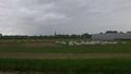
On a farmer's field in Noordwijkerhout
Participants
Plans
The plan is go by bike and arrive at exactly 4pm in case somebody else suffers from the same insanity.
Expedition
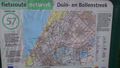
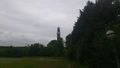
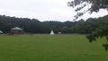
I decided to go by bike to this one. As soon as I left, I noticed it was almost storming and the entire way up to the hash it seemed it was headwind. If this wasn't enough, after a few minutes it also started to drizzle. Although the weather didn't really cooperate today, the route itself was pretty nice. There is an official bike route network in this area, and most of the roads I took were part of this network.
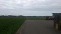
The geohash was on a flower farm located next to a camping site called 'Op hoop van zegen' (meaning something like 'upon hoping for god's blessing'). I left my bike at the camping site and walked to the farm. When I arrived, the farmer was just refilling his 'flowers for sale' stall in front of the farm. I asked him kindly if I could go into his fields to make some pictures. He agreed as long as I did not step on his freshly planted flowers, which was no problem at all, since there was a sand path in the field that led to the geohash.
At exactly 4 o'clock, I took a picture of myself, standing in the flower field. My GPS even said for a few moments that the distance was only 0.01m. I waited a few minutes on the farm, hoping to meet another geohasher, but alas.
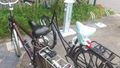
I bought a can of icetea in the camping shop and climbed back my bike. The route home was fantastic. It was dry and all the time it was downwind.
Added: A few weeks later, I learned that there is a (mystery) geocache hidden
very near the geohash location. In fact, if my camera had x-ray vision, I would
have photographed it. Even more amazingly, the cache owner is an active geohasher.
Note by Palmpje: If you thought I am the owner of this geocache I have to disappoint you... I merely know the solution and still have to log the thing, despite it being roughly 1.5 km from home. But I have met the owner, at yet another geocache!
Tracklog
Photos
Nice walking route
Church
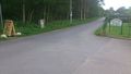
The bike route network
Some house on the route
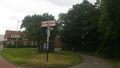
Bike route signs
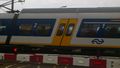
Train speeding by
Welcome to Noordwijkerhout
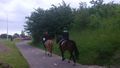
Horse riding
Clock tower, right on time
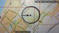
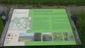
Map at the camping site, coincidentally in the bush behind this Map, there's a geocache!
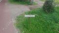
Walking up to the geohash
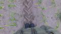
Bingo!
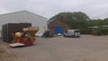
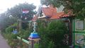
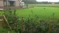
Things on the farm
Flowers for sale
Camping sign
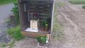
Here you can charge your bike..
Modern version of a cow (robot lawn mower)
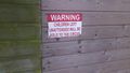
There were no children around this sign
Indian reservation
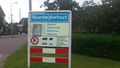
Sign with just a web address


Achievements
Murfie earned the Ambassador achievement
|
Murfie earned the Bicycle geohash achievement
|
Although I endured some rain showers, I don't feel I got wet enough to earn a Drowned Rat achievement.