Difference between revisions of "2012-07-01 50 -121"
From Geohashing
imported>Wijnland (file report) |
m |
||
| (3 intermediate revisions by 3 users not shown) | |||
| Line 50: | Line 50: | ||
}} | }} | ||
{{Minesweeper geohash | {{Minesweeper geohash | ||
| − | | graticule = Cache Creek | + | | graticule = Cache Creek, British Columbia |
| ranknumber = 3 | | ranknumber = 3 | ||
| e = true if graticule to the east has been hashed (optional) | | e = true if graticule to the east has been hashed (optional) | ||
| Line 58: | Line 58: | ||
}} | }} | ||
| − | + | [[Category:Expeditions]] | |
| − | |||
[[Category:Expeditions with photos]] | [[Category:Expeditions with photos]] | ||
[[Category:Expedition without GPS]] | [[Category:Expedition without GPS]] | ||
| − | |||
[[Category:Coordinates reached]] | [[Category:Coordinates reached]] | ||
| + | {{location|CA|BC|SL}} | ||
Latest revision as of 10:05, 22 September 2021
| Sun 1 Jul 2012 in 50,-121: 50.8506096, -121.7131653 geohashing.info google osm bing/os kml crox |
Location
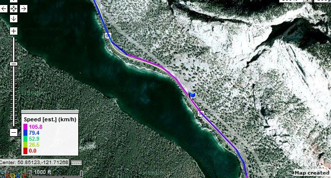
on the 99 near pavilion lake (between cache creek and lilloet)
Participants
Plans
go by there for a speedracer on a long weekend trip to the thomson and cascades. (lytton, Merrit, kamloops, pemberton, vancouver)
Expedition
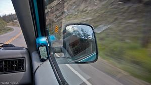
We camped at Juniper beach provincial park just east of Cache Creek, and after breakfast we left for lilloet and further to go for a hike at the joffre lakes trail. The geohash was on our route there, so we did not even have to cover any extra distance. After turning of the 97 we had no traffic on front of us, so we could maintain a steady pace at the speedracer maximum distance. The best shot of the gps showed 15m as the minimum distance, but we likely came a bit closer and at these speeds I consider this coordinates reached!
Tracklog
Photos
Achievements
This user earned the Speed racer achievement
|
Wijnland achieved level 3 of the Minesweeper Geohash achievement
|


