Difference between revisions of "2012-08-21 37 -97"
From Geohashing
imported>Nessalc m (→Tracklog: added tracklog) |
imported>FippeBot m (Location) |
||
| (3 intermediate revisions by one other user not shown) | |||
| Line 1: | Line 1: | ||
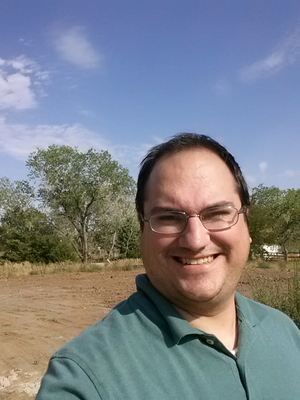
| + | [[Image:Nessalc_Photo01_2012-08-21_37_-97.png|Photographic evidence, complete with stupid grin™ (and squinting into the sun)|thumb|left]] | ||
| − | |||
| − | |||
| − | |||
| − | |||
| − | |||
| − | |||
| − | |||
| − | |||
| − | |||
{{meetup graticule | {{meetup graticule | ||
| lat=37 | | lat=37 | ||
| Line 18: | Line 10: | ||
__NOTOC__ | __NOTOC__ | ||
== Location == | == Location == | ||
| − | + | A cul-de-sac in Wichita, south of Kellogg on 107th St. | |
== Participants == | == Participants == | ||
[[User:Nessalc|Nessalc]] | [[User:Nessalc|Nessalc]] | ||
| − | |||
| − | |||
| − | |||
== Expedition == | == Expedition == | ||
| − | + | ===[[User:Nessalc|Nessalc]]=== | |
| + | Not much to tell. The location was extremely close to where I happened to be, so I figured I'd stop by for my first Geohash expedition. Almost, but not quite, an [[Easy Geohash]]. | ||
== Tracklog == | == Tracklog == | ||
<!-- if your GPS device keeps a log, you may post a link here --> | <!-- if your GPS device keeps a log, you may post a link here --> | ||
| − | [https://www.google.com/fusiontables/embedviz?viz=MAP&q=select+col2+from+1MlndwiSzVxIGOk3nycCu3JmEHoQwoi6tPvXIOAM&h=false&lat=37. | + | [https://www.google.com/fusiontables/embedviz?viz=MAP&q=select+col2+from+1MlndwiSzVxIGOk3nycCu3JmEHoQwoi6tPvXIOAM&h=false&lat=37.6435525588946&lng=-97.43701650000003&z=14&t=1&l=col2 Tracklog in Google Fusion Tables] |
== Photos == | == Photos == | ||
| Line 43: | Line 33: | ||
== Achievements == | == Achievements == | ||
| − | {{ | + | {{land geohash |
| − | + | | latitude = 37 | |
| − | + | | longitude = -97 | |
| − | + | | date = 2012-08-21 | |
| − | + | | name = Nessalc | |
| − | + | }} | |
| − | |||
| − | |||
| − | |||
| − | |||
| − | |||
| − | |||
| − | |||
| − | |||
| − | |||
| − | |||
| − | |||
| − | |||
| − | |||
| − | |||
| − | |||
| − | |||
| − | |||
| − | |||
| − | |||
| − | |||
| − | |||
| − | |||
| − | |||
| − | |||
| − | |||
| − | |||
| − | |||
| − | |||
| − | |||
| − | |||
| − | |||
| − | |||
| − | |||
| − | |||
| − | |||
| − | |||
[[Category:Expeditions]] | [[Category:Expeditions]] | ||
[[Category:Expeditions with photos]] | [[Category:Expeditions with photos]] | ||
[[Category:Coordinates reached]] | [[Category:Coordinates reached]] | ||
| + | {{location|US|KS|SG}} | ||
Latest revision as of 05:43, 13 August 2019
| Tue 21 Aug 2012 in 37,-97: 37.6594488, -97.4660541 geohashing.info google osm bing/os kml crox |
Location
A cul-de-sac in Wichita, south of Kellogg on 107th St.
Participants
Expedition
Nessalc
Not much to tell. The location was extremely close to where I happened to be, so I figured I'd stop by for my first Geohash expedition. Almost, but not quite, an Easy Geohash.
Tracklog
Tracklog in Google Fusion Tables
Photos
Achievements
Nessalc earned the Land geohash achievement
|


