Difference between revisions of "2012-10-05 51 -0"
imported>Haberdasher m (→Expedition) |
imported>FippeBot m (Location) |
||
| (6 intermediate revisions by one other user not shown) | |||
| Line 26: | Line 26: | ||
The Gravel Pits was open, and quite pretty. I initially started to go through a clearing near the entrance, but then noticed that I was focusing on the last two digits of my location and that I wasn't terribly close to the hashpoint yet. With a little trial-and-error, I found a trail that came quite close to the hashpoint... and therein lies the trouble. The trail was close, but not close enough. A little searching found a clearing just off of the trail in the right direction, which too was close but not close enough. | The Gravel Pits was open, and quite pretty. I initially started to go through a clearing near the entrance, but then noticed that I was focusing on the last two digits of my location and that I wasn't terribly close to the hashpoint yet. With a little trial-and-error, I found a trail that came quite close to the hashpoint... and therein lies the trouble. The trail was close, but not close enough. A little searching found a clearing just off of the trail in the right direction, which too was close but not close enough. | ||
| − | I might have trekked through the underbrush some more, except that it was quite prickly. Even in the clearing, the | + | I might have trekked through the underbrush some more, except that it was quite prickly. Even in the clearing, the thorns kept getting caught on my skirt (bad choice of clothing there), and my attempts to dislodge them got me scratched as often as not. Also, I was afraid that the area might contain poison ivy or poison oak, though I have no idea whether they're actually found around here. Still, I took a few readings, jotted down my nearest approach (about 50 feet from the hashpoint), and headed back. |
I considered going back after changing into more sensible clothes, but decided against it, as it'd just be spending more time and money to get a few achievements I can get later. I had an adventure, despite not reaching the hashpoint, and that's what really matters. | I considered going back after changing into more sensible clothes, but decided against it, as it'd just be spending more time and money to get a few achievements I can get later. I had an adventure, despite not reaching the hashpoint, and that's what really matters. | ||
| Line 33: | Line 33: | ||
<gallery widths=117px perrow="5"> | <gallery widths=117px perrow="5"> | ||
| + | Image:2012-10-05_51_-0Memorial.JPG | Memorial | ||
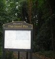
| + | Image:2012-10-05_51_-0GravelPits.jpg | Gravel Pits | ||
| + | Image:2012-10-05_51_-0Clearing.jpg | First Clearing | ||
| + | Image:2012-10-05_51_-0Underbrush.jpg | Underbrush | ||
| + | Image:2012-10-05_51_-0HashClearing.jpg | Second Clearing | ||
</gallery> | </gallery> | ||
| − | + | [[Category:Expeditions]] | |
| − | + | [[Category:Coordinates not reached]] | |
| − | + | [[Category:Not reached - Mother Nature]] | |
| − | [[Category: | + | {{location|GB|ENG|HIL}} |
Latest revision as of 06:24, 13 August 2019
| Fri 5 Oct 2012 in London West: 51.6099986, -0.4351693 geohashing.info google osm bing/os kml crox |
Location
Today's location is on the outskirts of London, in disused gravel pits that have been opened to the public.
Planning
More free time now, and this hash looks easy enough to access using the tube. I'll head there sometime tomorrow. -Haberdasher 18:25, 4 October 2012 (EDT)
Participants
Expedition
It started off well enough. The tube ride was uneventful, and I used it to admire the scenery and ensure that my GPS could locate satellites in the area (it could, and it was quite amusing watching the nearest address and intersection change as the train zoomed by). Northwood was a cute town, and truthfully named, as it was quite woodsy (and fairly northern as well). I stopped at a nearby Waitrose and got some Kinder eggs, which I was planning to use upon reaching the hash as an impromptu, informal "picnic".
The Gravel Pits was open, and quite pretty. I initially started to go through a clearing near the entrance, but then noticed that I was focusing on the last two digits of my location and that I wasn't terribly close to the hashpoint yet. With a little trial-and-error, I found a trail that came quite close to the hashpoint... and therein lies the trouble. The trail was close, but not close enough. A little searching found a clearing just off of the trail in the right direction, which too was close but not close enough.
I might have trekked through the underbrush some more, except that it was quite prickly. Even in the clearing, the thorns kept getting caught on my skirt (bad choice of clothing there), and my attempts to dislodge them got me scratched as often as not. Also, I was afraid that the area might contain poison ivy or poison oak, though I have no idea whether they're actually found around here. Still, I took a few readings, jotted down my nearest approach (about 50 feet from the hashpoint), and headed back.
I considered going back after changing into more sensible clothes, but decided against it, as it'd just be spending more time and money to get a few achievements I can get later. I had an adventure, despite not reaching the hashpoint, and that's what really matters.


