Difference between revisions of "2012-12-23 27 -82"
imported>DrCanadianNinja (Created page with "{{Advert}} {{meetup graticule | map=<map lat="27" lon="-82" date="2012-12-23" /> | lat=2 | lon=-82 | date=2012-12-23 | graticule_name=Bradenton, Florida | graticule_link=Tampa, ...") |
m |
||
| (5 intermediate revisions by 2 users not shown) | |||
| Line 3: | Line 3: | ||
{{meetup graticule | {{meetup graticule | ||
| map=<map lat="27" lon="-82" date="2012-12-23" /> | | map=<map lat="27" lon="-82" date="2012-12-23" /> | ||
| − | | lat= | + | | lat=27 |
| lon=-82 | | lon=-82 | ||
| date=2012-12-23 | | date=2012-12-23 | ||
| Line 15: | Line 15: | ||
=== The Geohashers === | === The Geohashers === | ||
| − | * [[user: | + | * [[user:Geoffistopheles|Geoff]] |
* Geoff's Dad | * Geoff's Dad | ||
| Line 28: | Line 28: | ||
== Gallery == | == Gallery == | ||
| − | I' | + | <gallery caption="Photo Gallery" widths="200px" heights="200px" perrow="3"> |
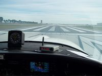
| + | Image:2012-12-23_27_-82_Takeoff.JPG|Takeoff! | ||
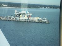
| + | Image:2012-12-23_27_-82_ThePier.JPG|Still standing, still slated for demolition, last I heard. | ||
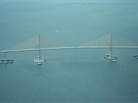
| + | Image:2012-12-23_27_-82_SunshineSkyway.JPG|The Sunshine Skyway, which is a pretty long bridge connecting St. Petersburg and Bradenton. | ||
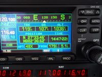
| + | Image:2012-12-23_27_-82_GPS.JPG|Success! | ||
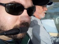
| + | Image:2012-12-23_27_-82_Geohashers.JPG|I'm ready for my closeup. | ||
| + | </gallery> | ||
== Achievables == | == Achievables == | ||
| Line 36: | Line 42: | ||
| longitude = -82 | | longitude = -82 | ||
| date = 2012-12-23 | | date = 2012-12-23 | ||
| − | | name = [[user: | + | | name = [[user:Geoffistopheles|Geoff]] |
| vehicle = Grumman American | | vehicle = Grumman American | ||
}} | }} | ||
| + | {{Multihash2 | count = 5 | date = 2012-12-23 | name = [[user:Geoffistopheles|Geoff]] }} | ||
[[Category:Expeditions]] | [[Category:Expeditions]] | ||
[[Category:Expeditions with photos]] | [[Category:Expeditions with photos]] | ||
[[Category:Coordinates reached]] | [[Category:Coordinates reached]] | ||
| + | {{location|US|FL|MN}} | ||
Latest revision as of 17:05, 24 March 2021
| Have you seen our geohashing marker? We'd love to hear from you! Click here to say "hi" and tell us what you've seen!
Curious about what geohashing is? Read more! |
| Sun 23 Dec 2012 in Bradenton, Florida: 27.5585921, -82.5100048 geohashing.info google osm bing/os kml crox |
Expedition
The Plan
Off I-95 across the Sunshine Skyway. The plan is to start with this one, then head for Sebring, then onto Fort Pierce, south beyond Lake Okeechobee, head westward to Lehigh Acres, then finally come back home.
The Geohashers
- Geoff
- Geoff's Dad
The Adventure
I said it before: maybe I'll try again Christmas.
We learned something about the best laid plans then; this time, we didn't bother making any plans. So few plans did we make that, come 7:30 this morning, I wasn't sure we will still doing it. After a misfire, we left half an hour later than expected and were airborne by 9:30.
Despite me thinking that within ten minutes of flight time that this would be easy, the tricky part was airspace. See, once you get within a specific range around high traffic airports, you need to be talking to their control tower. Things they really don't like: people who enter their airspace for a minute or two before leaving. As it turned out, the hash fell within 500 feet of Sarasota's airspace, which is the equivalent of holding your finger in their peripheral vision and taunting them with "I'm not touching you!"
Thankfully, it was just inside. When we came back, I left the Two of Spades at the airport, although I forgot to actually take a picture of that one. That happened many hours later, though, and instead we hauled away from Sarasota and moved towards Sebring.
Gallery
- Photo Gallery
Achievables
Geoff earned the Air geohash achievement
|
Geoff earned the Multihash Achievement
|
