Difference between revisions of "2013-05-27 50 11"
imported>Paintedhell (Created page with "{{meetup graticule | lat=50 | lon=11 | date=2013-05-27 }} __NOTOC__ == Location == Near Mellingen, on a path next to Magdel creek/river. Or maybe in the river, let's see. =...") |
imported>FippeBot m (Location) |
||
| (2 intermediate revisions by one other user not shown) | |||
| Line 13: | Line 13: | ||
== Expedition == | == Expedition == | ||
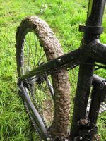
| − | + | I was coming back to Jena from my parents, so this point lay practically on the way, even though I changed the route and only cycled from Erfurt to Jena because of the crappy weather (yes, I'm a girl). I've had my fill for rain and mud, so I was resolved to stay on paved ways today, but of course the cycling route "Städtekette" led me right back in the swamps, the noises from my brake discs drove me nuts and the way to the point was, as usual for Geohashes, the worst swamp ever (cunningly disguised as grassy and nice). So I got dirty once more, had to clean my bike for quite some time when I got home and the only success of the day seems to have been that I really could trick my GPS to show me the 0m display before I stood in the middle of water. Alright. | |
== Photos == | == Photos == | ||
{{gallery|width=200|height=200|lines=2 | {{gallery|width=200|height=200|lines=2 | ||
| − | + | |Image:130527_50_11_1.jpg|Why did I even clean my bike? Again... | |
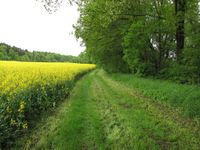
| + | |Image:130527_50_11_2.jpg|The nice way to the point that turned out to be a muddy monster. | ||
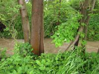
| + | |Image:130527_50_11_3.jpg|Magdel, the raging current (things that lots of rain can do!) | ||
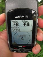
| + | |Image:130527_50_11_4.jpg|Finally: 0m distance to Geohash, done with dry feet. | ||
}} | }} | ||
[[Category:Expeditions]] | [[Category:Expeditions]] | ||
| − | + | [[Category:Expeditions with photos]] | |
[[Category:Coordinates reached]] | [[Category:Coordinates reached]] | ||
| + | {{location|DE|TH|AP}} | ||
Latest revision as of 02:36, 14 August 2019
| Mon 27 May 2013 in 50,11: 50.9264759, 11.4123964 geohashing.info google osm bing/os kml crox |
Location
Near Mellingen, on a path next to Magdel creek/river. Or maybe in the river, let's see.
Participants
- Juja and Benjy Mouse
Expedition
I was coming back to Jena from my parents, so this point lay practically on the way, even though I changed the route and only cycled from Erfurt to Jena because of the crappy weather (yes, I'm a girl). I've had my fill for rain and mud, so I was resolved to stay on paved ways today, but of course the cycling route "Städtekette" led me right back in the swamps, the noises from my brake discs drove me nuts and the way to the point was, as usual for Geohashes, the worst swamp ever (cunningly disguised as grassy and nice). So I got dirty once more, had to clean my bike for quite some time when I got home and the only success of the day seems to have been that I really could trick my GPS to show me the 0m display before I stood in the middle of water. Alright.
Photos
|


