Difference between revisions of "2013-05-29 50 11"
imported>Jens (→Photos) |
imported>FippeBot m (Location) |
||
| (3 intermediate revisions by 2 users not shown) | |||
| Line 7: | Line 7: | ||
__NOTOC__ | __NOTOC__ | ||
== Location == | == Location == | ||
| − | On a hill near Ammerbach | + | On a hill near Ammerbach. |
== Participants == | == Participants == | ||
* [[User:Jens|Jens]] | * [[User:Jens|Jens]] | ||
| + | * [[User:Paintedhell|Juja]] | ||
| − | == Expedition == | + | == Expedition: Jens == |
For a long time I was not sure, whether I will ignore this point or not. But at the end the short distance won and I decided to visit it after work. "Wetter-Online" predicted "two raindrops". That may mean everything from "cloudy but dry" till "be warned, you will be soaked", today it meant "two raindrops". That was acceptable. | For a long time I was not sure, whether I will ignore this point or not. But at the end the short distance won and I decided to visit it after work. "Wetter-Online" predicted "two raindrops". That may mean everything from "cloudy but dry" till "be warned, you will be soaked", today it meant "two raindrops". That was acceptable. | ||
| Line 18: | Line 19: | ||
It was a short way to Ammerbach by bike, where I parked it at the bottom of the hill the point lay on. From here I went the last 500 meters on foot. Good decision. Others may have tried to climb the hill by bike, but I’m not that crazy. So the last 500 meters were a relaxed walk and only the last 10 became haspoint typical. | It was a short way to Ammerbach by bike, where I parked it at the bottom of the hill the point lay on. From here I went the last 500 meters on foot. Good decision. Others may have tried to climb the hill by bike, but I’m not that crazy. So the last 500 meters were a relaxed walk and only the last 10 became haspoint typical. | ||
| − | I left the path and entered a thicket | + | I left the path and entered a thicket where a machete would have been helpful (once again). A cloudy sky above, trees and brushwood all around, so the GPS signal was fading of course. Whenever a moved 1 meter in reality the GPS device moved 5. And this in an area where it took 10 seconds to move this 1 meter. So a distance of 6 meters must be close enough for today’s finished-photo. (Btw. I forgot to switch on the coordinates field, but believe me, the flag is at the point) |
| − | == Photos == | + | == Photos: Jens == |
{{gallery|width=200|height=200|lines=2 | {{gallery|width=200|height=200|lines=2 | ||
| Line 31: | Line 32: | ||
|Image:130529 50 11 07.JPG|And another one. | |Image:130529 50 11 07.JPG|And another one. | ||
}} | }} | ||
| + | |||
| + | == Expedition: Juja == | ||
| + | |||
| + | Obviously I am no longer the Geohashing Weasel... I asked Jens the day before whether he would go to this point, and he didn't really want to because of the weather forecast (two raindrops, see above), and I also had my fill of mud on [[2013-05-27_50_11|Monday]]. So it looked like neither of us would go to this point that was, technically speaking, too near to miss. | ||
| + | |||
| + | But after I had been at the pool it still wasn't raining, so I decided to call Manu, ask for the coordinates (I hadn't even saved them to my GPS before) and visit them before no one else would go. I cycled to Ammerbach, then up the hill by bike (yes, yes I am), on paths that were really great for mountainbiking, why haven't I been there before? I could even trick my GPS to get 3 meters close to the point without leaving the path (due to bad reception in the forest), but for the 0m shot there was some climbing necessary - through the bushes, but there were some imaginary paths I could use (I am seeing quite a lot of imaginary paths lately). | ||
| + | |||
| + | After the work was done it was time for fun: I had passed another way before that was going straight uphill (even more), and of course I needed to know where this one would go, so I went up there and had a nice view over Ammerbach and Jena, and I also liked those paths up there a lot. So I made my peace with the forest, the mud and the "bad weather" again, yay! | ||
| + | |||
| + | == Photos: Juja == | ||
| + | |||
| + | {{gallery|width=200|height=200|lines=2 | ||
| + | |Image:130529_50_11_1.jpg|Hashpoint reached! | ||
| + | |Image:130529_50_11_2.jpg|Yes, it looks still the same as for Jens. | ||
| + | |Image:130529_50_11_3.jpg|Stupidly grinning Geohasher back out of the bushes. | ||
| + | |Image:130529_50_11_4.jpg|Not the way to the Geohash... | ||
| + | |Image:130529_50_11_5.jpg|...but to this nice outlook! | ||
| + | }} | ||
| + | |||
[[Category:Expeditions]] | [[Category:Expeditions]] | ||
[[Category:Expeditions with photos]] | [[Category:Expeditions with photos]] | ||
[[Category:Coordinates reached]] | [[Category:Coordinates reached]] | ||
| + | {{location|DE|TH|J}} | ||
Latest revision as of 02:36, 14 August 2019
| Wed 29 May 2013 in 50,11: 50.9010340, 11.5600973 geohashing.info google osm bing/os kml crox |
Location
On a hill near Ammerbach.
Participants
Expedition: Jens
For a long time I was not sure, whether I will ignore this point or not. But at the end the short distance won and I decided to visit it after work. "Wetter-Online" predicted "two raindrops". That may mean everything from "cloudy but dry" till "be warned, you will be soaked", today it meant "two raindrops". That was acceptable.
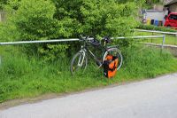
It was a short way to Ammerbach by bike, where I parked it at the bottom of the hill the point lay on. From here I went the last 500 meters on foot. Good decision. Others may have tried to climb the hill by bike, but I’m not that crazy. So the last 500 meters were a relaxed walk and only the last 10 became haspoint typical.
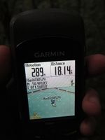
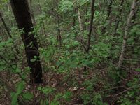
I left the path and entered a thicket where a machete would have been helpful (once again). A cloudy sky above, trees and brushwood all around, so the GPS signal was fading of course. Whenever a moved 1 meter in reality the GPS device moved 5. And this in an area where it took 10 seconds to move this 1 meter. So a distance of 6 meters must be close enough for today’s finished-photo. (Btw. I forgot to switch on the coordinates field, but believe me, the flag is at the point)
Photos: Jens
|
Expedition: Juja
Obviously I am no longer the Geohashing Weasel... I asked Jens the day before whether he would go to this point, and he didn't really want to because of the weather forecast (two raindrops, see above), and I also had my fill of mud on Monday. So it looked like neither of us would go to this point that was, technically speaking, too near to miss.
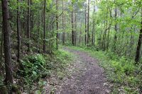
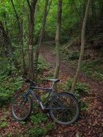
But after I had been at the pool it still wasn't raining, so I decided to call Manu, ask for the coordinates (I hadn't even saved them to my GPS before) and visit them before no one else would go. I cycled to Ammerbach, then up the hill by bike (yes, yes I am), on paths that were really great for mountainbiking, why haven't I been there before? I could even trick my GPS to get 3 meters close to the point without leaving the path (due to bad reception in the forest), but for the 0m shot there was some climbing necessary - through the bushes, but there were some imaginary paths I could use (I am seeing quite a lot of imaginary paths lately).
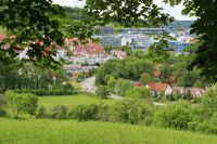
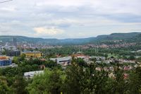
After the work was done it was time for fun: I had passed another way before that was going straight uphill (even more), and of course I needed to know where this one would go, so I went up there and had a nice view over Ammerbach and Jena, and I also liked those paths up there a lot. So I made my peace with the forest, the mud and the "bad weather" again, yay!
Photos: Juja
|
