Difference between revisions of "2013-06-29 48 11"
imported>LeslieHapablap ([live picture] Let's see who will join ;-) [http://www.openstreetmap.org/?lat=48.14945601&lon=11.46156730&zoom=16&layers=B000FTF @48.1495,11.4616]) |
imported>FippeBot m (Location) |
||
| (66 intermediate revisions by 3 users not shown) | |||
| Line 9: | Line 9: | ||
And DON'T FORGET to add your expedition and the best photo you took to the gallery on the Main Page! We'd love to read your report, but that means we first have to discover it! :) | And DON'T FORGET to add your expedition and the best photo you took to the gallery on the Main Page! We'd love to read your report, but that means we first have to discover it! :) | ||
--> | --> | ||
| + | [[Image:2013-06-29 48 11 04-00-48-510.jpg|left|1000px]] | ||
{{meetup graticule | {{meetup graticule | ||
| lat=48 | | lat=48 | ||
| Line 14: | Line 15: | ||
| date=2013-06-29 | | date=2013-06-29 | ||
}} | }} | ||
| − | + | {{ClearLeft}} | |
| − | |||
__NOTOC__ | __NOTOC__ | ||
== Location == | == Location == | ||
| − | + | ||
| + | Gauting near Munich, in a schoolyard. | ||
== Participants == | == Participants == | ||
| − | + | ||
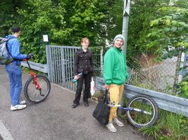
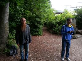
| − | -- | + | [[File:2013-06-29 48 11 03-25-23-176.jpg|150px|thumb|left|The group.]] |
| + | * Risctaker | ||
| + | * [[User:1-0|1-0]] | ||
| + | * [[User:RunningSushi|RunningSushi]] | ||
| + | * [[User:LeslieHapablap|LeslieHapablap]], ([[2013-06-22 47 11|previous]]|[[2013-08-24 47 11|next]]) | ||
| + | * [[User:Almagest|Almagest]] | ||
== Plans == | == Plans == | ||
| Line 28: | Line 34: | ||
== Expedition == | == Expedition == | ||
| − | + | ||
*Going to be there at meetup-o-clock! -- [[User:LeslieHapablap|LeslieHapablap]] ([[User talk:LeslieHapablap|talk]]) [http://www.openstreetmap.org/?lat=48.14899523&lon=11.46119228&zoom=16&layers=B000FTF @48.1490,11.4612] 13:17, 29 June 2013 (CEST) | *Going to be there at meetup-o-clock! -- [[User:LeslieHapablap|LeslieHapablap]] ([[User talk:LeslieHapablap|talk]]) [http://www.openstreetmap.org/?lat=48.14899523&lon=11.46119228&zoom=16&layers=B000FTF @48.1490,11.4612] 13:17, 29 June 2013 (CEST) | ||
| − | |||
| − | |||
| + | |||
| + | === The short version === | ||
| + | Three brave geohashers from Innsbruck ([[User:1-0|1-0]], [[User:RunningSushi|RunningSushi]] and [[User:LeslieHapablap|LeslieHapablap]]) are poaching in northern hashgrounds of the Munich graticule. They drag along Risctaker and meet [[User:Almagest|Almagest]] at the hashpoint to make this a Saturday meetup which deserve its name. | ||
| + | |||
| + | === The long version === | ||
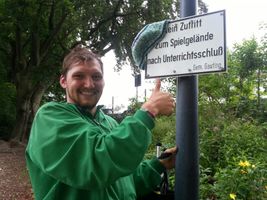
| + | Weekend in summer is juggling convention time. After Freiburg two weeks ago ([[2013-06-14_47_11|geohashing included]]), this time the convention calender sent us to Munich. The district Pasing was celebrating its 1250 year anniversary with a street festival, and as part of this event the local juggling association [http://jimev.de JIM] was organizing a small but exquisite convention. Small because it had less than a hundred participants, and exquisite because the guest list included some of the best jugglers worldwide. Thanks to the sponsorship of a nearby shopping mall everything was free of charge for the participants, including excellent catering, a gym to practice and a place to sleep. [[File:2013-06-29 48 11 03-57-31-359.jpg|300px|thumb|left|We save the "No trespassing consolation prize" for another expedition.]] As part of the arrangement, on two central areas of the festival the jugglers entertained the crowds by showing their skills, teaching and talking to people, performances and juggling games. All together the convention was a lot of fun and the weather played along nicely at least on the second day. To top it all the hashpoint for Saturday was only 10 km away from Pasing, easily reachable (or so we thought) directly next to a station of the urban railway. The perfect opportunity to start the [[Minesweeper_Geohash|minesweeper achievement]] and even to introduce new people to our sport. [[User:1-0|1-0]] and [[User:LeslieHapablap|LeslieHapablap]] have been hashing together in Innsbruck before, but for [[User:RunningSushi|RunningSushi]] and Risctaker it was the first expedition. | ||
| + | |||
| + | |||
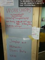
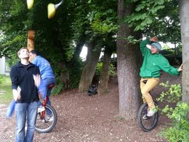
| + | On juggling conventions it is common that several workshops are offered, most but not all of them are related to juggling. So we announced a workshop on geohashing, and we even got a participant (Risctaker), which is more than many of the more exotic workshops at conventions have. For Risctaker it was the first time that he had heard of geohashing, but still he was brave enough to join us with his unicycle on this adventurous expedition. At 3:15 pm we purchased a group ticket and got on our train to Gauting, a ride of about 20 minutes. From the station in Gauting it was only about a hundred meters to the schoolyard where the hashpoint was located. Unfortunately there was a fence all around the yard and all the gates were closed. We climbed over one of the gates ignoring several signs which told us not to do so, performed the usual GPS dance and finally pinpointed the coordinates at a very peculiar tree with two trunks. [[File:2013-06-29 48 11 04-07-44-685.jpg|600px|thumb|right|Panorama view of the schoolyard with the hashpoint.]]Of course the tree was forced to take part in several nonsense activities like juggling clubs through between the two trunks, taking silly group pictures and marking the place with the xkcd writing. At exactly 4 pm [[User:Almagest|Almagest]] joined our group. He told us that he is usually sort of ninja-geohashing in the Munich graticule without documenting his expeditions on the wiki. For us it was the first time to actually meet someone at a Saturday meeting (yay for another achievement)! After some more fun with the two unicycles, juggling balls, clubs and the local accessory of the schoolyard we declared it a successful geohashing expedition and took the train back to Pasing, were we continued to have an amazing convention. | ||
| + | |||
| + | == Video == | ||
| + | Here is a small [http://www.youtube.com/watch?v=zlD2DgJofR4 video] of us at the hashpoint. | ||
| + | {{-}} | ||
== Photos == | == Photos == | ||
| − | |||
| − | |||
| − | |||
| − | |||
| − | Image:2013-06-29_48_11_13-23-50-038.jpg | | + | <gallery widths=300px heights=200px perrow="3"> |
| + | Image:2013-06-29_48_11_04-24-27-867.jpg | At the convention site. | ||
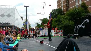
| + | Image:2013-06-29_48_11_03-13-59-290.jpg | One of the juggling areas of the convention (for bad weather) | ||
| + | Image:2013-06-29_48_11_04-11-33-038.jpg | John Nations preforming at the street festival. | ||
| + | Image:2013-06-29_48_11_13-23-50-038.jpg | Announcing the geohashing workshop (we made it back for the workshop with Thomas Dietz in time by the way) | ||
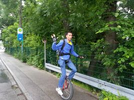
| + | Image:2013-06-29_48_11_03-16-06-580.jpg | [[User:1-0|1-0]] cycling to the hashpoint. | ||
| + | Image:2013-06-29_48_11_03-17-15-571.jpg | Risctaker on his first geohashing expedition. | ||
| + | Image:2013-06-29_48_11_03-20-09-097.jpg | The gate is locked, that can't be right... | ||
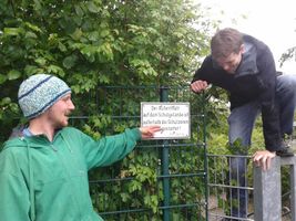
| + | Image:2013-06-29_48_11_03-24-21-171.jpg | "Access to the schoolyard is [not] permitted." | ||
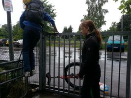
| + | Image:2013-06-29_48_11_03-57-31-359.jpg | [[User:RunningSushi|RunningSushi]] and Risctaker climbing over the gate. | ||
| + | Image:2013-06-29_48_11_03-25-23-176.jpg | Obligatory silly grin. | ||
| + | Image:2013-06-29_48_11_03-26-33-674.jpg | Obligatory proof. | ||
| + | Image:2013-06-29_48_11_03-29-10-825.jpg | [[User:RunningSushi|RunningSushi]] getting ready for the club passing action. | ||
| + | Image:2013-06-29_48_11_03-33-44-615.jpg | Passing juggling clubs through the tree and beneath [[User:RunningSushi|RunningSushi]]. | ||
| + | Image:2013-06-29_48_11_03-39-01-812.jpg | Weeeeeh! | ||
| + | Image:2013-06-29_48_11_03-42-56-715.jpg | [[User:1-0|1-0]] jumping up the stairs. | ||
| + | Image:2013-06-29_48_11_03-45-14-142.jpg | We met [[User:Almagest|Almagest]] at the coordinates. | ||
| + | Image:2013-06-29_48_11_03-50-10-371.jpg | [[User:RunningSushi|RunningSushi]] paying "tennis" over a bar. | ||
| + | Image:2013-06-29_48_11_03-52-21-488.jpg | More nonsense at the hashpoint. | ||
| + | Image:2013-06-29_48_11_03-55-08-960.jpg | Making "One access permitted" out of "No access permitted". | ||
| + | Image:2013-06-29_48_11_03-56-44-655.jpg | A hashtree. The X was already there. | ||
| + | Image:2013-06-29_48_11_03-57-54-805.jpg | [[User:1-0|1-0]] being silly. | ||
| + | Image:2013-06-29_48_11_04-00-48-510.jpg | | ||
| + | Image:2013-06-29_48_11_04-07-44-685.jpg | Panorama view of the schoolyard. | ||
| + | Image:2013-06-29_48_11_04-18-52-079.jpg | Leaving the place again. | ||
| + | |||
</gallery> | </gallery> | ||
| Line 48: | Line 86: | ||
<!-- Add any achievement ribbons you earned below, or remove this section --> | <!-- Add any achievement ribbons you earned below, or remove this section --> | ||
| + | {{land geohash | ||
| − | + | | latitude = 48 | |
| − | + | | longitude = 11 | |
| − | [[ | + | | date = 2013-06-29 |
| + | | name = Risctaker, [[User:1-0|1-0]], [[User:RunningSushi|RunningSushi]], [[User:LeslieHapablap|LeslieHapablap]], [[User:Almagest|Almagest]] | ||
| − | + | }} | |
| − | + | {{Circus_geohash | |
| − | |||
| − | |||
| − | + | | latitude = 48 | |
| + | | longitude = 11 | ||
| + | | date = 2013-06-29 | ||
| + | | name = Risctaker, [[User:1-0|1-0]], [[User:RunningSushi|RunningSushi]], [[User:LeslieHapablap|LeslieHapablap]] | ||
| + | | performance = juggling and unicycling | ||
| + | |||
| + | }} | ||
| + | {{Border geohash achievement | ||
| + | |||
| + | | latitude = 48 | ||
| + | | longitude = 11 | ||
| + | | date = 2013-06-29 | ||
| + | | country1 = Austria | ||
| + | | country2 = Germany | ||
| + | | name = [[User:1-0|1-0]], [[User:RunningSushi|RunningSushi]], [[User:LeslieHapablap|LeslieHapablap]] | ||
| + | |||
| + | }} | ||
| + | {{Earliest geohasher | ||
| + | |||
| + | | latitude = 48 | ||
| + | | longitude = 11 | ||
| + | | date = 2013-06-29 | ||
| + | | name = Risctaker, [[User:1-0|1-0]], [[User:RunningSushi|RunningSushi]], [[User:LeslieHapablap|LeslieHapablap]] | ||
| + | |||
| + | }} | ||
| + | {{drag-along | ||
| + | |||
| + | | latitude = 48 | ||
| + | | longitude = 11 | ||
| + | | date = 2013-06-29 | ||
| + | | partner = Risctaker and [[User:RunningSushi|RunningSushi]] | ||
| + | | name = [[User:1-0|1-0]] and [[User:LeslieHapablap|LeslieHapablap]] | ||
| + | |||
| + | }} | ||
| + | {{Meet-up | ||
| + | |||
| + | | latitude = 48 | ||
| + | | longitude = 11 | ||
| + | | date = 2013-06-29 | ||
| + | | name = Risctaker, [[User:1-0|1-0]], [[User:RunningSushi|RunningSushi]] and [[User:LeslieHapablap|LeslieHapablap]] | ||
| + | | other = [[User:Almagest|Almagest]] | ||
| + | |||
| + | }} | ||
| + | {{Minesweeper geohash | ||
| + | |||
| + | | graticule = Innsbruck, Austria | ||
| + | | ranknumber = 1 | ||
| + | | n = true | ||
| + | | name = [[User:1-0|1-0]] and [[User:LeslieHapablap|LeslieHapablap]] | ||
| + | |||
| + | }} | ||
[[Category:Expeditions]] | [[Category:Expeditions]] | ||
| − | + | ||
[[Category:Expeditions with photos]] | [[Category:Expeditions with photos]] | ||
[[Category:Expeditions with videos]] | [[Category:Expeditions with videos]] | ||
| − | |||
| − | |||
| − | |||
| − | |||
[[Category:Coordinates reached]] | [[Category:Coordinates reached]] | ||
| − | + | {{location|DE|BY|STA}} | |
| − | |||
| − | |||
| − | |||
| − | |||
| − | |||
| − | |||
| − | |||
| − | |||
| − | |||
| − | |||
| − | |||
| − | |||
| − | |||
| − | |||
| − | |||
| − | |||
| − | |||
Latest revision as of 02:59, 14 August 2019
| Sat 29 Jun 2013 in 48,11: 48.0695241, 11.3760538 geohashing.info google osm bing/os kml crox |
Location
Gauting near Munich, in a schoolyard.
Participants
- Risctaker
- 1-0
- RunningSushi
- LeslieHapablap, (previous|next)
- Almagest
Plans
Expedition
- Going to be there at meetup-o-clock! -- LeslieHapablap (talk) @48.1490,11.4612 13:17, 29 June 2013 (CEST)
The short version
Three brave geohashers from Innsbruck (1-0, RunningSushi and LeslieHapablap) are poaching in northern hashgrounds of the Munich graticule. They drag along Risctaker and meet Almagest at the hashpoint to make this a Saturday meetup which deserve its name.
The long version
Weekend in summer is juggling convention time. After Freiburg two weeks ago (geohashing included), this time the convention calender sent us to Munich. The district Pasing was celebrating its 1250 year anniversary with a street festival, and as part of this event the local juggling association JIM was organizing a small but exquisite convention. Small because it had less than a hundred participants, and exquisite because the guest list included some of the best jugglers worldwide. Thanks to the sponsorship of a nearby shopping mall everything was free of charge for the participants, including excellent catering, a gym to practice and a place to sleep.
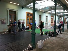
As part of the arrangement, on two central areas of the festival the jugglers entertained the crowds by showing their skills, teaching and talking to people, performances and juggling games. All together the convention was a lot of fun and the weather played along nicely at least on the second day. To top it all the hashpoint for Saturday was only 10 km away from Pasing, easily reachable (or so we thought) directly next to a station of the urban railway. The perfect opportunity to start the minesweeper achievement and even to introduce new people to our sport. 1-0 and LeslieHapablap have been hashing together in Innsbruck before, but for RunningSushi and Risctaker it was the first expedition.
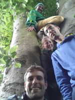
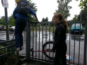
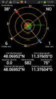
On juggling conventions it is common that several workshops are offered, most but not all of them are related to juggling. So we announced a workshop on geohashing, and we even got a participant (Risctaker), which is more than many of the more exotic workshops at conventions have. For Risctaker it was the first time that he had heard of geohashing, but still he was brave enough to join us with his unicycle on this adventurous expedition. At 3:15 pm we purchased a group ticket and got on our train to Gauting, a ride of about 20 minutes. From the station in Gauting it was only about a hundred meters to the schoolyard where the hashpoint was located. Unfortunately there was a fence all around the yard and all the gates were closed. We climbed over one of the gates ignoring several signs which told us not to do so, performed the usual GPS dance and finally pinpointed the coordinates at a very peculiar tree with two trunks.
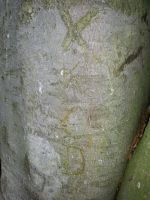
Of course the tree was forced to take part in several nonsense activities like juggling clubs through between the two trunks, taking silly group pictures and marking the place with the xkcd writing. At exactly 4 pm Almagest joined our group. He told us that he is usually sort of ninja-geohashing in the Munich graticule without documenting his expeditions on the wiki. For us it was the first time to actually meet someone at a Saturday meeting (yay for another achievement)! After some more fun with the two unicycles, juggling balls, clubs and the local accessory of the schoolyard we declared it a successful geohashing expedition and took the train back to Pasing, were we continued to have an amazing convention.
Video
Here is a small video of us at the hashpoint.
Photos
1-0 cycling to the hashpoint.
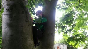
RunningSushi and Risctaker climbing over the gate.
RunningSushi getting ready for the club passing action.
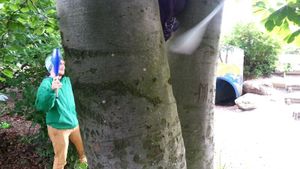
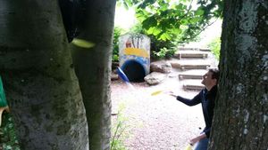
Passing juggling clubs through the tree and beneath RunningSushi.
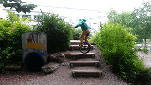
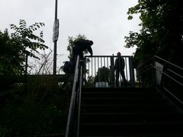
1-0 jumping up the stairs.
We met Almagest at the coordinates.
RunningSushi paying "tennis" over a bar.
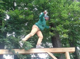
1-0 being silly.
Achievements
Risctaker, 1-0, RunningSushi, LeslieHapablap, Almagest earned the Land geohash achievement
|
Risctaker, 1-0, RunningSushi, LeslieHapablap earned the Circus Geohash Achievement
|
1-0, RunningSushi, LeslieHapablap earned the Border geohash achievement
|
Risctaker, 1-0, RunningSushi, LeslieHapablap earned the Earliest geohasher achievement
|
1-0 and LeslieHapablap earned the Drag-along achievement
|
Risctaker, 1-0, RunningSushi and LeslieHapablap earned the Meet-up achievement
|
1-0 and LeslieHapablap achieved level 1 of the Minesweeper Geohash achievement
|
- Meetup on 2013-06-29
- Meetup in 48 11
- Land geohash achievement
- Circus geohash achievement
- Border geohash achievement
- Earliest geohash achievement
- Drag-along achievement
- Meet-up achievement
- Minesweeper geohash achievement
- Expeditions
- Expeditions with photos
- Expeditions with videos
- Coordinates reached
- Meetup in Landkreis Starnberg

