Difference between revisions of "2013-07-10 30 -81"
imported>DrCanadianNinja m (Removed the completed categories and templates.) |
m |
||
| (3 intermediate revisions by 2 users not shown) | |||
| Line 1: | Line 1: | ||
| + | {{Advert}} | ||
| + | |||
{{meetup graticule | {{meetup graticule | ||
| map=<map lat="30" lon="-81" date="2013-07-10" /> | | map=<map lat="30" lon="-81" date="2013-07-10" /> | ||
| Line 15: | Line 17: | ||
=== The Geohashers === | === The Geohashers === | ||
| − | * [[user: | + | * [[user:Geoffistopheles|Geoff]] |
* [[user:NinjaBait|Erica]] | * [[user:NinjaBait|Erica]] | ||
=== The Adventure === | === The Adventure === | ||
| + | Getting to the hash itself was pretty self-explanatory. We sat through rush hour traffic, ignored instructions to get on I-10, the source of said traffic, and took off running. We got there around 6:30, and the hash was just off the right side of the road. While I went down to take the GPS pictures, Erica stayed on higher ground for a new take on the picture. | ||
| + | Then we figured, why not visit the cemetery? We're already here. To my surprise, there were already two people there, Jody and Denise. They had been going around visiting old graveyards, Antioch being the third one, and were curious why we managed to find ourselves out here. I briefly explained, and the answer was satisfactory enough to them. It was around that point that I realized that in over a year of geohashing, these were the first people I spoke to about geohashing at a hash site without ulterior motives of needing to get in somewhere. Progress! | ||
| + | |||
| + | Antioch Cemetery is a turn of the 20th century era graveyard, with most of the stones cracked or fallen apart. There were a few Confederate graves as well, though the most notable one came due to the tattered flag flying on it. I was a bit reluctant to leave a marker at all - a graveyard seems like a poor place to leave a playing card - but I decided to leave the King of Clubs at the intersection leading here about a mile down the road. Seemed the only respectable option. | ||
== Gallery == | == Gallery == | ||
| − | + | <gallery caption="Photo Gallery" widths="200px" heights="200px" perrow="4"> | |
| + | Image:2013-07-10_30_-81_GPS.jpg|Success! | ||
| + | Image:2013-07-10_30_-81_Geohashers.jpg|Now on the Kiss Cam... | ||
| + | Image:2013-07-10_30_-81_GeohashE.JPG|The Georgian equivalent of a wasteland. | ||
| + | Image:2013-07-10_30_-81_GeohashS.JPG|I was surprised to see it open up like this, though. | ||
| + | Image:2013-07-10_30_-81_GeohashN.JPG|The entrance to Antioch Cemetery. | ||
| + | Image:2013-07-10_30_-81_AntiochCemetery.JPG| | ||
| + | Image:2013-07-10_30_-81_CemeteryNW.JPG| | ||
| + | Image:2013-07-10_30_-81_Gated.JPG|This section was gated off from the rest. | ||
| + | Image:2013-07-10_30_-81_CemeterySE.JPG| | ||
| + | Image:2013-07-10_30_-81_Howard.JPG|The old, tattered Confederate flag makes it. | ||
| + | Image:2013-07-10_30_-81_Marker.jpg|K♣ | ||
| + | Image:2013-07-10_30_-81_MarkerLocation.JPG|At the intersection leading to the cemetery. | ||
| + | </gallery> | ||
== Achieveables == | == Achieveables == | ||
| − | + | {{Reverse Regional | |
| + | | latitude = 30 | ||
| + | | longitude = -81 | ||
| + | | name = [[user:Geoffistopheles|Geoff]] | ||
| + | | count = 6 | ||
| + | | graticule = Jacksonville, Florida | ||
| + | | level = the county | ||
| + | }} | ||
| + | {{Meet-up | ||
| + | | latitude = 30 | ||
| + | | longitude = -81 | ||
| + | | date = 2013-07-10 | ||
| + | | name = [[user:Geoffistopheles|Geoff]] | ||
| + | | other = Jody and Denise | ||
| + | }} | ||
[[Category:Expeditions]] | [[Category:Expeditions]] | ||
| + | [[Category:Coordinates reached]] | ||
| + | [[Category:Expeditions with photos]] | ||
| + | {{location|US|GA|CT}} | ||
Latest revision as of 17:09, 24 March 2021
| Have you seen our geohashing marker? We'd love to hear from you! Click here to say "hi" and tell us what you've seen!
Curious about what geohashing is? Read more! |
| Wed 10 Jul 2013 in Folkston, Georgia: 30.9021716, -81.9926588 geohashing.info google osm bing/os kml crox |
Expedition
The Plan
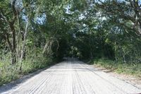
Just outside Antioch Cemetery in Folkston, Georgia. Doesn't look like any fences, just two more miles of dirt roads at the end.
I almost wish I could have hit something yesterday to keep the streak alive, but oh well. This is a big one for me anyway, as it would complete a reverse regional for my home graticule at the county level.
The Geohashers
The Adventure
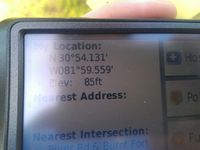
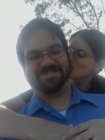
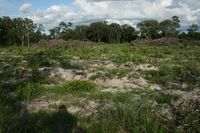
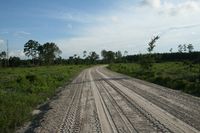
Getting to the hash itself was pretty self-explanatory. We sat through rush hour traffic, ignored instructions to get on I-10, the source of said traffic, and took off running. We got there around 6:30, and the hash was just off the right side of the road. While I went down to take the GPS pictures, Erica stayed on higher ground for a new take on the picture.
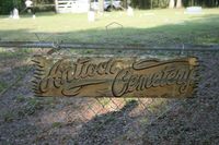
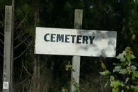
Then we figured, why not visit the cemetery? We're already here. To my surprise, there were already two people there, Jody and Denise. They had been going around visiting old graveyards, Antioch being the third one, and were curious why we managed to find ourselves out here. I briefly explained, and the answer was satisfactory enough to them. It was around that point that I realized that in over a year of geohashing, these were the first people I spoke to about geohashing at a hash site without ulterior motives of needing to get in somewhere. Progress!
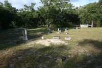
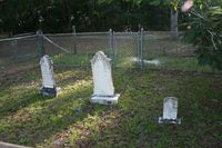
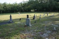
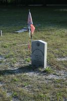
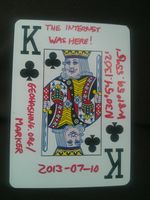
Antioch Cemetery is a turn of the 20th century era graveyard, with most of the stones cracked or fallen apart. There were a few Confederate graves as well, though the most notable one came due to the tattered flag flying on it. I was a bit reluctant to leave a marker at all - a graveyard seems like a poor place to leave a playing card - but I decided to leave the King of Clubs at the intersection leading here about a mile down the road. Seemed the only respectable option.
Gallery
- Photo Gallery
Achieveables
Geoff earned the Reverse regional achievement
|
Geoff earned the Meet-up achievement
|
