Difference between revisions of "2014-01-26 39 -84"
imported>Humbucker |
imported>FippeBot m (Location) |
||
| (One intermediate revision by one other user not shown) | |||
| Line 39: | Line 39: | ||
| latitude = 39 | | latitude = 39 | ||
| longitude = -84 | | longitude = -84 | ||
| − | | date = | + | | date = 2014-01-26 |
| name = [[User:Humbucker|Humbucker]] | | name = [[User:Humbucker|Humbucker]] | ||
| image = 1-26-2014 Humbucker Hashpoint.jpg | | image = 1-26-2014 Humbucker Hashpoint.jpg | ||
| Line 46: | Line 46: | ||
| latitude = 39 | | latitude = 39 | ||
| longitude = -84 | | longitude = -84 | ||
| − | | date = | + | | date = 2014-01-26 |
| name = [[User:Humbucker|Humbucker]] | | name = [[User:Humbucker|Humbucker]] | ||
| image = Humbucker Speed Racer1.jpg | | image = Humbucker Speed Racer1.jpg | ||
| Line 54: | Line 54: | ||
| latitude = 39 | | latitude = 39 | ||
| longitude = -84 | | longitude = -84 | ||
| − | | date = | + | | date = 2014-01-26 |
| tracklog = https://maps.google.com/maps?saddr=1021+Saratoga+Street,+Newport,+KY&daddr=39.0517236,-84.5612429+to:39.0277667,-84.579043+to:39.0104337,+-84.5536921+to:1021+Saratoga+Street,+Newport,+KY&hl=en&ll=39.036786,-84.558678&spn=0.156003,0.338173&sll=39.024652,-84.574642&sspn=0.039008,0.084543&geocode=FcdsVAIdl9P2-inv440wc7FBiDEJgm_fK219tw%3BFcvhUwIdprL1-in7fWesC7dBiDFnl4nC31Cpwg%3BFTaEUwIdHW31-ikvyBNPJ7hBiDHw3MKHrqhd1g%3BFYJAUwIdJND1-g%3BFcdsVAIdl9P2-inv440wc7FBiDEJgm_fK219tw&t=h&mra=dpe&mrsp=2&sz=14&via=1,2&z=12 | | tracklog = https://maps.google.com/maps?saddr=1021+Saratoga+Street,+Newport,+KY&daddr=39.0517236,-84.5612429+to:39.0277667,-84.579043+to:39.0104337,+-84.5536921+to:1021+Saratoga+Street,+Newport,+KY&hl=en&ll=39.036786,-84.558678&spn=0.156003,0.338173&sll=39.024652,-84.574642&sspn=0.039008,0.084543&geocode=FcdsVAIdl9P2-inv440wc7FBiDEJgm_fK219tw%3BFcvhUwIdprL1-in7fWesC7dBiDFnl4nC31Cpwg%3BFTaEUwIdHW31-ikvyBNPJ7hBiDHw3MKHrqhd1g%3BFYJAUwIdJND1-g%3BFcdsVAIdl9P2-inv440wc7FBiDEJgm_fK219tw&t=h&mra=dpe&mrsp=2&sz=14&via=1,2&z=12 | ||
| possessive = his | | possessive = his | ||
| Line 64: | Line 64: | ||
[[Category:Expeditions with photos]] | [[Category:Expeditions with photos]] | ||
[[Category:Coordinates reached]] | [[Category:Coordinates reached]] | ||
| + | {{location|US|KY|KE}} | ||
Latest revision as of 06:58, 6 August 2019
| Sun 26 Jan 2014 in 39,-84: 39.0104337, -84.5536921 geohashing.info google osm bing/os kml crox |
Location
Smack in the middle of Dudley Pk., in Edgewood, KY.
Participants
Plans
Considering the ease of the location and the fact that the hashpoint was forecast on http://gh.eupeodes.nl/ several days in advance, I decided to use the opportunity to pick up a few bonus achievements, such as Speed Racer, Tron and No Batteries. Unfortunately, Nofu was not in the area, so he could not partake in the gratuitous ribbon-getting.
I planned out my route of attack beforehand on Google Maps (Fig. 1), wrote it in my water-logged red notebook, scanned the hashpoint on Google Streetview, and set out.
Expedition
Everything went exactly as planned. Got to see some of Thomas More College on the way. The half-hour drive actually made for a nice study break.
Photos
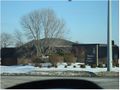
Thomas More College
The hashpoint
- Error creating thumbnail: Unable to save thumbnail to destination
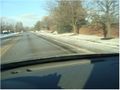
Speed limit - 1


Awards
Humbucker earned the No Batteries Geohash Achievement
|

Humbucker earned the Tron achievement
|