Difference between revisions of "2014-05-25 51 9"
From Geohashing
imported>GeorgDerReisende (create page) |
m (Linking to The Dance™) |
||
| (4 intermediate revisions by 2 users not shown) | |||
| Line 1: | Line 1: | ||
| − | |||
| − | |||
| − | |||
| − | |||
| − | |||
| − | |||
| − | |||
| − | |||
| − | |||
| − | |||
{{meetup graticule | {{meetup graticule | ||
| lat=51 | | lat=51 | ||
| Line 18: | Line 8: | ||
__NOTOC__ | __NOTOC__ | ||
== Location == | == Location == | ||
| − | + | ||
| + | The hash lay in a forest north of Freienhagen. | ||
== Participants == | == Participants == | ||
| − | + | ||
| − | + | [[User:GeorgDerReisende|GeorgDerReisende]] | |
== Plans == | == Plans == | ||
| − | + | ||
| + | After electing I wanted to hitchhike to Dehringhausen and to walk from there into the forest. | ||
== Expedition == | == Expedition == | ||
| − | |||
| − | |||
| − | |||
| − | |||
| − | == | + | {| |
| − | + | |- | |
| − | Image: | + | ! style="width:300px" | !! style="width:300px" | !! style="width:300px" | |
| − | -- | + | |- |
| − | + | | [[Image:2014-05-25 51 9 GeorgDerReisende 1107.jpg|300px]] || || After my voting for the European Parliament I started to travel for the hash. I waited at the Wilhelmshöhe junction for nearly 30 minutes and near the Zierenberg junction another 30 minutes. I arrived at Freienhagen at 14:45. There I walked into the road to Dehringhausen. Some cars passed, but no car stopped for a lift. I walked along the road and reached the forest. There I noticed that the walk to Dehringhausen and from there to the hash was three kilometers long, but I was only one kilometer away from the hash, so I entered the forest. I wanted to take the Old Arolser Road. I choosed the right one, but at the end I found out, that the Old Arolser Road was the left one. | |
| − | + | |- | |
| + | | [[Image:2014-05-25 51 9 GeorgDerReisende 1050.jpg|300px]] || [[Image:2014-05-25 51 9 GeorgDerReisende 1057.jpg|300px]] || Arriving at the forest. 90 meters to the hash. | ||
| + | |- | ||
| + | | [[Image:2014-05-25 51 9 GeorgDerReisende 1063.jpg|300px]] || || I used my towel as a shield against the branches of the trees. | ||
| + | |- | ||
| + | | [[Image:2014-05-25 51 9 GeorgDerReisende 1066.jpg|300px]] || [[Image:2014-05-25 51 9 GeorgDerReisende 1067.jpg|300px]] || After a dance under the trees I found the hash. | ||
| + | |- | ||
| + | | [[Image:2014-05-25 51 9 GeorgDerReisende 1073.jpg|300px]] south || [[Image:2014-05-25 51 9 GeorgDerReisende 1074.jpg|300px]] west || [[Image:2014-05-25 51 9 GeorgDerReisende 1075.jpg|300px]] north | ||
| + | |- | ||
| + | | [[Image:2014-05-25 51 9 GeorgDerReisende 1076.jpg|300px]] east || [[Image:2014-05-25 51 9 GeorgDerReisende 1077.jpg|300px]] proof of [[The Dance™|the dance]] || | ||
| + | |- | ||
| + | | [[Image:2014-05-25 51 9 GeorgDerReisende 1078.jpg|300px]] || [[Image:2014-05-25 51 9 GeorgDerReisende 1081.jpg|300px]] || After a short stay I walked further to the other forest way. There was a thicket between me and the forest way. I passed it, but I got hurt. There were geohasher eating plants in the thicket. | ||
| + | |- | ||
| + | | [[Image:2014-05-25 51 9 GeorgDerReisende 1084.jpg|300px]] || || Sorry, I don't have photos of the fight. I could either fight against the geohasher eating plants or you could get photos of geohasher eating plants eating a geohasher. | ||
| + | |- | ||
| + | | [[Image:2014-05-25 51 9 GeorgDerReisende 1098.jpg|300px]] || || This is the Old Arolser Road, which I found at last. Then I walked back to Freienhagen and then I hitchhiked home. | ||
| + | |} | ||
== Achievements == | == Achievements == | ||
| Line 44: | Line 48: | ||
<!-- Add any achievement ribbons you earned below, or remove this section --> | <!-- Add any achievement ribbons you earned below, or remove this section --> | ||
| + | {{ Towel Day | latitude = 51 | longitude = 9 | date = 2014-05-25 | name = GeorgDerReisende }} | ||
| − | + | [[Category:Expeditions]] | |
| − | |||
| − | [[Category: | ||
| − | + | [[Category:Expeditions with photos]] | |
| − | |||
| − | |||
| − | |||
| − | [[Category: | ||
| − | |||
| − | |||
| − | |||
| − | |||
| − | |||
| − | |||
| − | |||
| − | |||
| − | |||
| − | |||
[[Category:Coordinates reached]] | [[Category:Coordinates reached]] | ||
| − | + | {{location|DE|HE|WA}} | |
| − | |||
| − | |||
| − | |||
| − | |||
| − | |||
| − | |||
| − | |||
| − | |||
| − | |||
| − | |||
| − | |||
| − | |||
| − | |||
| − | |||
| − | |||
| − | |||
| − | |||
Latest revision as of 17:01, 14 November 2020
| Sun 25 May 2014 in 51,9: 51.2995598, 9.0462197 geohashing.info google osm bing/os kml crox |
Location
The hash lay in a forest north of Freienhagen.
Participants
Plans
After electing I wanted to hitchhike to Dehringhausen and to walk from there into the forest.
Expedition
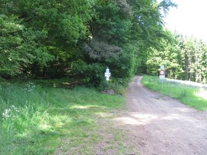 |
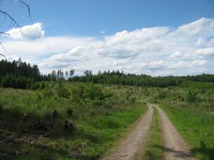
After my voting for the European Parliament I started to travel for the hash. I waited at the Wilhelmshöhe junction for nearly 30 minutes and near the Zierenberg junction another 30 minutes. I arrived at Freienhagen at 14:45. There I walked into the road to Dehringhausen. Some cars passed, but no car stopped for a lift. I walked along the road and reached the forest. There I noticed that the walk to Dehringhausen and from there to the hash was three kilometers long, but I was only one kilometer away from the hash, so I entered the forest. I wanted to take the Old Arolser Road. I choosed the right one, but at the end I found out, that the Old Arolser Road was the left one. | |
 |
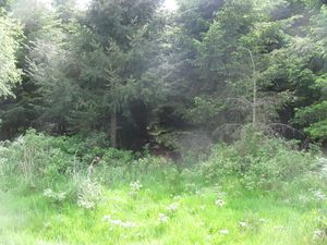 |
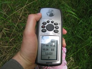
Arriving at the forest. 90 meters to the hash. |
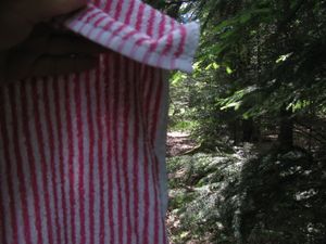 |
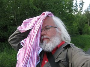
I used my towel as a shield against the branches of the trees. | |
 |
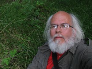 |
After a dance under the trees I found the hash. |
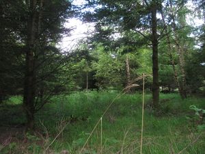 south south |
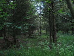 west west |
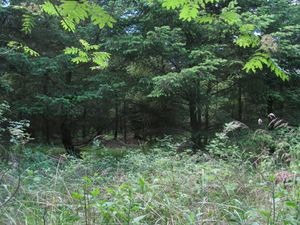 north north
|
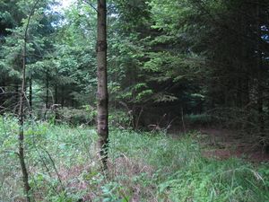 east east |
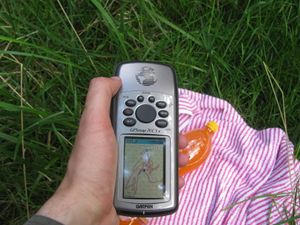 proof of the dance proof of the dance |
|
 |
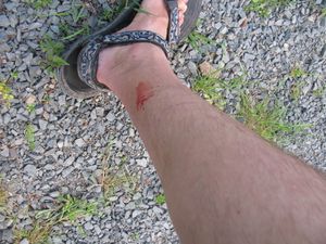 |
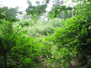
After a short stay I walked further to the other forest way. There was a thicket between me and the forest way. I passed it, but I got hurt. There were geohasher eating plants in the thicket. |
 |
Sorry, I don't have photos of the fight. I could either fight against the geohasher eating plants or you could get photos of geohasher eating plants eating a geohasher. | |
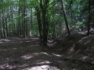 |
This is the Old Arolser Road, which I found at last. Then I walked back to Freienhagen and then I hitchhiked home. |
Achievements
GeorgDerReisende earned the Towel Day achievement
|