Difference between revisions of "2014-05-31 50 10"
From Geohashing
imported>GeorgDerReisende (new expedition to Eckardtshausen-Wilhelmsthal) |
m (Linking to The Dance™) |
||
| (3 intermediate revisions by 2 users not shown) | |||
| Line 20: | Line 20: | ||
== Expedition == | == Expedition == | ||
| − | |||
| − | == | + | {| |
| − | + | |- | |
| − | + | ! style="width:300px" | !! style="width:300px" | !! style="width:300px" | | |
| − | + | |- | |
| − | + | | [[Image:2014-05-31 50 10 GeorgDerReisende 1334.jpg|300px]] || colspan = 2 | I left home at 10:00. Shortly before I started to hitchhike I found a second use for thickets and index pages of road maps after a wrong breakfast. At Hessisch Lichtenau I had to wait for 1 3/4 hours for the next lift. After two more lifts I arrived at Hohe Sonne. At this place the hiking trail ''Rennsteig'' crosses the national road B19 and I thought, this would be a good place for starting my walk to Wilhelmsthal. But in the forest I got lost. Several times I took the wrong branches. At least I arrived back at Hohe Sonne at 16:10. Then I started to hurry to Wilhelmsthal. At 16:32 I had the first view to the lake. | |
| − | Image: | + | |- |
| − | -- | + | | [[Image:2014-05-31 50 10 GeorgDerReisende 1336.jpg|300px]] || [[Image:2014-05-31 50 10 GeorgDerReisende 1341.jpg|300px]] || Some minutes later I arrived at a shelter above Wilhelmsthal. I had a view to the hash. |
| − | + | |- | |
| − | + | | [[Image:2014-05-31 50 10 GeorgDerReisende 1343.jpg|300px]] || [[Image:2014-05-31 50 10 GeorgDerReisende 1345.jpg|300px]] || I found a geocache at the shelter. | |
| + | |- | ||
| + | | [[Image:2014-05-31 50 10 GeorgDerReisende 1377.jpg|300px]] || [[Image:2014-05-31 50 10 GeorgDerReisende 1378.jpg|300px]] || Then I walked further and I found the hash. Because I was an hour too late, this is no xkcd meetup. | ||
| + | |- | ||
| + | | [[Image:2014-05-31 50 10 GeorgDerReisende 1374.jpg|300px]] || [[Image:2014-05-31 50 10 GeorgDerReisende 1379.jpg|300px]] || The hash lay at the hedge south of the gate. | ||
| + | |- | ||
| + | | [[Image:2014-05-31 50 10 GeorgDerReisende 1384.jpg|300px]] || [[Image:2014-05-31 50 10 GeorgDerReisende 1399.jpg|300px]] || The geohasher and the proof. Today no proof for [[The Dance™|the dance]] but for the detours in the forest. | ||
| + | |- | ||
| + | | [[Image:2014-05-31 50 10 GeorgDerReisende 1382.jpg|300px]] || || View to the geocache. Do you see the small blue box? | ||
| + | |- | ||
| + | | [[Image:2014-05-31 50 10 GeorgDerReisende 1387.jpg|300px]] || || View to the educational center with the hash at the left side. | ||
| + | |- | ||
| + | | [[Image:2014-05-31 50 10 GeorgDerReisende 1391.jpg|300px]] || [[Image:2014-05-31 50 10 GeorgDerReisende 1411.jpg|300px]] || View to the houses besides the castle. | ||
| + | |- | ||
| + | | [[Image:2014-05-31 50 10 GeorgDerReisende 1420.jpg|300px]] || || Because of the anger I got from the detours I took all the waste I found in the forest out of it. | ||
| + | |} | ||
== Achievements == | == Achievements == | ||
| Line 36: | Line 50: | ||
<!-- Add any achievement ribbons you earned below, or remove this section --> | <!-- Add any achievement ribbons you earned below, or remove this section --> | ||
| + | {{Thumbs Up | latitude = 50 | longitude = 10 | date = 2014-05-31 | name = GeorgDerReisende }} | ||
| − | + | {{Hash collision | latitude = 50 | longitude = 10 | date = 2014-05-31 | name = GeorgDerReisende | link = http://coord.info/GC38X55 | id = GC38X55 | distance = 0.47 km | honor = yes }} | |
| − | |||
| − | |||
| − | + | [[Category:Expeditions]] | |
| − | + | [[Category:Expeditions with photos]] | |
| − | |||
| − | [[Category: | ||
| − | |||
| − | |||
| − | |||
| − | |||
| − | |||
| − | |||
| − | |||
| − | |||
| − | |||
| − | |||
[[Category:Coordinates reached]] | [[Category:Coordinates reached]] | ||
| − | + | {{location|DE|TH|WAK}} | |
| − | |||
| − | |||
| − | |||
| − | |||
| − | |||
| − | |||
| − | |||
| − | |||
| − | |||
| − | |||
| − | |||
| − | |||
| − | |||
| − | |||
| − | |||
| − | |||
| − | |||
Latest revision as of 17:02, 14 November 2020
| Sat 31 May 2014 in 50,10: 50.9179713, 10.3020586 geohashing.info google osm bing/os kml crox |
Location
The hash lies on a meadow in Wilhelmsthal near Eisenach.
Participants
Plans
I am hitchhiking to Eisenach and Wilhelmsthal. Wait for 16:00 as to become a xkcd meetup.
Expedition
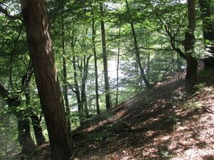 |
I left home at 10:00. Shortly before I started to hitchhike I found a second use for thickets and index pages of road maps after a wrong breakfast. At Hessisch Lichtenau I had to wait for 1 3/4 hours for the next lift. After two more lifts I arrived at Hohe Sonne. At this place the hiking trail Rennsteig crosses the national road B19 and I thought, this would be a good place for starting my walk to Wilhelmsthal. But in the forest I got lost. Several times I took the wrong branches. At least I arrived back at Hohe Sonne at 16:10. Then I started to hurry to Wilhelmsthal. At 16:32 I had the first view to the lake. | |
 |
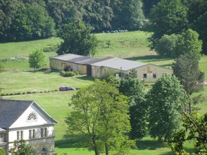 |
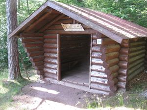
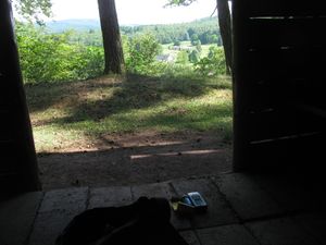
Some minutes later I arrived at a shelter above Wilhelmsthal. I had a view to the hash. |
 |
 |
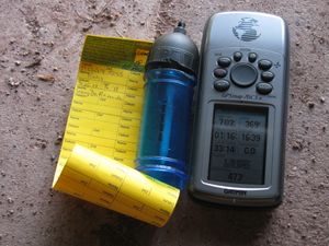
I found a geocache at the shelter. |
 |
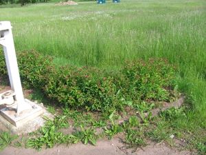 |
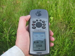
Then I walked further and I found the hash. Because I was an hour too late, this is no xkcd meetup. |
 |
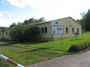 |
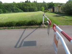
The hash lay at the hedge south of the gate. |
 |
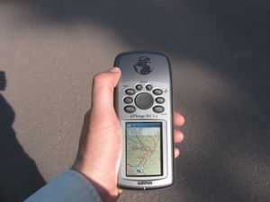 |
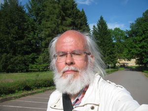
The geohasher and the proof. Today no proof for the dance but for the detours in the forest. |
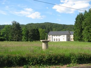 |
View to the geocache. Do you see the small blue box? | |
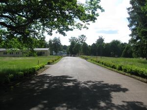 |
View to the educational center with the hash at the left side. | |
 |
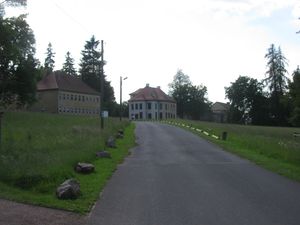 |
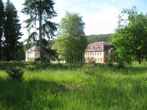
View to the houses besides the castle. |
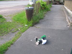 |
Because of the anger I got from the detours I took all the waste I found in the forest out of it. | |
Achievements
GeorgDerReisende earned the Thumbs Up Geohash Achievement
|
GeorgDerReisende earned the Hash collision honorable mention
|