Difference between revisions of "2015-01-12 49 9"
From Geohashing
imported>Q-Owl m |
m |
||
| (7 intermediate revisions by 2 users not shown) | |||
| Line 11: | Line 11: | ||
*[[User:Q-Owl|Q-Owl]] | *[[User:Q-Owl|Q-Owl]] | ||
| + | *[[User:Q-Owla|Q-Owla]] | ||
== Plan == | == Plan == | ||
| Line 39: | Line 40: | ||
<gallery perrow="5" > | <gallery perrow="5" > | ||
Image:2015-01-12 49 9 proof1.png | Proof 1 | Image:2015-01-12 49 9 proof1.png | Proof 1 | ||
| − | Image:2015-01-12 49 9 | + | Image:2015-01-12 49 9 wood.jpg | into the woods |
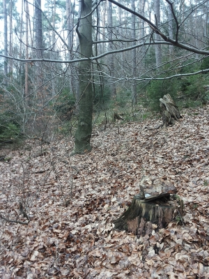
| − | + | Image:2015-01-12 49 9 hp.jpg | Hashpoint (stump marked with log) and view to the east | |
| − | Image:2015-01-12 49 9 | + | Image:2015-01-12 49 9 n.jpg | North |
| − | Image:2015-01-12 49 9 | + | Image:2015-01-12 49 9 s.jpg | South |
| − | Image:2015-01-12 49 9 | + | Image:2015-01-12 49 9 grin.jpg | Smile |
| − | Image:2015-01-12 49 9 grin.jpg | Smile | ||
</gallery> | </gallery> | ||
<!-- | <!-- | ||
| Line 52: | Line 52: | ||
More information: http://wiki.xkcd.com/geohashing/User:Q-Owl#HowTo_in_this_Wiki | More information: http://wiki.xkcd.com/geohashing/User:Q-Owl#HowTo_in_this_Wiki | ||
--> | --> | ||
| + | |||
| + | == Other Geohashing Expeditions and Plans on This Day == | ||
| + | |||
| + | {{expedition summaries|2015-01-12}} | ||
| + | |||
== Achievements == <!-- / Honorable Mention --> | == Achievements == <!-- / Honorable Mention --> | ||
| Line 58: | Line 63: | ||
{{land geohash | {{land geohash | ||
| latitude = 49 | | latitude = 49 | ||
| − | | longitude = | + | | longitude = 9 |
| − | | date = | + | | date = 2015-01-12 |
| − | | name = | + | | name = Q-Owl & Q-Owla |
| + | }} | ||
| + | {{ Regional geohash | ||
| + | | name = Q-Owl & Q-Owla | ||
| + | | region = Odenwaldkreis (ERB) | ||
| + | | count = 2 | ||
| + | |image = Wappen_Odenwaldkreis.png | ||
}} | }} | ||
{{Minesweeper geohash | {{Minesweeper geohash | ||
| Line 69: | Line 80: | ||
| sw = true | | sw = true | ||
| w = true | | w = true | ||
| − | | name = Q-Owl | + | | name = Q-Owl & Q-Owla |
| + | }} | ||
| + | |||
| + | |||
| + | Have I really been the only one? | ||
| + | {{gratuitous ribbon | ||
| + | | achievement = Last couple standing achievement | ||
| + | | latitude = 49 | ||
| + | | longitude = 9 | ||
| + | | date = 2015-01-12 | ||
| + | | name = [[User:Q-Owl|Q-Owl]] | ||
}} | }} | ||
| Line 88: | Line 109: | ||
[[Category: Meetup on 2015-01-12]] | [[Category: Meetup on 2015-01-12]] | ||
[[Category: Meetup in 49 9]] | [[Category: Meetup in 49 9]] | ||
| + | {{location|DE|HE|ERB}} | ||
Latest revision as of 21:14, 5 March 2020
| Mon 12 Jan 2015 in 49,9: 49.7147307, 9.0137191 geohashing.info google osm bing/os kml crox |
Location
South of Bad König, in the north eastern part of the Odenwald.
Participants
Plan
We had to visit Bad König today and to buy a special item there.
So it was nice, that the hash point of the eastern next graticule Würzburg lay near its western border, even in the little Hessian part of that graticule.
We planned:
- Drive to Bad König, buy (or at least order) what we needed
- reach the hash point and get the next level of the mine sweeper achievement
- find some geocaches
- return home.
Expedition
Success:
- We arrived at about 12:30 near the hash point and had a nice 0.5 km walk to it.
- After a little bit of trying to find the best position under clouds and lage trees I marked the hash piont and took some photos.
- Then we walked back to the car and drove home.
Results:
- one geohash
- two geocaches by www.geocaching.com
- two safari caches safari caches (by www.opencaching.de only).
Photos
Other Geohashing Expeditions and Plans on This Day
Expeditions and Plans
| 2015-01-12 | ||
|---|---|---|
| Würzburg, Germany | Q-Owl, Q-Owla | South of Bad König, in the north eastern part of the Odenwald. |
Achievements
Q-Owl & Q-Owla earned the Land geohash achievement
|
Q-Owl & Q-Owla earned the Regional geohashing achievement
|
Q-Owl & Q-Owla achieved level 4 of the Minesweeper Geohash achievement
|
Have I really been the only one?
Q-Owl earned the Last couple standing achievement
|


