Difference between revisions of "2015-01-20 63 28"
imported>Pastori (→Achievements) |
imported>FippeBot m (Location) |
||
| Line 79: | Line 79: | ||
[[Category:Expeditions with photos]] | [[Category:Expeditions with photos]] | ||
[[Category:Coordinates reached]] | [[Category:Coordinates reached]] | ||
| + | {{location|FI|13}} | ||
Latest revision as of 02:30, 15 August 2019
| Tue 20 Jan 2015 in 63,28: 63.7473503, 28.6047148 geohashing.info google osm bing/os kml crox |
Location
In Rasimäki, Valtimo. The point lies in a forest.
Participants
Expedition
The year's first attempted hashpoint was only 1,3 km from Pastori's home, so it was a must to visit. Pastori decided to also try the juggernaut approach, maybe it would go better this time than the previous one. The Editor can calculate whether he succeeded. Pastori tried really hard, but keeping the heading steady was really difficult. Mostly he could see only 10-20 meters forward, sometimes only 5 meters. A lot of deep ditches there also were.
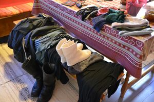
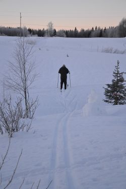
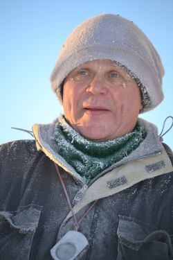
Trudging was in Pastori's opinion nevertheless rather nice, because in wintertime he likes to anyway ski around in untouched snow with his long forest cross country skis. The arctic weather, in the morning -31°C, presented an added challenge. The frosty temperatures caused The Wife to stay home, so she instead helped Pastori to gear up and to ensure that he took all the necessary wilderness equipment with him: PMR, compass, a knife, matches, a spare woollen mittens, a spare woollen hat, extra charging battery for phone, and of course the usual geohashing equipment, not forgetting the three or four layers of clothing.
Pastori isn't afraid of the cold, so let's go! Despite the cold and all the juggernaut-rumbling, after 50 minutes Pastori was at the point within 2 meters of accuracy. He took the mandatory photographs and screenshots and quickly skied back through an easier path to get to the warmth of the home. Going there, 1,3 km, took 50 minutes and going back 30 minutes. The Wife was there to photograph the start and the finish.
So there it goes again, this year's geohashing adventures. Let's see, what the year will bring along. Pastori and The Wife wish all the participants of this silly and funny hobby A Happy New Geohashing Year!
[Editor's note: I think the juggernaut was successful! Just barely, 1:20, but a success anyway. I used the following method: 1) Open the tracklog picture in Paint. 2) Draw a straight line between the start point and the hashpoint. 3) Measure with a manual ruler how long the above-mentioned line is. 4) Measure with the same ruler how far Pastori deviated from the straight line. 5) Division the number gotten in step 3 with the one gotten from step 4.]
Additional photos
Achievements
Pastori earned the Juggernaut achievement
|
Pastori earned the Frozen Geohash Achievement
|
Pastori earned the Land geohash achievement
|
Pastori earned the cross-country skiing achievement
|


