Difference between revisions of "2016-02-21 50 11"
imported>Jens (→Photos) |
imported>FippeBot m (Location) |
||
| (3 intermediate revisions by 2 users not shown) | |||
| Line 23: | Line 23: | ||
Here the most exciting question of the day was answered. Will the point be located on public or private ground? Thanks to the clouds above us the GPS drifting was that large, that there was no need to explain unknown people the secrets of geohashing. So we took some photos and went home. | Here the most exciting question of the day was answered. Will the point be located on public or private ground? Thanks to the clouds above us the GPS drifting was that large, that there was no need to explain unknown people the secrets of geohashing. So we took some photos and went home. | ||
| − | That is, how geohashing works, very easy, wasn’t it? I hope today’s promotion tour resulted in a new geohashing member and Juja has one more option for sending people into the wilderness when the next point is | + | That is, how geohashing works, very easy, wasn’t it? I hope today’s promotion tour resulted in a new geohashing member and Juja has one more option for sending people into the wilderness when the next point is “too close to miss”. And there will be such a point..., soon... |
| − | |||
== Photos == | == Photos == | ||
{{gallery|width=200|height=200|lines=2 | {{gallery|width=200|height=200|lines=2 | ||
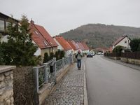
| − | |Image:160221 50 11 01.JPG|Coordinates reached | + | |Image:160221_50_11_3.JPG|734m distance from Juja's home. |
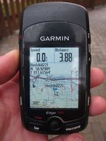
| + | |Image:160221 50 11 01.JPG|Coordinates reached (Jens) | ||
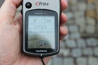
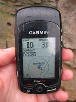
| + | |Image:160221_50_11_1.JPG|Coordinates reached (Juja) | ||
| + | |Image:160221_50_11_2.JPG|Jens documenting the expedition | ||
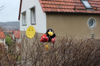
|Image:160221 50 11 02.JPG|Davey and Räbe sitting on the point | |Image:160221 50 11 02.JPG|Davey and Räbe sitting on the point | ||
}} | }} | ||
| − | + | == Achievements == | |
| + | {{couch potato geohash | latitude = 50 | longitude = 11 | date = 2016-02-21 | name = Juja | honor = true }} | ||
[[Category:Expeditions]] | [[Category:Expeditions]] | ||
[[Category:Expeditions with photos]] | [[Category:Expeditions with photos]] | ||
[[Category:Coordinates reached]] | [[Category:Coordinates reached]] | ||
| + | {{location|DE|TH|J}} | ||
Latest revision as of 06:45, 15 August 2019
| Sun 21 Feb 2016 in 50,11: 50.9298868, 11.6156385 geohashing.info google osm bing/os kml crox |
Location
Jena
Participants
Expedition
During the last few weeks many hashpoints have been sent to Jena. Unfortunately I was unable to attend every time it happened. Others may say, I had lame excuses. But whatever it was in the past, today I was able to participate in this very ambitious expedition. We met at Jujas home, from were we had to overcome a distance of about 700 meters.
Juja invited a friend (Sorry, I forgot your name. You may insert it yourself.) to join us and see, how a typical geohash expedition works. After a relaxed walk through the streets of Jena we arrived 10 minutes later at our target. To make the expedition more authentic we left the main street one crossing too soon and had to accept a detour of 100 meters. With clean shoes and (almost) dry clothes we arrived at the point without gazing any plant.
Here the most exciting question of the day was answered. Will the point be located on public or private ground? Thanks to the clouds above us the GPS drifting was that large, that there was no need to explain unknown people the secrets of geohashing. So we took some photos and went home.
That is, how geohashing works, very easy, wasn’t it? I hope today’s promotion tour resulted in a new geohashing member and Juja has one more option for sending people into the wilderness when the next point is “too close to miss”. And there will be such a point..., soon...
Photos
|
Achievements
Juja earned the Couch Potato Geohash Honorable Mention
|
