Difference between revisions of "2016-04-13 49 8"
imported>DODO (→Location) |
m (Location correction) |
||
| (7 intermediate revisions by 2 users not shown) | |||
| Line 25: | Line 25: | ||
<!-- who attended: If you link to your wiki user name in this section, your expedition will be picked up by the various statistics generated for geohashing. You may use three tildes ~ as a shortcut to automatically insert the user signature of the account you are editing with. | <!-- who attended: If you link to your wiki user name in this section, your expedition will be picked up by the various statistics generated for geohashing. You may use three tildes ~ as a shortcut to automatically insert the user signature of the account you are editing with. | ||
--> | --> | ||
| + | [[User:DODO|DODO]] | ||
== Plans == | == Plans == | ||
<!-- what were the original plans --> | <!-- what were the original plans --> | ||
| + | To close, not to go. I'll either go there in the morning on my way to work on my bull, or in the evening by foot. In the unlikely case that anyone wants to join me, I'd even go twice. | ||
== Expedition == | == Expedition == | ||
<!-- how it all turned out. your narrative goes here. --> | <!-- how it all turned out. your narrative goes here. --> | ||
| + | I had to change plans a little bit. It was raining in the morning and I decided to go to work by car. So I couldn't visit the hp on my way to work on my bull. And I forgot that little lady got her four wisdom teeth removed today, or at least I forgot that we two are alone at home today and she must not be left alone. So I couldn't walk there in the evening either. But I could leave work a little bit earlier and swing by on my way home. It was just a detour of 9 kilometers, allowed even with the big car :-) From the parking lot it was a 1,5 kilometers walk, rather boring around the hash field. 60 m from the hash was a trace leading some meters into the field. A lazy Ninja (why try to reach the exact point, if I don't document my visit anyway)? | ||
| + | |||
| + | Took some photos, went back and drove home. Full story. | ||
== Tracklog == | == Tracklog == | ||
<!-- if your GPS device keeps a log, you may post a link here --> | <!-- if your GPS device keeps a log, you may post a link here --> | ||
| + | [https://www.komoot.de/tour/8553998 1,6 kilometer walk], didn't track the driving. | ||
== Photos == | == Photos == | ||
| Line 40: | Line 46: | ||
--> | --> | ||
<gallery perrow="5"> | <gallery perrow="5"> | ||
| + | Image:2016-04-13_49_8-1.jpg|big car | ||
| + | Image:2016-04-13_49_8-2.jpg|view over the hash field | ||
| + | Image:2016-04-13_49_8-3.jpg|lazy ninja hashers trace | ||
| + | Image:2016-04-13_49_8-10.png|proof | ||
| + | Image:2016-04-13_49_8-4.jpg|west | ||
| + | Image:2016-04-13_49_8-5.jpg|south | ||
| + | Image:2016-04-13_49_8-6.jpg|east | ||
| + | Image:2016-04-13_49_8-7.jpg|north | ||
| + | Image:2016-04-13_49_8-8.jpg|hashers grin | ||
| + | Image:2016-04-13_49_8-9.jpg|some beautiful bushes near the hash | ||
</gallery> | </gallery> | ||
| Line 45: | Line 61: | ||
{{#vardefine:ribbonwidth|800px}} | {{#vardefine:ribbonwidth|800px}} | ||
<!-- Add any achievement ribbons you earned below, or remove this section --> | <!-- Add any achievement ribbons you earned below, or remove this section --> | ||
| + | {{land geohash | ||
| + | | latitude = 49 | ||
| + | | longitude = 8 | ||
| + | | date = 2016-04-13 | ||
| + | | name = DODO | ||
| + | }} | ||
| − | |||
| − | |||
| − | |||
| − | |||
| − | |||
| − | |||
| − | |||
| − | |||
| − | |||
| − | |||
| − | |||
| − | |||
[[Category:Expeditions]] | [[Category:Expeditions]] | ||
| − | |||
[[Category:Expeditions with photos]] | [[Category:Expeditions with photos]] | ||
| − | |||
| − | |||
| − | |||
| − | |||
| − | |||
[[Category:Coordinates reached]] | [[Category:Coordinates reached]] | ||
| − | + | {{location|DE|RP|RP}} | |
| − | |||
| − | |||
| − | |||
| − | |||
| − | |||
| − | |||
| − | |||
| − | |||
| − | |||
| − | |||
| − | |||
| − | |||
| − | |||
| − | |||
| − | |||
| − | |||
| − | |||
Latest revision as of 20:32, 16 May 2020
| Wed 13 Apr 2016 in 49,8: 49.2950729, 8.4226536 geohashing.info google osm bing/os kml crox |
Location
A field between Berhausen and the Berghäuser Altrhein.
Participants
Plans
To close, not to go. I'll either go there in the morning on my way to work on my bull, or in the evening by foot. In the unlikely case that anyone wants to join me, I'd even go twice.
Expedition
I had to change plans a little bit. It was raining in the morning and I decided to go to work by car. So I couldn't visit the hp on my way to work on my bull. And I forgot that little lady got her four wisdom teeth removed today, or at least I forgot that we two are alone at home today and she must not be left alone. So I couldn't walk there in the evening either. But I could leave work a little bit earlier and swing by on my way home. It was just a detour of 9 kilometers, allowed even with the big car :-) From the parking lot it was a 1,5 kilometers walk, rather boring around the hash field. 60 m from the hash was a trace leading some meters into the field. A lazy Ninja (why try to reach the exact point, if I don't document my visit anyway)?
Took some photos, went back and drove home. Full story.
Tracklog
1,6 kilometer walk, didn't track the driving.
Photos
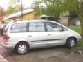
big car
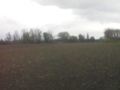
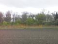
view over the hash field
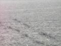
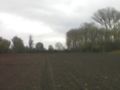
lazy ninja hashers trace
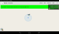
proof
west
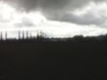
south
east
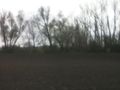
north

hashers grin
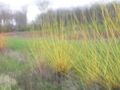
some beautiful bushes near the hash


Achievements
DODO earned the Land geohash achievement
|