Difference between revisions of "2016-06-21 52 1"
From Geohashing
imported>Sourcerer (→Planning) |
imported>FippeBot m (Location) |
||
| (2 intermediate revisions by one other user not shown) | |||
| Line 21: | Line 21: | ||
== Expedition == | == Expedition == | ||
| − | + | A track led into the field and it was OK to park at the road end of this. This was easy enough apart from a power loss exactly as I reached the hashpoint. Freshly charged batteries were installed and only a minute or two got lost. The hashpoint was, as expected, about 10 metres off the track. With seven metres to go, there were no further obstructions other than potential crop damage. The coordinates were reached. | |
== Photos == | == Photos == | ||
<gallery caption="Photo Gallery" widths="200px" heights="200px" perrow="3"> | <gallery caption="Photo Gallery" widths="200px" heights="200px" perrow="3"> | ||
| + | Image:2016-06-21_52_1_Sourcerer_1466547046530.jpg | Arrived. [http://www.openstreetmap.org/?lat=52.38149285&lon=1.30332828&zoom=16&layers=B000FTF @52.3815,1.3033] | ||
| + | Image:2016-06-21_52_1_Sourcerer.jpg | Google Earth Track | ||
</gallery> | </gallery> | ||
| Line 38: | Line 40: | ||
}} | }} | ||
| − | |||
| − | |||
[[Category:Expeditions]] | [[Category:Expeditions]] | ||
[[Category:Expeditions with photos]] | [[Category:Expeditions with photos]] | ||
[[Category:Coordinates reached]] | [[Category:Coordinates reached]] | ||
| − | + | {{location|GB|ENG|SFK}} | |
Latest revision as of 00:49, 16 August 2019
| Tue 21 Jun 2016 in Norwich, UK: 52.3815434, 1.3031658 geohashing.info google osm bing/os kml crox |
Location
10 metres off a farm track, north of Weybread, Suffolk, UK.
Participants
Plans
One of two spanning midnight - 2016-06-21 52 1 - 2016-06-22 52 1 - ETA 23:20.
Expedition
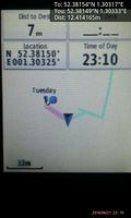
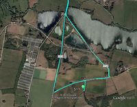
A track led into the field and it was OK to park at the road end of this. This was easy enough apart from a power loss exactly as I reached the hashpoint. Freshly charged batteries were installed and only a minute or two got lost. The hashpoint was, as expected, about 10 metres off the track. With seven metres to go, there were no further obstructions other than potential crop damage. The coordinates were reached.
Photos
- Photo Gallery
Arrived. @52.3815,1.3033
Achievements
Expeditions and Plans
| 2016-06-21 | ||
|---|---|---|
| Portland, Oregon | Jim | Farm land south of Hillsboro |
| Norwich, United Kingdom | Sourcerer | 10 metres off a farm track, north of Weybread, Suffolk, UK. |
Sourcerer's Expedition Links
2016-06-19 52 1 - 2016-06-21 52 1 - 2016-06-22 52 1 - KML file download of Sourcerer's expeditions for use with Google Earth.

