Difference between revisions of "2016-06-30 38 -74"
From Geohashing
imported>Mckaysalisbury (Adding Images) |
m (per Renaming Proposal) |
||
| (One intermediate revision by one other user not shown) | |||
| Line 35: | Line 35: | ||
{{#vardefine:ribbonwidth|800px}} | {{#vardefine:ribbonwidth|800px}} | ||
| − | {{ | + | {{Graticule unlocked |
| latitude = 38 | | latitude = 38 | ||
| longitude = -74 | | longitude = -74 | ||
| Line 45: | Line 45: | ||
[[Category:Expeditions with photos]] | [[Category:Expeditions with photos]] | ||
[[Category:Coordinates reached]] | [[Category:Coordinates reached]] | ||
| + | {{location|US|NJ|CP}} | ||
Latest revision as of 05:00, 20 March 2024
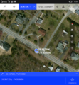
| Thu 30 Jun 2016 in 38,-74: 38.9673062, -74.9338860 geohashing.info google osm bing/os kml crox |
Location
Just off the road outside of Cape May
Participants
Plans
Stop and take a picture as we're driving up the coast.
Expedition
As we were driving up the coast, after getting off the ferry, we stopped by the hash, I got out of the car, and took a few pictures.
Photos
Achievements
McKay (talk) earned the Graticule Unlocked Achievement
|


