| Philadelphia, Pennsylvania | Atlantic City | 39,-73 |
| Salisbury, Maryland | Cape May | 38,-73 |
| Eastern Shore, Virginia | 37,-74 | 37,-73 |
|
Today's location: not yet announced | ||
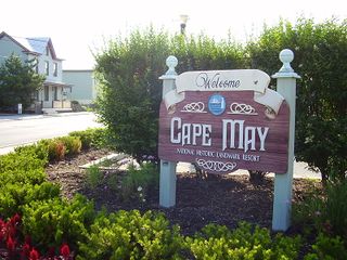
The Cape May, NJ graticule is at 38 N, -74 W. It has very little land area, as it includes only the lower third of Cape May County. It comes within 10 miles of land in Delaware and Maryland as well, and includes part of the route for the Cape May-Lewes Ferry.
It has approximately 25 sq mi of land, one third of which could be considered wetlands, in a graticule that measures 3,735 sq mi. (69.09mi. ^2 * cos 38.5°). So there's a one chance in 150 of a land-based geohash. While this might be a problem for land-lubbers, a fair number of people in the area own boats or know someone who does, so geohashes in Delaware Bay, or a few miles off Cape May or Wildwood are fair game.
Also to our benefit, raptors don't swim well, and aquaraptors haven't been seen any further south than Montauk, NY in ages.
The bad news is, zombies don't drown.
Contents
[hide]Users in graticule
Jevanyn spends one or two weeks vacation in the area every year, and a few weekends besides.
Attempted geohashes
- 2008-08-23, 2008-09-02
- Jevanyn took a ride on his uncle's boat around Wildwood island, and cruised right past the hashpoint (north of the 39th parallel), not knowing it was there. The September 2nd hashpoint later landed close to the route.
- 2008-12-25 38 -74 was almost attempted.
- 2011-09-04
- There was an expedition, but it was unsuccessful.
- 2016-06-30 38 -74 McKay (talk) hit while traveling up the coast.
Achievements
McKay (talk) earned the Graticule Unlocked Achievement
|
Recent locations
- 2012-02-01: A house on Shunpike Rd, south of the canal in Cape May Point (?)
- 2012-04-10: In the wetlands behind the houses along Lafayette St. / County Rd 633. Probably reachable by boat if you can make it up the creek from the bridge. Technically on the property of a house on Clay St., but the creek isn't.
- 2012-07-05: In Cape May Harbor, at the inner end of the inlet. Can someone swim there from Champagne Island? Or reach it by boat / surfboard / raft?
- 2013-03-04: a house on Lafayette St., at the north end of Cape May city, in sight of the bridge.
- 2013-03-07: The est end of the canal, as it empties into Cape May Harbor. Easily reachable by anything that can float.
Towns and other features
- Wildwood, NJ
- Cape May, NJ
- Delaware Bay
- Cape May-Lewes Ferry
- Sunset Beach
- Cape May Lighthouse
