Difference between revisions of "2017-07-19 50 11"
imported>Jens (→Photos) |
imported>FippeBot m (Location) |
||
| (2 intermediate revisions by 2 users not shown) | |||
| Line 11: | Line 11: | ||
== Participants == | == Participants == | ||
* [[user:Jens|Jens]] and Räbe | * [[user:Jens|Jens]] and Räbe | ||
| + | * [[User:Paintedhell|Juja]], Benjy and Frankie Mouse | ||
| − | == Expedition == | + | == Expedition: Jens == |
There is only one question: "Why?". Only a single word, nothing more. Why? A long working day is over. Unfortunately there was no lunch today, dentist stuff. Now I climbed up a hill that was advertised as "quite human". I am 2 minutes away from the top of the hill, but there is no power left to continue these last meters. So I stop. 30°C. No shadow available. Doesn't matter, I'm out of power. At this moment there is room left for a single word only. Why? | There is only one question: "Why?". Only a single word, nothing more. Why? A long working day is over. Unfortunately there was no lunch today, dentist stuff. Now I climbed up a hill that was advertised as "quite human". I am 2 minutes away from the top of the hill, but there is no power left to continue these last meters. So I stop. 30°C. No shadow available. Doesn't matter, I'm out of power. At this moment there is room left for a single word only. Why? | ||
| Line 27: | Line 28: | ||
* 42 | * 42 | ||
| − | == Photos == | + | == Photos: Jens == |
{{gallery|width=200|height=200|lines=2 | {{gallery|width=200|height=200|lines=2 | ||
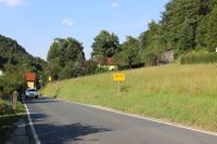
| − | |Image:170719 50 10 01.JPG| | + | |Image:170719 50 10 01.JPG|Bucha, formerly known as Nennsdorf |
| − | |Image:170719 50 10 02.JPG| | + | |Image:170719 50 10 02.JPG|On the top |
| − | |Image:170719 50 10 03.JPG| | + | |Image:170719 50 10 03.JPG|Raebe, having a break |
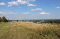
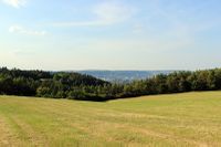
| − | |Image:170719 50 10 04.JPG| | + | |Image:170719 50 10 04.JPG|View to the right |
| − | |Image:170719 50 10 | + | |Image:170719 50 10 07.JPG|View to the left |
| − | |Image:170719 50 10 | + | |Image:170719 50 10 05.JPG|Coordinates reached |
| − | |Image:170719 50 10 | + | |Image:170719 50 10 06.JPG|Raebe, sitting on the point |
}} | }} | ||
| + | |||
| + | == Expedition: Juja == | ||
| + | |||
| + | There is only one question: "Why?". Only a single word, and a row of cursewords muttered under my breath. | ||
| + | |||
| + | Actually I had no time for this Geohash that came straight from the Too-close-to-miss-category, so I tried to persuade Jens to go, but couldn't get a positive answer (while Manu and Reinhard didn't even pretend to think about going). But my evening amusements were over sooner than I had thought (about 9pm), it was still pretty warm and a short check on the Geohashing site did not show any successful new expedition for Jens. Somebody has to do it, right? So I started my Geohashing trip while it got darker and hurried up through Kleinertal (I must have passed that Nennsdorf/Bucha sign, but didn't notice in the dusk) to Mönchsberg, where it already was suspiciously windy. Luckily the grass on the hashmeadow was short so I could ride my bike right to the point, but from there I had a very good view back to Jena and saw a thunderstorm build up in the distance, first lightnings already flashing. I probably should have checked the weather before starting... | ||
| + | |||
| + | To make the disaster complete my camera wasn't working at all because of its dead battery, and since the storm came nearer and nearer I wasn't quite in the right mood to spend half an hour fumbling around with my phone for a blurry proof picture, so I just grabbed my bike, chickened out and hurried back down to the city. The [http://www.gpsies.com/map.do?fileId=tyxjuotrvvihinjz tracklog] must be enough proof for today that I passed the point within GPS accuracy. | ||
| + | |||
| + | Down in the city I still had to cycle about 6 kms to get home, I was panicking quite a bit but strangely, the town seemed to be full of bikers and pedestrians enjoying themselves, the evening and the interesting weather. Anyway, I felt really relieved to finally be home before the storm got even worse. | ||
[[Category:Expeditions]] | [[Category:Expeditions]] | ||
[[Category:Expeditions with photos]] | [[Category:Expeditions with photos]] | ||
[[Category:Coordinates reached]] | [[Category:Coordinates reached]] | ||
| + | {{location|DE|TH|J}} | ||
Latest revision as of 02:45, 16 August 2019
| Wed 19 Jul 2017 in 50,11: 50.8826744, 11.5751769 geohashing.info google osm bing/os kml crox |
Location
Cospoth
Participants
Expedition: Jens
There is only one question: "Why?". Only a single word, nothing more. Why? A long working day is over. Unfortunately there was no lunch today, dentist stuff. Now I climbed up a hill that was advertised as "quite human". I am 2 minutes away from the top of the hill, but there is no power left to continue these last meters. So I stop. 30°C. No shadow available. Doesn't matter, I'm out of power. At this moment there is room left for a single word only. Why?
There is no answer.
After 5 minutes break in blistering heat I somehow managed to continue up to the top and finally to the hash point. On the way back home I tried to find the answer. Here are some trails:
- because Juja wanted me to go there by using the phrase "Manu, Reinhardt and me, we set all our hope on you."
- in order to discover that some prankster has moved the place-name sign of Bucha to Nennsdorf
- to find out once more that the mountain is NOT my friend
- to enjoy the view from the top of the hill down to Jena
- 42
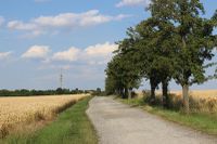
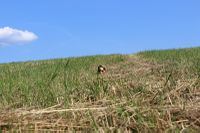
Photos: Jens
|
Expedition: Juja
There is only one question: "Why?". Only a single word, and a row of cursewords muttered under my breath.
Actually I had no time for this Geohash that came straight from the Too-close-to-miss-category, so I tried to persuade Jens to go, but couldn't get a positive answer (while Manu and Reinhard didn't even pretend to think about going). But my evening amusements were over sooner than I had thought (about 9pm), it was still pretty warm and a short check on the Geohashing site did not show any successful new expedition for Jens. Somebody has to do it, right? So I started my Geohashing trip while it got darker and hurried up through Kleinertal (I must have passed that Nennsdorf/Bucha sign, but didn't notice in the dusk) to Mönchsberg, where it already was suspiciously windy. Luckily the grass on the hashmeadow was short so I could ride my bike right to the point, but from there I had a very good view back to Jena and saw a thunderstorm build up in the distance, first lightnings already flashing. I probably should have checked the weather before starting...
To make the disaster complete my camera wasn't working at all because of its dead battery, and since the storm came nearer and nearer I wasn't quite in the right mood to spend half an hour fumbling around with my phone for a blurry proof picture, so I just grabbed my bike, chickened out and hurried back down to the city. The tracklog must be enough proof for today that I passed the point within GPS accuracy.
Down in the city I still had to cycle about 6 kms to get home, I was panicking quite a bit but strangely, the town seemed to be full of bikers and pedestrians enjoying themselves, the evening and the interesting weather. Anyway, I felt really relieved to finally be home before the storm got even worse.
