Difference between revisions of "2017-08-05 66 26"
imported>Pastori (→Achievements) |
m |
||
| (3 intermediate revisions by 3 users not shown) | |||
| Line 57: | Line 57: | ||
{{land geohash | latitude = 66 | longitude = 26 | date = 2017-08-05 | name = Pastori | image = 2017-08-05 66 26DSC 0964 1500px.jpg | {{land geohash | latitude = 66 | longitude = 26 | date = 2017-08-05 | name = Pastori | image = 2017-08-05 66 26DSC 0964 1500px.jpg | ||
}} | }} | ||
| − | {{Minesweeper geohash | graticule = Vanttauskoski, Finland | ranknumber = | + | {{Minesweeper geohash | graticule = Vanttauskoski, Finland | ranknumber = 4 || e = true | w = true | nw = true | ne = true | name = [[User:Pastori|Pastori]]}} |
{{#vardefine:ribbonwidth|800px}} | {{#vardefine:ribbonwidth|800px}} | ||
{{Multihash | latitude1 = 67 | longitude1 = 24 | latitude2 = 66 | longitude2 = 26 | date = 2017-08-05 | name = Pastori and The Wife }} | {{Multihash | latitude1 = 67 | longitude1 = 24 | latitude2 = 66 | longitude2 = 26 | date = 2017-08-05 | name = Pastori and The Wife }} | ||
| + | |||
| + | [[Category:Expeditions]] | ||
| + | [[Category:Expeditions with photos]] | ||
| + | [[Category:Coordinates reached]] | ||
| + | {{location|FI|10}} | ||
Latest revision as of 12:14, 23 September 2021
| Sat 5 Aug 2017 in 66,26: 66.5327826, 26.2276548 geohashing.info google osm bing/os kml crox |
Location
Rovaniemi, on the edge of the swampy area of Palo-Korvalampi. The point lies on the egde of the swamp, in a pine forest.
Participants
- Pastori
- The Wife
Expedition
After conquering the Ylläs graticule Pastori and Wife continued on their journey in a nice summer weather towards Rovaniemi and the next unconquered graticule.
The swampy area where the hashpoint was supposed to be seemed to behind some road barriers, according to the map. This added its own bit of excitement to the trip, but it wouldn't hurt to try. They got a boost of hope when the first barrier had been moved aside and had been so for years. There were also several cars parked beside the road, presumably by people searching for cloud berries, so that boded well as well and they did indeed get to the point easily and it was only 40 m from the road. They reached it with an accuracy of 1.942 m.
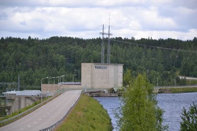
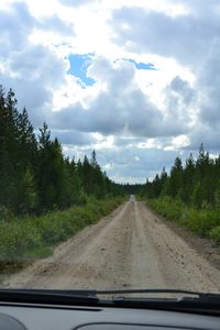
The rattle and noise of little stones in their mudguards continued for about 20 km all the way to proper roads. By the time they got near any settlements Pastori and Wife were ready for lunch which they found in a nice serving of kebab meat with fries and pasta carbonara in a cafe by the road in Vanttauskoski. This graticule is actually named after the power plant in Vanttauskoski.
After 13 hours, 600 km and 2 new graticules Pastori and Wife slumped in their own beds that night, dreaming of new hashpoint adventures.

Photos
Achievements
Pastori earned the Land geohash achievement
|
Pastori achieved level 4 of the Minesweeper Geohash achievement
|
Pastori and The Wife earned the Multihash Achievement
|


