Difference between revisions of "2018-03-23 50 11"
imported>Jens (Created page with "{{meetup graticule | lat=50 | lon=11 | date=2018-03-23 }} __NOTOC__ == Location == above Wöllnitz == Participants == * Jens and Räbe == Expedition == '''S...") |
imported>FippeBot m (Location) |
||
| (3 intermediate revisions by 3 users not shown) | |||
| Line 14: | Line 14: | ||
== Expedition == | == Expedition == | ||
| − | '''Saturday, March 17th, 12:20''': [[User:Paintedhell|Juja]] send a last note about the confusion in the hash report of [[2018-03-16_50_11|March 16th]] to me and then started into holiday. In the week to come there will be no one here to discover hash points that are " | + | '''Saturday, March 17th, 12:20''': [[User:Paintedhell|Juja]] send a last note about the confusion in the hash report of [[2018-03-16_50_11|March 16th]] to me and then started into holiday. In the week to come there will be no one here to discover hash points that are "too close to miss". Yeah! |
'''Thursday, March 22th, 17:58''': I found an e-mail from [[User:Reinhard|Reinhard]], containing the coordinates of today's hash point and the sentence: "Great that you care about it!". Damn! | '''Thursday, March 22th, 17:58''': I found an e-mail from [[User:Reinhard|Reinhard]], containing the coordinates of today's hash point and the sentence: "Great that you care about it!". Damn! | ||
| Line 20: | Line 20: | ||
'''Thursday, March 22th, sometime in the evening''': Will I go there or not? Of course, it's really near. But on the other hand - why? | '''Thursday, March 22th, sometime in the evening''': Will I go there or not? Of course, it's really near. But on the other hand - why? | ||
| − | '''Friday, March | + | '''Friday, March 23th, 15:54''': Okay, work is over, weekend has arrived, weather is fine (at least better than in the days before). Let's do something stupid and go to the point. I cycled 3 or 4 km in south direction to Wöllnitz, entered Pennickental and parked my bike as the climb became steeper. True heroes would have gone up to the top on bike, but I am no true hero. So I went up the mountain on foot, following the yellow trail. The higher I came, the more snow lay on the ground, making it slippery. A direction board just beside the trail gave the hint “sure-footedness required” just for the way I used. I wondered if slippery shoes on slippery ground would fulfill this requirement, but hey this is a geohash, of course it would. I safely reached the top of the hill. 80 meters before the point I had to leave the trail and enter the wood. It was not particularly dense, with only a few shrubs. So no real challenge for a real geohasher. |
| − | '''Friday, March | + | '''Friday, March 23th, 17:25''': Coordinates reached. Time to take some photos and walk home again. |
| − | '''Friday, March | + | '''Friday, March 23th, 17:37''': Climbing up a hill with slippery shoes on slippery ground is one thing, but after going it down again you know why the board recommended to be sure-footed. |
== Photos == | == Photos == | ||
{{gallery|width=200|height=200|lines=2 | {{gallery|width=200|height=200|lines=2 | ||
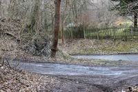
| − | |Image:180323 50 11 01.JPG| | + | |Image:180323 50 11 01.JPG|bike parked |
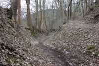
| + | |Image:180323 50 11 02.JPG|entrering the trail | ||
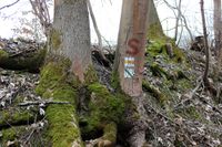
| + | |Image:180323 50 11 03.JPG|follow the yellow sign | ||
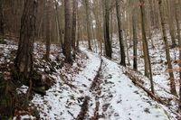
| + | |Image:180323 50 11 04.JPG|the ground becomes snowy | ||
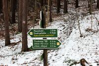
| + | |Image:180323 50 11 05.JPG|sure-footedness required for the yellow trail | ||
| + | |Image:180323 50 11 06.JPG|the trail on top of the hill ... | ||
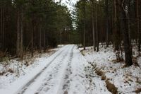
| + | |Image:180323 50 11 07.JPG|... a mix of ice and snow | ||
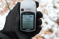
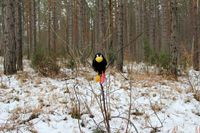
| + | |Image:180323 50 11 08.JPG|coordinates reached | ||
| + | |Image:180323 50 11 09.JPG|Räbe checking the coordinates | ||
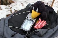
| + | |Image:180323 50 11 10.JPG|Räbe sitting on the point | ||
}} | }} | ||
| Line 36: | Line 45: | ||
[[Category:Expeditions with photos]] | [[Category:Expeditions with photos]] | ||
[[Category:Coordinates reached]] | [[Category:Coordinates reached]] | ||
| + | {{location|DE|TH|J}} | ||
Latest revision as of 03:25, 16 August 2019
| Fri 23 Mar 2018 in 50,11: 50.8982570, 11.6185456 geohashing.info google osm bing/os kml crox |
Location
above Wöllnitz
Participants
- Jens and Räbe
Expedition
Saturday, March 17th, 12:20: Juja send a last note about the confusion in the hash report of March 16th to me and then started into holiday. In the week to come there will be no one here to discover hash points that are "too close to miss". Yeah!
Thursday, March 22th, 17:58: I found an e-mail from Reinhard, containing the coordinates of today's hash point and the sentence: "Great that you care about it!". Damn!
Thursday, March 22th, sometime in the evening: Will I go there or not? Of course, it's really near. But on the other hand - why?
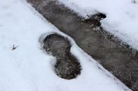
Friday, March 23th, 15:54: Okay, work is over, weekend has arrived, weather is fine (at least better than in the days before). Let's do something stupid and go to the point. I cycled 3 or 4 km in south direction to Wöllnitz, entered Pennickental and parked my bike as the climb became steeper. True heroes would have gone up to the top on bike, but I am no true hero. So I went up the mountain on foot, following the yellow trail. The higher I came, the more snow lay on the ground, making it slippery. A direction board just beside the trail gave the hint “sure-footedness required” just for the way I used. I wondered if slippery shoes on slippery ground would fulfill this requirement, but hey this is a geohash, of course it would. I safely reached the top of the hill. 80 meters before the point I had to leave the trail and enter the wood. It was not particularly dense, with only a few shrubs. So no real challenge for a real geohasher.
Friday, March 23th, 17:25: Coordinates reached. Time to take some photos and walk home again.
Friday, March 23th, 17:37: Climbing up a hill with slippery shoes on slippery ground is one thing, but after going it down again you know why the board recommended to be sure-footed.
Photos
|
