Difference between revisions of "2008-06-04 37 -121"
From Geohashing
imported>Tapin (→Photographic Evidence) |
imported>FippeBot m (Location) |
||
| (3 intermediate revisions by 2 users not shown) | |||
| Line 21: | Line 21: | ||
== Execution/aftermath == | == Execution/aftermath == | ||
| − | * [[User:Tapin|Tapin]] made it to the parking lot a little after 6:45, taped the geohashing logo to his rear window, and headed up to the April Trail. A bit of wandering around through underbrush choked with poison oak on the side of a forested hill, and the geohash was located. Made it back to the car at about 8:15 -- with about eight minutes to spare before the gate was locked | + | * [[User:Tapin|Tapin]] made it to the parking lot a little after 6:45, taped the geohashing logo to his rear window, and headed up to the April Trail. A bit of wandering around through underbrush choked with poison oak on the side of a forested hill, and the geohash was located. Made it back to the car at about 8:15 -- with about eight minutes to spare before the gate was locked. |
* Bah! I missed Tapin again! It is my destiny... <sigh> Sorry, work got long, and I wasn't sure about heading out at 7:45 from SJC-ish. Glad to see the group was represented :) [[User:Ted|Ted]] 06:50, 5 June 2008 (UTC) | * Bah! I missed Tapin again! It is my destiny... <sigh> Sorry, work got long, and I wasn't sure about heading out at 7:45 from SJC-ish. Glad to see the group was represented :) [[User:Ted|Ted]] 06:50, 5 June 2008 (UTC) | ||
| Line 29: | Line 29: | ||
<gallery widths="150px" heights="100px" perrow="3"> | <gallery widths="150px" heights="100px" perrow="3"> | ||
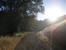
Image:2008-06-04 37 -121-AlreadyLate.JPG|The sun was already pretty low when I got to the parking lot. | Image:2008-06-04 37 -121-AlreadyLate.JPG|The sun was already pretty low when I got to the parking lot. | ||
| − | Image:2008-06-04 37 - | + | Image:2008-06-04 37 -121-Tapin-1.JPG|Obligatory "grinning like an idiot who just exposed himself to large amounts of poison oak" picture. |
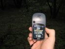
Image:2008-06-04 37 -121-Tapin-2.JPG|Obligatory GPS shot, complete with poison oak background. The hill doesn't look too steep in this picture. | Image:2008-06-04 37 -121-Tapin-2.JPG|Obligatory GPS shot, complete with poison oak background. The hill doesn't look too steep in this picture. | ||
</gallery> | </gallery> | ||
| Line 35: | Line 35: | ||
[[Category:Expeditions]] | [[Category:Expeditions]] | ||
[[Category:Expeditions with photos]] | [[Category:Expeditions with photos]] | ||
| + | [[Category:Coordinates reached]] | ||
| + | {{location|US|CA|SL}} | ||
Latest revision as of 04:43, 7 August 2019
| Wed 4 Jun 2008 in San Jose, California: 37.1802923, -121.8450323 geohashing.info google osm bing/os kml crox |
Logistics
- Google Maps link
- Looks to be lots of trails around, but the actual spot is about 50' from the nearest one, in a dense clump of trees.
- Unless I miss my guess (always a possibility), the nearest trail should be the April Trail. The geohash appears almost on top of the Powder House historical site; if that's the case, easiest parking is going to be at the Hacienda entrance off Almaden/Alamitos Road. From there, pick up a trail map and take the Mine Hill Trail approximately 1.5 miles (past several other trails, keep a close eye out) until you see the signs for the April Trail or Powder House.
- The last time I was in this park, I hiked near this area and seem to remember a hillside completely covered in poison oak in the Church Hill vicinity. Consider bringing Tecnu.
- The April Mine entrance isn't all that far away from this geohash. But given that it's an abandoned, closed to the public mine shaft that was used for extracting mercury, it might not be that great of an idea to try for the Underground Geohash. Besides, without a GPS lock, how can you prove it? Oh, and: Please Do Not Tresspass.
Intended attendees
- Tapin is going to try to be there, but he'll be at the trailhead in the early evening -- 6:45pm-ish if everything goes well.
- Ted sez: 6:45-ish, you say...? Oh, what the heck, I'll try to get out there, too. (Don't wait for me, though.)
Execution/aftermath
- Tapin made it to the parking lot a little after 6:45, taped the geohashing logo to his rear window, and headed up to the April Trail. A bit of wandering around through underbrush choked with poison oak on the side of a forested hill, and the geohash was located. Made it back to the car at about 8:15 -- with about eight minutes to spare before the gate was locked.
- Bah! I missed Tapin again! It is my destiny... <sigh> Sorry, work got long, and I wasn't sure about heading out at 7:45 from SJC-ish. Glad to see the group was represented :) Ted 06:50, 5 June 2008 (UTC)


