Difference between revisions of "2019-10-21 54 13"
(Created page with "__NOTOC__ {{meetup graticule | lat=54 | lon=13 | date=2019-10-21 | graticule_name = Greifswald, Deutschland | graticule_link=54,13 }} == Location == In a sugar-bee...") |
m (User categories) |
||
| (3 intermediate revisions by the same user not shown) | |||
| Line 49: | Line 49: | ||
== Achievements == | == Achievements == | ||
| − | {{#vardefine:ribbonwidth| | + | {{#vardefine:ribbonwidth|1000px}} |
{{land geohash | latitude = 54 | longitude = 13 | date = 2019-10-21 | name = SastRe.O}} | {{land geohash | latitude = 54 | longitude = 13 | date = 2019-10-21 | name = SastRe.O}} | ||
{{Walk geohash | latitude = 54 | longitude = 13 | date = 2019-10-21 | name = SastRe.O | distance = 9.4km}} | {{Walk geohash | latitude = 54 | longitude = 13 | date = 2019-10-21 | name = SastRe.O | distance = 9.4km}} | ||
| + | {{Dark Ages | latitude = 54 | longitude = 13 | date = 2019-10-21 | name = SastRe.O}} | ||
== Other Geohashing Expeditions and Plans on This Day == | == Other Geohashing Expeditions and Plans on This Day == | ||
| Line 57: | Line 58: | ||
{{Location|DE|MV|HGW}} | {{Location|DE|MV|HGW}} | ||
| + | {{user categories|user=SastRe.O|foot=9.4}} | ||
[[Category:Expeditions]] | [[Category:Expeditions]] | ||
[[Category:Expeditions with photos]] | [[Category:Expeditions with photos]] | ||
[[Category:Coordinates reached]] | [[Category:Coordinates reached]] | ||
Latest revision as of 18:45, 16 February 2022
| Mon 21 Oct 2019 in Greifswald, Deutschland: 54.0619377, 13.4456941 geohashing.info google osm bing/os kml crox |
Location
In a sugar-beet field in Greifswald, MV, Germany.
Participants
Plans
Walk there in the afternoon. Leave home before sunset, but get there when it's already dark.
Expedition
Well, again in the 54,13 graticule after a few weeks home. And today a close geohash, less than 3km away. Well, it looks like I can walk there, no need to grab Winterbuche (which has some trouble in a wheel).
So, I downloaded some podcasts and when I had the afternoon free, at 17pm, I went for the hash. Winter is coming and you can feel the days get shorter. And at this latitude the change is more noticeable.
I have been many times theses paths with bike, so I thought there was nothing new to discover. Going there, after Groß Schönwalde I scared a group of 3 deers, which had a long way to run. I had my binoculars with me.
Then I approached the sugar beet field where the hash fell. Here are a lot of these field, I think I may have explained that in my second expedition, this one, when the hash also fell in a sugar beet field.
It was already dark. According to google maps imagery the hash fell near the tractor tracks, which is suprisingly acurate. I approached the hash until reaching it. Don't tell the owner, but I discretly took the hash-sugar-beet home. Let's see if I find an easy way to cook it. Let's see how geohashing tastes.
The way back home was as routinary as you can image it.
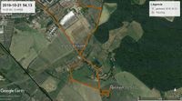
Tracklog
Photos
|
Achievements
SastRe.O earned the Land geohash achievement
|
SastRe.O earned the Walk geohash Achievement
|
SastRe.O earned the Dark Ages achievement
|
Other Geohashing Expeditions and Plans on This Day
Expeditions and Plans
| 2019-10-21 | ||
|---|---|---|
| Mannheim, Germany | Kellerkind | located on a path in a forest in Blankenloch. |
| Stralsund, Germany | SastRe.O | In a sugar-beet field in Greifswald, MV, Germany. |


