Difference between revisions of "2008-06-15 52 13"
imported>Thilo (New page: =Near-Motorway geohashing= This day's hash was east of Berlin, close to the Schöneiche motorway exit, in a wild meadow.) |
m |
||
| (9 intermediate revisions by 4 users not shown) | |||
| Line 2: | Line 2: | ||
This day's hash was east of Berlin, close to the Schöneiche motorway exit, in a wild meadow. | This day's hash was east of Berlin, close to the Schöneiche motorway exit, in a wild meadow. | ||
| + | |||
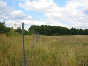
| + | [[Image:img_3281.jpg|thumb|left|A fence protects the motorway from the dangerous meadow]] | ||
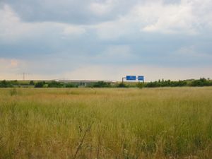
| + | [[Image:img_3286.jpg|thumb|right|Motorway exit (blue signs in the distance)]] | ||
| + | It was just a few meters of walking from the motorway exit. The motorway itself is aside the meadow. Meadow and motorway are separated by a fence, the geohash being alongside the fence on the meadow's part. | ||
| + | |||
| + | <br clear="all"> | ||
| + | <hr> | ||
| + | |||
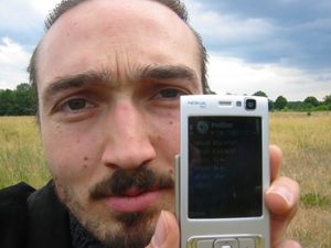
| + | [[Image:img_3278.jpg|thumb|left|Me at the spot]] | ||
| + | {{meetup graticule | ||
| + | | map=<map lat="52" lon="13" date="2008-06-15" /> | ||
| + | | lat=52 | ||
| + | | lon=13 | ||
| + | | date=2008-06-15 | ||
| + | }} | ||
| + | |||
| + | I ([[User:Thilo|Thilo]]) hit the spot at about 4:30. As usual, no one else came. | ||
| + | |||
| + | <br clear="all"> | ||
| + | <hr> | ||
| + | |||
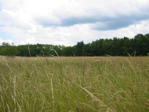
| + | [[Image:img_3282.jpg|thumb|left|Grass]] | ||
| + | [[Image:img_3283.jpg|thumb|right|More grass]] | ||
| + | |||
| + | Something noticeable about Google Maps' idea about the meadow is that google thinks there is a small dead-end road named "Berghof Weiche" into the meadow, pointing right to the geohash. In the real world I could only find grass; no trace of any road. | ||
| + | |||
| + | <br clear="all"> | ||
| + | <hr> | ||
| + | |||
| + | [[Image:img_3279.jpg|thumb|left|A storm is coming...]] | ||
| + | [[Image:img_3280.jpg|thumb|right|Well, some rainclouds. But for a geek, there is no difference.]] | ||
| + | |||
| + | Soon after I reached the spot some rainclouds appeared. Cowardly, I fled... no picknick today. | ||
| + | |||
| + | <br clear="all"> | ||
| + | <hr> | ||
| + | |||
| + | [[Image:img_3287.jpg|thumb|left|Vintage tram]] | ||
| + | On my way back I saw this cool vintage tram. The line connects Schöneiche with Berlin. | ||
| + | |||
| + | [[Category:Expeditions]] | ||
| + | [[Category:Expeditions with photos]] | ||
| + | [[Category:Coordinates reached]] | ||
| + | {{location|DE|BB|MOL}} | ||
Latest revision as of 17:10, 19 March 2022
Near-Motorway geohashing
This day's hash was east of Berlin, close to the Schöneiche motorway exit, in a wild meadow.
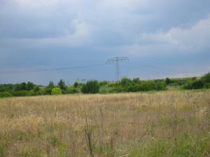
It was just a few meters of walking from the motorway exit. The motorway itself is aside the meadow. Meadow and motorway are separated by a fence, the geohash being alongside the fence on the meadow's part.
| Sun 15 Jun 2008 in 52,13: 52.4753808, 13.7612767 geohashing.info google osm bing/os kml crox |
I (Thilo) hit the spot at about 4:30. As usual, no one else came.
Something noticeable about Google Maps' idea about the meadow is that google thinks there is a small dead-end road named "Berghof Weiche" into the meadow, pointing right to the geohash. In the real world I could only find grass; no trace of any road.
Soon after I reached the spot some rainclouds appeared. Cowardly, I fled... no picknick today.
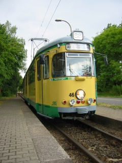
On my way back I saw this cool vintage tram. The line connects Schöneiche with Berlin.
