Difference between revisions of "2020-05-09 39 -78"
From Geohashing
([live] This is the one for today! Very chilly, and I am better dressed for this one than the last one where it f****** snowed) |
m (Location) |
||
| (4 intermediate revisions by 2 users not shown) | |||
| Line 1: | Line 1: | ||
| − | + | {{meetup graticule | |
| − | |||
| − | |||
| − | |||
| − | |||
| − | |||
| − | |||
| − | |||
| − | |||
| lat=39 | | lat=39 | ||
| lon=-78 | | lon=-78 | ||
| date=2020-05-09 | | date=2020-05-09 | ||
| − | }} | + | }} |
__NOTOC__ | __NOTOC__ | ||
== Location == | == Location == | ||
| − | + | This Geohash is located in Buchanan State Forest. | |
== Participants == | == Participants == | ||
| − | + | *[[User:OfficeLinebacker|OfficeLinebacker]] | |
| − | |||
| − | |||
| − | |||
| − | |||
== Expedition == | == Expedition == | ||
| − | + | *This is the one for today! Very chilly, and I am better dressed for this one than the last one where it f****** snowed -- [[User:OfficeLinebacker|OfficeLinebacker]] ([[User talk:OfficeLinebacker|talk]]) 10:10, 9 May 2020 (EDT) | |
| − | + | *Getting close -- [[User:OfficeLinebacker|OfficeLinebacker]] ([[User talk:OfficeLinebacker|talk]]) [https://openstreetmap.org/?lat=39.82643010&lon=-78.56383540&zoom=16&layers=B000FTF @39.8264,-78.5638] 13:19, 9 May 2020 (EDT) | |
| − | * | ||
== Tracklog == | == Tracklog == | ||
<!-- if your GPS device keeps a log, you may post a link here --> | <!-- if your GPS device keeps a log, you may post a link here --> | ||
== Photos == | == Photos == | ||
| − | |||
| − | |||
| − | |||
<gallery perrow="5"> | <gallery perrow="5"> | ||
| + | |||
| + | Image:2020-05-09_39_-78_OfficeLinebacker_1589045163303.jpg|Made it! [https://openstreetmap.org/?lat=39.82819920&lon=-78.56473240&zoom=16&layers=B000FTF @39.8282,-78.5647] | ||
| + | |||
| + | Image:2020-05-09_39_-78_OfficeLinebacker_1589045345102.jpg|Nearby [https://openstreetmap.org/?lat=39.82813830&lon=-78.56453950&zoom=16&layers=B000FTF @39.8281,-78.5645] | ||
</gallery> | </gallery> | ||
| Line 42: | Line 30: | ||
<!-- Add any achievement ribbons you earned below, or remove this section --> | <!-- Add any achievement ribbons you earned below, or remove this section --> | ||
| − | |||
| − | |||
| − | |||
| − | |||
| − | |||
| − | |||
| − | |||
| − | |||
| − | |||
| − | |||
| − | |||
| − | |||
| − | |||
| − | |||
[[Category:Expeditions]] | [[Category:Expeditions]] | ||
| − | |||
[[Category:Expeditions with photos]] | [[Category:Expeditions with photos]] | ||
| − | |||
| − | |||
| − | |||
| − | |||
| − | |||
[[Category:Coordinates reached]] | [[Category:Coordinates reached]] | ||
| − | + | {{location|US|PA|BO}} | |
| − | |||
| − | |||
| − | |||
| − | |||
| − | |||
| − | |||
| − | |||
| − | |||
| − | |||
| − | |||
| − | |||
| − | |||
| − | |||
| − | |||
| − | |||
| − | |||
| − | |||
Latest revision as of 20:43, 10 May 2020
| Sat 9 May 2020 in 39,-78: 39.8281465, -78.5649037 geohashing.info google osm bing/os kml crox |
Location
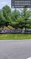
This Geohash is located in Buchanan State Forest.
Participants
Expedition
- This is the one for today! Very chilly, and I am better dressed for this one than the last one where it f****** snowed -- OfficeLinebacker (talk) 10:10, 9 May 2020 (EDT)
- Getting close -- OfficeLinebacker (talk) @39.8264,-78.5638 13:19, 9 May 2020 (EDT)
Tracklog
Photos

Made it! @39.8282,-78.5647
Nearby @39.8281,-78.5645

