Difference between revisions of "2020-06-10 51 10"
(expedition report for Bad Lauterberg-Osterhagen) |
m (subst-ing) |
||
| (One intermediate revision by the same user not shown) | |||
| Line 1: | Line 1: | ||
{{meetup graticule | {{meetup graticule | ||
| − | | lat= | + | | lat=51 |
| − | | lon= | + | | lon=10 |
| − | | date= | + | | date=2020-06-10 |
}} | }} | ||
| Line 46: | Line 46: | ||
[[Category:Coordinates reached]] | [[Category:Coordinates reached]] | ||
| + | {{location|DE|NI|GÖ}} | ||
Latest revision as of 20:16, 24 May 2024
| Wed 10 Jun 2020 in 51,10: 51.5819314, 10.4778293 geohashing.info google osm bing/os kml crox |
Location
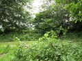
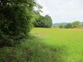
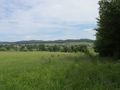
The hash lay at the edge of a valley south of Osterhagen.
Participants
Plans
A journey with public transport and walking.
Expedition
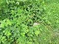
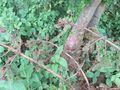
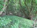
There was an easy travel to Osterhagen and there I walked through fields and meadows and up a hill. Looking from only some meters away it looked easy, but then I saw, that directly behind the edge of the forest, there was a deep valley. Trying the direct way to the hash I felt a little bit uneasy, because I couldn't see the ground beyond the plants and the ground was deeper than the plants told me. Then I decided to walk at first across the meadow and then into the forest. And just entering the meadow I saw the end of a concrete pipe, which should be a bridge across a ditch. After that all was easy.
Photos

arrived in Osterhagen
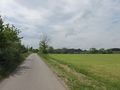
the way to hash
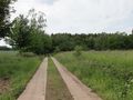
some meters to go
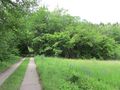
the first view
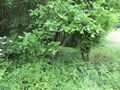
and there it is: the hash!
a concrete pipe as a bridge
the hash
looking south
west, with the valley
north, without the valley
east
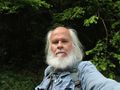
the geohasher


