Difference between revisions of "2020-11-07 52 9"
From Geohashing
(Expedition report) |
m (Location) |
||
| (4 intermediate revisions by 2 users not shown) | |||
| Line 1: | Line 1: | ||
| − | + | {{meetup graticule | |
| − | + | | lat=52 | |
| − | + | | lon=9 | |
| − | + | | date=2020-11-07 | |
| − | + | |graticule_name = Hannover | |
| − | + | |graticule_link = 52,9 | |
| − | + | }} | |
| − | |||
| − | |||
| − | | lat= | ||
| − | | lon= | ||
| − | | date= | ||
| − | }} | ||
__NOTOC__ | __NOTOC__ | ||
== Location == | == Location == | ||
| − | |||
Near the edge of the forest near Schloss Ricklingen. | Near the edge of the forest near Schloss Ricklingen. | ||
== Participants == | == Participants == | ||
| − | |||
| − | |||
* [[User:DLichti|DLichti]] ([[User talk:DLichti|talk]]) was there. | * [[User:DLichti|DLichti]] ([[User talk:DLichti|talk]]) was there. | ||
== Plans == | == Plans == | ||
| − | |||
There was no plan. | There was no plan. | ||
== Expedition == | == Expedition == | ||
| − | |||
It was already a little late when I noticed todays GeoHash location, but it was still enough time to reach it at 16:00. | It was already a little late when I noticed todays GeoHash location, but it was still enough time to reach it at 16:00. | ||
I took my bike and rode out to the location near Schloss Ricklingen. | I took my bike and rode out to the location near Schloss Ricklingen. | ||
| Line 39: | Line 28: | ||
Image:2020-##-## ## ## Alpha.jpg | Witty Comment | Image:2020-##-## ## ## Alpha.jpg | Witty Comment | ||
--> | --> | ||
| − | |||
<gallery perrow="5"> | <gallery perrow="5"> | ||
| + | [[:File:2020-11-07_Field.jpg]][[:File:2020-11-07_Screenshot.png]][[:File:2020-11-07_Hat_of_proof.jpg]][[:File:2020-11-07_Sunset.jpg]] | ||
</gallery> | </gallery> | ||
| + | {{gallery|width=200|height=200|lines=2 | ||
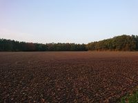
| + | |Image:2020-11-07_Field.jpg|The location is right behind the trees at the far side of the field. | ||
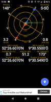
| + | |Image:2020-11-07_Screenshot.png|Here it is. | ||
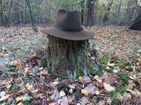
| + | |Image:2020-11-07_Hat_of_proof.jpg|I was there. | ||
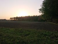
| + | |Image:2020-11-07_Sunset.jpg|Shadows are groing longer. | ||
| + | }} | ||
== Achievements == | == Achievements == | ||
| Line 47: | Line 42: | ||
<!-- Add any achievement ribbons you earned below, or remove this section --> | <!-- Add any achievement ribbons you earned below, or remove this section --> | ||
| − | |||
| − | |||
| − | |||
| − | |||
| − | |||
| − | |||
| − | |||
[[Category:Expeditions]] | [[Category:Expeditions]] | ||
[[Category:Coordinates reached]] | [[Category:Coordinates reached]] | ||
| − | |||
| − | |||
[[Category:Expeditions with photos]] | [[Category:Expeditions with photos]] | ||
| + | <!-- | ||
[[Category:Expeditions with videos]] | [[Category:Expeditions with videos]] | ||
[[Category:Expedition without GPS]] | [[Category:Expedition without GPS]] | ||
--> | --> | ||
| + | {{location|DE|NI|H}} | ||
Latest revision as of 17:42, 10 November 2020
| Sat 7 Nov 2020 in Hannover: 52.4434585, 9.5091758 geohashing.info google osm bing/os kml crox |
Location
Near the edge of the forest near Schloss Ricklingen.
Participants
Plans
There was no plan.
Expedition
It was already a little late when I noticed todays GeoHash location, but it was still enough time to reach it at 16:00. I took my bike and rode out to the location near Schloss Ricklingen. The cycleways were pretty good for most of the distance, but I lost a few minutes when I took a wrong turn. Fortunately, the GeoHash happened to lie right on a forest aisle a dozen meters from the forest track where I parked my bike. I reached it a few minutes after 16:00, but didn't see anyone else there. So I took a screenshot and some pictures, before I rode back home.
Photos
|


