Difference between revisions of "2021-01-12 41 1"
(New report) |
m (User categories) |
||
| (2 intermediate revisions by the same user not shown) | |||
| Line 63: | Line 63: | ||
{{Location|ES|CT|B}} | {{Location|ES|CT|B}} | ||
| + | {{user categories|user=SastRe.O|bike=26.2}} | ||
[[Category:Expeditions]] | [[Category:Expeditions]] | ||
[[Category:Expeditions with photos]] | [[Category:Expeditions with photos]] | ||
[[Category:Coordinates reached]] | [[Category:Coordinates reached]] | ||
| − | |||
| − | |||
| − | |||
| − | |||
| − | |||
| − | |||
| − | |||
| − | |||
| − | |||
| − | |||
| − | |||
| − | |||
| − | |||
Latest revision as of 12:26, 15 February 2022
| Tue 12 Jan 2021 in Tarragona, Catalonia: 41.4281192, 1.9967297 geohashing.info google osm bing/os kml crox |
Location
Ronda de Santa Eulàlia, Pallejà, Baix Llobregat, Catalonia.
Participants
Plans
So close, yet so far. It has been a while since I last went geohashing. The municipal confinement we are under is being rough and I can not plan any long expeditions. But this hash seemed so close... We can go to the bordering municipality if we are doing sport outside, and... since it was so close I thought I would go another municipality further and grab this hash. Don't tell anybody. I mean, I am going there alone and not planing to meet anybody in the way.
The only thing is... yes, the hash is less than 7km from home, but I have to cross a meridian (easy), train tracks (less easy), two highways and a river! What a mess! There seems to be one bridge that would be very useful, but I cannot cross it if the flow of the river is big, and this last weekend has rained a lot. I will see. Otherwise, I will have to do a 2-3km detour to either side of the river to find the next bridge.
Expedition
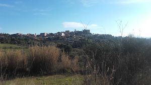
So here we go, first expedition with Frühlingskiefer. And visiting my neighbour graticule which is so close. I left home at exactly 15:00 after lunch. The first part was easy, some slope but it's towards el Papiol, in an area which I go very often either with my bike, walking or jogging. I know these paths very well.
Once the uphill was done, downward to El Papiol and here I crossed the first highway. Ugly area, but what can you do. All highways are mostly ugly. Now I was at the train station, and had to find the way under the tracks. First tracks done and yet another ones to cross. Now I am finally at the bed of the river. And not just any river, but El Llobregat, one of the main rivers in Catalonia. Now I had to search for the crossing point.
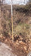
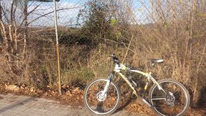
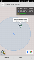
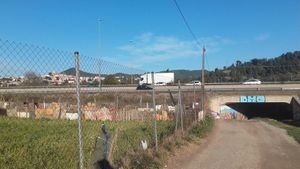
Crossed the first stream and looked for the bridge and... yes! Easy to cross. 6km detour avoided. Biked and little more and shortly after that I was already at the street where the hash fell in Pallejà. Approached the exact point in was behind a fence... but, a convenient hole was made on the fence right where the hash. Since there was onobody there I sneaked in there for just a few seconds only to reach the exact point. Right as I was entering I was already out and taking pictures and proof :)
I could say that the rest is history. If only so.. Right when I was arriving again at el Papiol the rear wheel has no air... a flat tire, now that I have to face the mountain again... Come on. Lucky for me, if I pumped it the wheel lasted for about 10 minutes. So it started the boring routine of pumping and biking and pumping again. It delayed a little the way back but eventually I reached home.
I has been a few months with no hashes. I hope this 2021 goes a little different ;)
Tracklog
Photos
|
Achievements
SastRe.O earned the Land geohash achievement
|
SastRe.O with Frühlingskiefer earned the Bicycle geohash achievement
|
SastRe.O achieved level 1 of the Minesweeper Geohash achievement
|
SastRe.O achieved level 1 of the Minesweeper Geohash achievement
|
Other Geohashing Expeditions and Plans on This Day
Expeditions and Plans
| 2021-01-12 | ||
|---|---|---|
| Tarragona, Spain | SastRe.O | Ronda de Santa Eulàlia, Pallejà, Baix Llobregat, Catalonia. |
| Tampere, Finland | PJH FIN | Kangasala |
