Difference between revisions of "2021-07-03 40 -111"
From Geohashing
m (Location) |
m (per Renaming Proposal) |
||
| (One intermediate revision by one other user not shown) | |||
| Line 1: | Line 1: | ||
| − | + | [[Image:2021-07-03 grin.jpg|thumb|left]] | |
| − | + | {{meetup graticule | |
| − | |||
| − | |||
| − | |||
| − | |||
| − | |||
| − | |||
| lat=40 | | lat=40 | ||
| lon=-111 | | lon=-111 | ||
| Line 17: | Line 11: | ||
== Participants == | == Participants == | ||
| − | + | * [[User:Mckaysalisbury|McKay]] ([[User talk:Mckaysalisbury|talk]]) (and fam) | |
| − | |||
== Plans == | == Plans == | ||
| Line 24: | Line 17: | ||
== Expedition == | == Expedition == | ||
| − | + | Visiting the spot was only a few minutes, and Alf's was closed, so we hiked up to Cecret Lake | |
| − | |||
| − | |||
| − | |||
== Photos == | == Photos == | ||
| − | |||
| − | |||
| − | |||
<gallery perrow="5"> | <gallery perrow="5"> | ||
| + | Image:2021-07-03 grin.jpg | GPS | ||
| + | Image:2021-07-03 gps.png | GPS | ||
</gallery> | </gallery> | ||
== Achievements == | == Achievements == | ||
{{#vardefine:ribbonwidth|800px}} | {{#vardefine:ribbonwidth|800px}} | ||
| − | + | {{one with nature | |
| − | + | | latitude=40 | |
| − | + | | longitude=-111 | |
| − | + | | date=2021-07-03 | |
| − | + | | name = [[User:Mckaysalisbury|McKay]] ([[User talk:Mckaysalisbury|talk]]) | |
| − | + | }} | |
| − | |||
| − | |||
[[Category:Expeditions]] | [[Category:Expeditions]] | ||
| − | |||
[[Category:Expeditions with photos]] | [[Category:Expeditions with photos]] | ||
| − | |||
| − | |||
| − | |||
| − | |||
| − | |||
[[Category:Coordinates reached]] | [[Category:Coordinates reached]] | ||
| − | |||
| − | |||
| − | |||
| − | |||
| − | |||
| − | |||
| − | |||
| − | |||
| − | |||
| − | |||
| − | |||
| − | |||
| − | |||
| − | |||
| − | |||
| − | |||
| − | |||
| − | |||
{{location|US|UT|SL}} | {{location|US|UT|SL}} | ||
Latest revision as of 14:27, 2 April 2024
| Sat 3 Jul 2021 in 40,-111: 40.5838493, -111.6214716 geohashing.info google osm bing/os kml crox |
Location
Between Sunnyside lift and Little Cottonwood Creek in the Alta ski area, in Little Cottonwood Canyon east of Salt Lake City.
Participants
Plans
To head up in the morning or early afternoon. Get the hash, then hope for a geosquishy at 9200 feet at Alf's!
Expedition
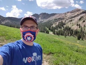
Visiting the spot was only a few minutes, and Alf's was closed, so we hiked up to Cecret Lake
Photos
Achievements
McKay (talk) earned the One with Nature Geohash Achievement
|


