Difference between revisions of "2021-08-18 -38 146"
m (Location) |
|||
| (2 intermediate revisions by one other user not shown) | |||
| Line 61: | Line 61: | ||
== Achievements == | == Achievements == | ||
| − | {{ | + | {{drag-along |
| − | |||
| − | + | | latitude = -38 | |
| − | + | | longitude = 146 | |
| − | [[ | + | | date = 2021-08-18 |
| + | | partner = Brad | ||
| + | | name = [[User:mdixon4|mdixon4]] | ||
| + | | image = 2021-08-18 -38 146 photo.jpg | ||
| − | + | }} | |
| − | + | {{Ambassador geohash | |
| − | |||
| − | |||
| − | |||
| − | + | | latitude = -38 | |
| + | | longitude = 146 | ||
| + | | date = 2021-08-18 | ||
| + | | granter = the property dweller | ||
| + | | name = [[User:mdixon4|mdixon4]] | ||
| + | | image = 2021-08-18 -38 146 photo.jpg | ||
| + | |||
| + | }} | ||
| − | |||
[[Category:Expeditions]] | [[Category:Expeditions]] | ||
| − | |||
[[Category:Expeditions with photos]] | [[Category:Expeditions with photos]] | ||
| − | |||
| − | |||
| − | |||
| − | |||
| − | |||
[[Category:Coordinates reached]] | [[Category:Coordinates reached]] | ||
| − | + | {{location|AU|VIC|BB}} | |
| − | |||
| − | |||
| − | |||
| − | |||
| − | |||
| − | |||
| − | |||
| − | |||
| − | |||
| − | |||
| − | |||
| − | |||
| − | |||
| − | |||
| − | |||
| − | |||
| − | |||
Latest revision as of 08:42, 18 August 2021
| Wed 18 Aug 2021 in -38,146: -38.0941449, 146.2088219 geohashing.info google osm bing/os kml crox |
Location
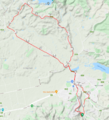
A front yard at the top of the Moe-Willow Grove ridge road
Participants
Brad
Expedition
His motorcycle club held an A-to-Z competition a few years back. Take the club banner and get photos at town signs starting with every letter of the alphabet (except X). Winner gets $500.
But it wasn't about the money, he told me. That was a nice bonus, but the real prize was having an excuse to get out-and-about, visit places he never would've otherwise. So, although he'd never heard of geohashing before, he got it straight away.
"Hi, this is going to sound odd, but do you mind if I take a selfie in your front yard, somewhere over that way?"
I'd roped in my occasional cycling buddy Brad and we'd taken advantage of the sunny afternoon to head for the hash. I wasn't sure it would be accessible, but it was close enough to the road that it was surely worth a shot. As we drew close it became apparent we'd need to venture onto private property, but fortunately the owner was in the yard, so I asked for permission.
"I suppose so, but... what?"
"There's a website that spits out random coordinates every day. Today, they're in your front yard. I thought I might go to them."
The ride had been at a rather brisk pace, my reward for roping Brad in. He's a road cyclist and can maintain a decent effort, so I was happy just to sit on his tail as we climbed the ridge, with wide vistas on either side. The house we had stopped at was close to the top of the ridge, with hints of phenomenal views in both directions through the trees. The owner seemed chuffed, proud even, that the algorithm's random coordinates had landed on his patch.
"Too right! Go for it!"
He watched as I wandered to-and-fro, trying to get to the exact point, and eventually working out they were just over the fence into his neighbour's yard.
"Jump the fence, they won't mind."
I did, and got the hash, and then spent some time explaining how the hash really worked, and how it was, more than anything, an excuse to get out and go somewhere surprising. He got it immediately.
It might not always be about the destination, but sometimes a journey won't happen without one.
Photos
Achievements
mdixon4 earned the Drag-along achievement
|
mdixon4 earned the Ambassador achievement
|


